La Moine River facts for kids
Quick facts for kids La Moine River |
|
|---|---|

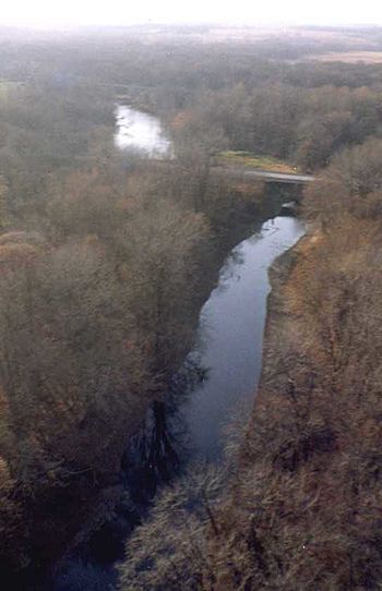
La Moine River in McDonough County, Illinois near Colmar, Illinois
|
|
| Physical characteristics | |
| Main source | Warren County southwest of Galesburg, Illinois 40°38′28″N 90°45′32″W / 40.6411508°N 90.7590232°W |
| River mouth | Confluence with the Illinois River southwest of Beardstown, Illinois 440 ft (130 m) 39°59′14″N 90°30′50″W / 39.9872706°N 90.5140153°W |
| Length | 125 mi (201 km) |
| Basin features | |
| Progression | La Moine River → Illinois River → Mississippi River → Gulf of Mexico |
| GNIS ID | 411649 |
The La Moine River is a 125-mile-long river in western Illinois, United States. It's like a long, winding path of water! This river is a tributary of the Illinois River, meaning it flows into it.
The La Moine River's watershed is huge, covering about 2,000 square miles. A watershed is all the land where water drains into a specific river. This makes the La Moine River the sixth-largest tributary to the Illinois River. Ultimately, its waters join the mighty Mississippi River and flow all the way to the Gulf of Mexico.
Contents
Where the La Moine River Flows
The La Moine River starts in the southwestern part of Warren County. From there, it begins its journey, flowing southwest through parts of Henderson and McDonough counties.
Journey Through Counties
As the river continues, it enters Hancock County. Here, it makes a turn, heading southeast. It then flows through Schuyler County and back into McDonough County.
In its lower section, the river passes by the small village of Ripley. It also helps form part of the border between Schuyler and Brown counties. Finally, the La Moine River flows into the Illinois River from the northwest. This meeting point is about 4 miles southwest of the town of Beardstown.
Smaller Rivers Joining In
The La Moine River isn't alone; it has some smaller rivers that join it along the way:
- South Branch La Moine River: This shorter river starts in McDonough County. It flows west-southwest into Hancock County, passing near La Harpe.
- East Fork La Moine River: This river begins in Warren County. It flows south and southwest through McDonough County, going past the city of Macomb.
Different Names for the River
Rivers sometimes have many names over time! The official name, "La Moine River," was decided by the United States Board on Geographic Names in 1933.
However, this river has been known by other names throughout history, including:
- Crooked Creek
- Lamoine River
- Lamoine Creek
- Rivière à la Moine or Rivière au Moine (which means Monk river in French)
- Rivière à la Mine (which means Mine river in French)
 | Tommie Smith |
 | Simone Manuel |
 | Shani Davis |
 | Simone Biles |
 | Alice Coachman |

