
Brown County, Illinois facts for kids
Quick facts for kids
Brown County
|
|
|---|---|

Brown County Courthouse in Mount Sterling
|
|

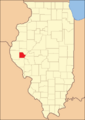
Location within the U.S. state of Illinois
|
|
 Illinois's location within the U.S. |
|
| Country | |
| State | |
| Founded | 1839 |
| Named for | Jacob Brown |
| Seat | Mount Sterling |
| Largest city | Mount Sterling |
| Area | |
| • Total | 307 sq mi (800 km2) |
| • Land | 306 sq mi (790 km2) |
| • Water | 1.6 sq mi (4 km2) 0.5% |
| Population
(2020)
|
|
| • Total | 6,244 |
| • Estimate
(2023)
|
6,294 |
| • Density | 20.34/sq mi (7.853/km2) |
| Time zone | UTC−6 (Central) |
| • Summer (DST) | UTC−5 (CDT) |
| Congressional district | 15th |
| Website | https://www.browncoil.org |
Brown County is a county in the state of Illinois. In 2020, about 6,244 people lived here. The main town and county seat is Mount Sterling. Part of Siloam Springs State Park is also in Brown County.
Contents
History of Brown County
Brown County was created in 1839. It was formed from a part of Schuyler County. The county is named after General Jacob Brown. He was a U.S. General who won an important battle in 1813. This battle was called the Battle of Sackett's Harbor.
-
Brown County when it was first created in 1839.

Geography of Brown County
Brown County covers about 307 square miles (795 square kilometers). Most of this area is land. Only a small part, about 1.6 square miles, is water. The Illinois River flows along some of the county's eastern edge.
Neighboring Counties
Brown County shares borders with these other counties:
- Schuyler County to the north
- Cass County to the east
- Morgan County to the southeast
- Pike County to the south
- Adams County to the west
Main Roads
These are the major highways that go through Brown County:
 US Route 24
 Illinois Route 99
 Illinois Route 107
Climate and Weather
| Weather chart for Mount Sterling, Illinois | |||||||||||||||||||||||||||||||||||||||||||||||
|---|---|---|---|---|---|---|---|---|---|---|---|---|---|---|---|---|---|---|---|---|---|---|---|---|---|---|---|---|---|---|---|---|---|---|---|---|---|---|---|---|---|---|---|---|---|---|---|
| J | F | M | A | M | J | J | A | S | O | N | D | ||||||||||||||||||||||||||||||||||||
|
1.6
32
15
|
1.9
38
20
|
3.1
50
30
|
3.9
63
41
|
5.1
73
51
|
3.9
82
61
|
3.9
87
65
|
3.5
84
63
|
3.6
78
54
|
3.3
66
43
|
3.2
50
31
|
2.4
37
20
|
||||||||||||||||||||||||||||||||||||
| temperatures in °F precipitation totals in inches source: The Weather Channel |
|||||||||||||||||||||||||||||||||||||||||||||||
|
Metric conversion
|
|||||||||||||||||||||||||||||||||||||||||||||||
In Mount Sterling, the county seat, temperatures change throughout the year. In January, the average low is about 15°F (-9°C). In July, the average high is about 87°F (31°C). The coldest temperature ever recorded was -26°F (-32°C) in February 1905. The hottest was 113°F (45°C) in July 1936.
The amount of rain and snow also changes. January usually gets about 1.55 inches (39 mm) of precipitation. May is the wettest month, with about 5.14 inches (131 mm).
People of Brown County (Demographics)

| Historical population | |||
|---|---|---|---|
| Census | Pop. | %± | |
| 1840 | 4,183 | — | |
| 1850 | 7,198 | 72.1% | |
| 1860 | 9,938 | 38.1% | |
| 1870 | 12,205 | 22.8% | |
| 1880 | 13,041 | 6.8% | |
| 1890 | 11,951 | −8.4% | |
| 1900 | 11,557 | −3.3% | |
| 1910 | 10,397 | −10.0% | |
| 1920 | 9,336 | −10.2% | |
| 1930 | 7,892 | −15.5% | |
| 1940 | 8,053 | 2.0% | |
| 1950 | 7,132 | −11.4% | |
| 1960 | 6,210 | −12.9% | |
| 1970 | 5,586 | −10.0% | |
| 1980 | 5,411 | −3.1% | |
| 1990 | 5,836 | 7.9% | |
| 2000 | 6,950 | 19.1% | |
| 2010 | 6,937 | −0.2% | |
| 2020 | 6,244 | −10.0% | |
| 2023 (est.) | 6,294 | −9.3% | |
| U.S. Decennial Census 1790-1960 1900-1990 1990-2000 2010 |
|||
In 2010, there were 6,937 people living in Brown County. There were about 2,099 households, which are groups of people living together. About 1,346 of these were families. The average household had 2.30 people. The average family had 2.88 people.
Most people in the county were white (76.1%). About 18.5% were black or African American. A small number were Asian (0.2%) or American Indian (0.2%). About 4.4% were from other races. About 5.8% of the population was of Hispanic or Latino background.
Many people in Brown County have German (25.5%), American (15.6%), Irish (12.7%), or English (6.1%) roots. The median age in the county was 37.3 years old. This means half the people were younger than 37.3 and half were older.
Communities in Brown County
Brown County has several towns and villages. Here are some of them:
| Community |
Community type |
Population | Total Area |
Water Area |
Land Area |
Pop. Density |
|
|---|---|---|---|---|---|---|---|
| Mound Station | village | 117 | 0.52 | 0.00 | 0.52 | 225.43 | |
| Mount Sterling (seat) | city | 2,006 | 1.11 | 0.00 | 1.11 | 1,810.47 | |
| Ripley | village | 53 | 0.38 | 0.00 | 0.38 | 139.84 | |
| Versailles | village | 446 | 0.94 | 0.01 | 0.93 | 470 | |
| Brown County | county | 6,244 | 307 | 1.6 | 306 | 20 |
Townships
Brown County is divided into nine smaller areas called townships:
- Buckhorn
- Cooperstown
- Elkhorn
- Lee
- Missouri
- Mount Sterling
- Pea Ridge
- Ripley
- Versailles
Unincorporated Communities
These are smaller communities that are not officially part of a city or village:
Education in Brown County
Students in Brown County attend schools in these districts:
- Brown County Community Unit School District 1
- Meredosia-Chambersburg Community Unit School District 11
- Southeastern Community Unit School District 337
See also
 In Spanish: Condado de Brown (Illinois) para niños
