
Adams County, Illinois facts for kids
Quick facts for kids
Adams County
|
|
|---|---|

Adams County Courthouse
|
|

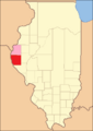
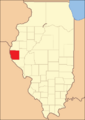
Location within the U.S. state of Illinois
|
|
 Illinois's location within the U.S. |
|
| Country | |
| State | |
| Founded | 1825 |
| Named for | John Quincy Adams |
| Seat | Quincy |
| Largest city | Quincy |
| Area | |
| • Total | 871 sq mi (2,260 km2) |
| • Land | 855 sq mi (2,210 km2) |
| • Water | 16 sq mi (40 km2) 1.9% |
| Population
(2020)
|
|
| • Total | 65,737 |
| • Estimate
(2023)
|
64,441 |
| • Density | 75.47/sq mi (29.140/km2) |
| Time zone | UTC−6 (Central) |
| • Summer (DST) | UTC−5 (CDT) |
| Congressional district | 15th |
Adams County is a county located in the very western part of Illinois, a state in the United States. It sits right next to the Mississippi River. In 2020, about 65,737 people lived here. The main city and the place where the county government is located is Quincy. Adams County is also part of a larger area called the Quincy, IL–MO Micropolitan Statistical Area.
Contents
History of Adams County
Adams County was created in 1825. It was formed from a part of Pike County. The county was named after John Quincy Adams, who was the sixth President of the United States.
-
When Adams County was first created in 1825, another area called Hancock County was temporarily part of it.
-
By 1829, Adams County was made smaller to its current size and shape.


Geography and Nature
Adams County covers a total area of about 871 square miles. Most of this area, about 855 square miles, is land. The remaining 16 square miles (about 1.9%) is water, like rivers and lakes.
Neighboring Counties
Adams County shares its borders with several other counties:
- To the north: Hancock County
- To the east: Brown County and Schuyler County
- To the south: Pike County
- To the west (across the Mississippi River in Missouri): Marion County, Missouri and Lewis County, Missouri
Major Roads
Many important roads run through Adams County, helping people travel around. These include:
 Interstate 172
 US Route 24
 US Route 36
 Illinois Route 57
 Illinois Route 61
 Illinois Route 94
 Illinois Route 96
 Illinois Route 104
 Illinois Route 336
Protected Areas
A small part of the Great River National Wildlife Refuge is located in Adams County. This refuge helps protect wildlife and their natural homes.
Climate and Weather
The weather in Adams County changes with the seasons. In Quincy, the county seat, average temperatures in January are around 16°F. In July, they can reach about 88°F. However, temperatures can be much colder or hotter. The record low was -21°F in January 1979, and the record high was 105°F in July 2005. The county gets a good amount of rain, with the most rain usually falling in May.
People and Population

In 2020, Adams County had 65,737 people living in 27,199 households. The population density was about 75.5 people per square mile.
Most people in the county are white (about 89.5%). Other groups include Black or African American (3.8%), Asian (0.8%), and American Indian (0.2%). About 2.0% of the population is of Hispanic or Latino origin. Many families in Adams County have German (35.9%), Irish (11.1%), or English (8.1%) backgrounds.
The average age of people in the county was 41.4 years. About 22.6% of the population was under 18 years old.
The average income for a household in Adams County was $55,052. For families, the average income was $72,091. About 12.5% of all people in the county lived below the poverty line. This included 17.7% of those under 18 years old.
Communities in Adams County

Adams County has several cities and villages, as well as many smaller, unincorporated communities.
Cities and Villages
The largest city is Quincy, which is also the county seat. Other villages include Camp Point, Clayton, Golden, Liberty, Mendon, and Payson. Each community has its own unique features and population size.
| Community |
Community type |
Population | Total Area |
Water Area |
Land Area |
Pop. Density |
|
|---|---|---|---|---|---|---|---|
| Camp Point | village | 1,121 | 1.27 | 0.00 | 1.27 | 885.47 | |
| Clayton | village | 639 | 0.89 | 0.01 | 0.88 | 722.85 | |
| Coatsburg | village | 150 | 0.13 | 0.00 | 0.13 | 1,136.36 | |
| Columbus | village | 114 | 0.22 | 0.00 | 0.22 | 520.55 | |
| Golden | village | 648 | 0.64 | 0.00 | 0.64 | 1,009.35 | |
| La Prairie | village | 42 | 0.19 | 0.00 | 0.19 | 217.62 | |
| Liberty | village | 543 | 0.39 | 0.00 | 0.39 | 1,388.75 | |
| Lima | village | 148 | 0.14 | 0.00 | 0.14 | 1,096.30 | |
| Loraine | village | 300 | 0.84 | 0.00 | 0.84 | 355.45 | |
| Mendon | village | 872 | 0.86 | 0.00 | 0.86 | 1,017.50 | |
| Payson | village | 1,025 | 1.17 | 0.00 | 1.17 | 876.07 | |
| Plainville | village | 271 | 0.23 | 0.00 | 0.23 | 1,153.19 | |
| Quincy (seat) | city | 39,463 | 15.81 | 0.04 | 15.77 | 2,503.20 | |
| Ursa | village | 609 | 0.69 | 0.00 | 0.69 | 882.61 | |
| Adams County | county | 65,737 | 871 | 16 | 855 | 75 |
Townships
Adams County is divided into 23 smaller areas called townships. These townships help organize local services and government.
- Beverly
- Burton
- Camp Point
- Clayton
- Columbus
- Concord
- Ellington
- Fall Creek
- Gilmer
- Honey Creek
- Houston
- Keene
- Liberty
- Lima
- McKee
- Melrose
- Mendon
- Northeast
- Payson
- Quincy
- Richfield
- Riverside
- Ursa
Education
Adams County offers many educational opportunities, from public schools to colleges.
Public Schools
Several school districts serve the students in Adams County, including:
- Central Community Unit School District 3
- Liberty Community Unit School District 2
- Mendon Community Unit School District 4
- Payson Community Unit School District 1
- Quincy Public School District 172
Private Schools
There are also private schools in the county, such as:
- Blessed Sacrament Catholic School
- Chaddock School
- Quincy Christian School
- Quincy Notre Dame High School
- St. Dominic Catholic School
- St. Francis Solanus Catholic School
- St. James Lutheran School
- St. Peter Catholic School
Colleges and Universities
For higher education, students can attend:
- Blessing-Rieman College of Nursing
- John Wood Community College
- Quincy University
Fun Places to Visit
Adams County has many attractions for residents and visitors to enjoy:
- Adams County Fair
- Bayview Bridge
- Burton Cave
- Fall Creek Scenic Park
- Golden Windmill
- John Wood Mansion
- Saukenauk Scout Reservation
- Siloam Springs State Park
- Spirit Knob Winery
- Villa Katharine
- Wavering Park
Images for kids
-
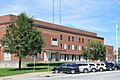
The Adams County Courthouse in Quincy, where the county government is located.
See also
 In Spanish: Condado de Adams (Illinois) para niños
