Ladysmith, Wisconsin facts for kids
Quick facts for kids
Ladysmith, Wisconsin
|
|
|---|---|
|
|
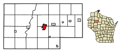
Location of Ladysmith in Rusk County, Wisconsin.
|
|
| Country | |
| State | |
| County | Rusk |
| Area | |
| • Total | 4.59 sq mi (11.90 km2) |
| • Land | 4.22 sq mi (10.93 km2) |
| • Water | 0.38 sq mi (0.97 km2) |
| Elevation | 1,145 ft (349 m) |
| Population
(2020)
|
|
| • Total | 3,216 |
| • Density | 762.1/sq mi (294.2/km2) |
| Time zone | UTC-6 (Central (CST)) |
| • Summer (DST) | UTC-5 (CDT) |
| ZIP code |
54848
|
| Area code(s) | 715 & 534 |
| FIPS code | 55-40850 |
| GNIS feature ID | 1567715 |
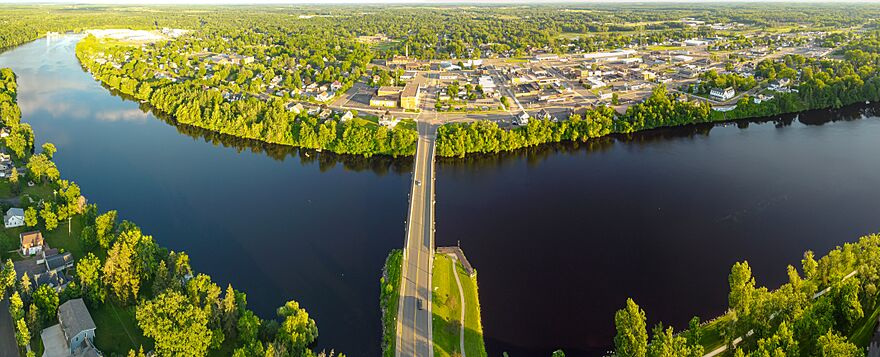
Ladysmith is a city in Wisconsin, United States. It's the main town, or county seat, of Rusk County, Wisconsin. Ladysmith is located right next to the Flambeau River. In 2020, about 3,216 people lived there.
Contents
History of Ladysmith
The Ojibwe people, who traveled along the Flambeau River, called this area Gakaabikijiwanan. This means "of cliffed rapids."
The city of Ladysmith was started in 1885. It was built where the Minneapolis, St. Paul and Sault Ste. Marie Railroad (called the Soo Line) crossed the Flambeau River. At first, it was named Flambeau Falls.
How Ladysmith Got Its Name
A man named Robert Corbett was very important in the early days of the city. He worked in logging and lumber. He first changed the city's name to Corbett. Then, in 1891, he changed it again to Warner. Finally, on July 1, 1900, he named it Ladysmith. He chose this name to honor the wife of Charles R. Smith, who was in charge of a company called Menasha Wooden Ware Co.
The Flambeau Mine
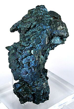
The Flambeau Copper Mine was a place where valuable metals were dug out of the ground. It was run by a company called Kennecott from 1993 to 1997. This mine had a very rich supply of ore. The ore was so rich that it could be sent directly to a smelter, which is a place where metals are separated from their ore.
After the mine closed, the land was cleaned up and new plants were grown there. Today, the old mine site has walking trails for people to enjoy.
The 2002 Tornado
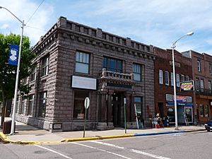
On September 2, 2002, a powerful tornado hit Ladysmith. A tornado is a spinning column of air that touches the ground. This tornado was very strong, rated F3 on the Fujita scale. It caused a lot of damage to the downtown area of Ladysmith.
The total damage was estimated to be about $20 million. Even with all that damage, it's important to know that no one died in the tornado.
Geography and Location
Ladysmith is located at coordinates 45°27′50″N 91°6′0″W / 45.46389°N 91.10000°W.
The city covers an area of about 4.59 square miles (11.9 square kilometers). Most of this area, about 4.21 square miles (10.9 square kilometers), is land. The rest, about 0.38 square miles (0.97 square kilometers), is water.
The main roads that go through Ladysmith are U.S. Highway 8 and Wisconsin Highway 27. The city is also located along the Flambeau River.
Population of Ladysmith
| Historical population | |||
|---|---|---|---|
| Census | Pop. | %± | |
| 1910 | 2,352 | — | |
| 1920 | 3,581 | 52.3% | |
| 1930 | 3,493 | −2.5% | |
| 1940 | 3,671 | 5.1% | |
| 1950 | 3,924 | 6.9% | |
| 1960 | 3,584 | −8.7% | |
| 1970 | 3,674 | 2.5% | |
| 1980 | 3,826 | 4.1% | |
| 1990 | 3,938 | 2.9% | |
| 2000 | 3,932 | −0.2% | |
| 2010 | 3,414 | −13.2% | |
| 2020 | 3,216 | −5.8% | |
| U.S. Decennial Census | |||
In 2010, there were 3,414 people living in Ladysmith. These people lived in 1,527 households. A household is a group of people living together in one home.
About 26.1% of the households had children under 18 years old living with them. The average age of people in the city was 43.8 years old.
Transportation
Ladysmith has its own airport called Rusk County Airport (KRCX).
For getting around town and Rusk County, there is a service called the Rusk County Transit Commission. They provide transportation for people in the area.
Education
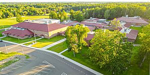
Ladysmith has schools that are part of the Ladysmith School District. These include Ladysmith High School and Ladysmith Elementary School.
There are also private schools in Ladysmith:
- Our Lady of Sorrows is a Catholic grade school.
- North Cedar Academy is a private high school where students live at the school. It helps students get ready for college. They have a special "BluGold" study program where students can earn college credits while still in high school.
Ladysmith used to be home to Mount Senario College, which closed in 2002. Today, North Cedar Academy uses the old campus of Mount Senario.
Notable People from Ladysmith
Many interesting people have come from Ladysmith, including:
- Gary Beecham, an artist
- Lois Capps, who was a member of the United States House of Representatives for California
- Jorge A. Carow, who served in the Wisconsin State Assembly
- Mark Hayes, a composer and arranger of music
- Donald J. Hoffman, a four-star general in the Air Force
- Ron Kovic, an author and Vietnam War veteran
- Jim Leonhard, a player in the NFL (National Football League)
- Earl Maves, another NFL player
- A. R. Morlan (1958–2016), an author
- Martin Reynolds, who was the mayor of Ladysmith and also served in the Wisconsin State Assembly
- Kathleen Slattery-Moschkau, a filmmaker
See also
 In Spanish: Ladysmith (Wisconsin) para niños
 | Precious Adams |
 | Lauren Anderson |
 | Janet Collins |


