
Lake Arkona facts for kids
Quick facts for kids Lake Arkona |
|
|---|---|
_1913.JPG)
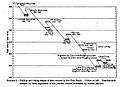
USGS map of Glacial Lakes Arkona and Chicago.
|
|

Lake Arkona
Location in Ontario
|
|
| Location | North America |
| Group | Great Lakes |
| Coordinates | 42°12′N 81°12′W / 42.2°N 81.2°W |
| Lake type | former lake |
| Etymology | Arkona, Ontario |
| Primary inflows | Laurentide Ice Sheet |
| Primary outflows | Black River valley in Michigan |
| Basin countries | Canada United States |
| First flooded | 12,000 years before present |
| Max. length | 241 mi (388 km) |
| Max. width | 57 mi (92 km) |
| Residence time | 200 years in existence |
| Surface elevation | 710 ft (216 m) |
Lake Arkona was a huge ancient lake that existed about 12,000 years ago. It was part of the history of the Great Lakes in North America. This lake formed after the Lake Maumee stage and before the Lake Whittlesey stage. It was named after Arkona, Ontario, a town about 50 miles (80 km) east of Sarnia.
Contents
How Glacial Lakes Formed
During the last Ice Age, massive sheets of ice covered much of North America. As these ice sheets slowly melted and retreated, they left behind huge amounts of water. This meltwater filled up low areas, creating enormous temporary lakes called "glacial lakes." Lake Arkona was one of these lakes.
Ancient Shorelines and Beaches
Even though Lake Arkona is gone, scientists can still find clues about where its shores used to be. These clues are called "beaches" or "shorelines." They are like faint lines in the landscape. These lines show where the water once met the land.
The movement of the ice sheet affected these ancient beaches in different ways:
- In the Saginaw area, the Arkona beaches were not covered by water or changed much.
- In the "thumb" area of Michigan, the ice sheet moved over the beaches and destroyed them.
- In the Black River valley, the beaches were covered by water but stayed safe from being changed.
- In the area that later became Lake Whittlesey, the beaches were covered by water and changed by strong storm waves.
Why Some Beaches Are Hard to Find
Some of Lake Arkona's old beaches are very faint and hard to see. This is true in places like southeastern Lenawee County in Ohio and Pennsylvania. These beaches often look like areas of gravel or gravelly soil.
The main reason they are hard to find is because they were changed a lot by later events. When Lake Whittlesey formed, its waves washed away the top parts of the Arkona beaches. Later, fine clay settled on top of the remaining gravel. This made the soil very stiff and clumpy. Because of this, these old beaches don't look like typical sandy beaches. Scientists had to look for their consistent height to identify them.
Lake Arkona's Neighbors
Lake Arkona wasn't the only glacial lake around. It had neighbors!
- At the same time, Lake Chicago (which was a very early version of Lake Michigan) was almost at its biggest size.
- In the Superior basin, the ice sheet still covered the entire area.
- In New York, many of the Finger Lakes had joined with Lake Arkona.
Lake Arkona formed when the ice sheet moved north from the Lake Maumee area. This allowed the waters of Lake Maumee to connect with another ancient lake called Lake Saginaw. When these two lakes joined, they created Lake Arkona.
How Lake Arkona Disappeared
Later, the huge Laurentide Ice Sheet grew again and moved south. This ice movement caused the water levels to rise by about 30 feet (9.1 m) in the areas to the east and south. This rise in water created a new, larger lake called Lake Whittlesey. The western area became Later Lake Saginaw again.
This rise in water levels covered most of the Arkona beaches. The strong waves of Lake Whittlesey washed them away or changed them. In some places, you can still find parts of the Arkona beaches near the edge of the Port Huron Moraine.
Images for kids
-
Summary of prehistoric beaches from the six glacial lakes that preceded the modern Lake Erie

