Lake Temagami facts for kids
Quick facts for kids Lake Temagami |
|
|---|---|

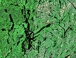
The lake with its many branches, bays and islands
|
|
| Location | Temagami, Ontario |
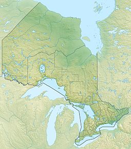
| Coordinates | 46°57′N 80°05′W / 46.950°N 80.083°W |
| Part of | Great Lakes Basin |
| Primary inflows | Anima Nipissing River |
| Primary outflows | Temagami River |
| Basin countries | Canada |
| Max. length | 47 km (29 mi) |
| Surface elevation | 293 m (961 ft) |
| Islands | ca. 1,259 (Temagami Island) |
Lake Temagami is a beautiful lake in northeastern Ontario, Canada. It is about 80 kilometers (50 miles) north of North Bay. The lake was once spelled Lake Timagami. Its name comes from the Ojibwa language. Te-mee-ay-gaming means "deep water by the shore."
Contents
Exploring Lake Temagami's Geography
Lake Temagami has a very interesting shape. It has long arms reaching north, northeast, and southwest. There are also shorter arms to the northwest and south. Many smaller bays add to its unique look.
The town of Temagami is located at the end of the lake's northeast arm. The lake stretches almost 50 kilometers (31 miles) from north to south. It is about 35 kilometers (22 miles) wide from east to west. Lake Temagami is home to around 1,259 islands. The biggest one is Temagami Island.
The lake's water flows out into the Temagami River. This river then joins the Sturgeon River. Several land areas that stick out into the lake are called peninsulas. These include the McLean, Cynthia, and Joan peninsulas. Sand Point separates the Northwest Arm from the rest of the lake.
The land around Lake Temagami is part of the Canadian Shield. This is a huge area of very old rocks. These rocks formed when the Earth's crust first cooled down. Some parts of Lake Temagami are in a special area called the Temagami Magnetic Anomaly. This is an egg-shaped rock structure. It stretches from Lake Wanapitei to Bear Island.
The hills in the Temagami area are what is left of North America's oldest mountain ranges. These mountains formed billions of years ago. They were once taller than any mountains we see today. Over millions of years, these huge mountains slowly wore down. This process is called erosion.
The rocks in Temagami today are igneous (formed from cooled lava), metamorphic (changed by heat and pressure), and sedimentary (formed from layers of sediment). Some rocks here are about 2 billion years old. They are called pillow lava. This shows that huge submarine volcanoes existed when the Earth's crust was just forming.
The northeast arm of Lake Temagami has a strong fault zone. This is a crack in the Earth's crust. This area is known as the Northeast Arm Deformation Zone. It is part of the Temagami Greenstone Belt. This belt has very old volcanic rocks.
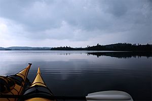
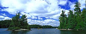
Lake Temagami and its nearby lakes are perfect for canoe camping. There are over 2,000 kilometers (1,240 miles) of canoe routes that connect to each other. The area also has some of Ontario's largest old-growth forests. These forests are filled with tall red and white pine trees.
Lake Temagami's History
In 1834, the Hudson's Bay Company opened a fur trading post on Lake Temagami. This post was important for trading furs in the 1800s.
In 1898, the Temagami Forest Reserve was created. This protected the forests around the lake. It was meant to save the trees for future logging. Because of this reserve, people could only build cottages and resorts on the lake's islands. This rule is still in place today.
Lake Temagami is a very popular place for cottage vacationing. There are hundreds of cottages on the lake. There are also nine youth camps and twelve commercial lodges.
Famous Summer Camps
Many summer camps have a long history on Lake Temagami. These camps focus on outdoor adventures.
- Keewaydin Canoe Camp is on Devil Island. It started in 1892. Keewaydin teaches kids about wilderness canoe trips. They use traditional gear like cedar and canvas canoes. It was one of the first private businesses on the lake.
- Camp Temagami began in 1903. It was a camp for boys. It focused on canoe trips and in-camp activities. These included sports, lifeguard training, and learning about nature. It closed in 1972 but reopened in 2003.
- Camp Wigwasati started running canoe trips in 1930.
Many vacation lodges and canoe camps grew popular in the early 1900s. Visitors came from cities in Ontario and the United States. They traveled by train or later by car on the Ferguson Highway. A large steamboat called the Belle of Temagami carried vacationers. It operated on the lake from the 1900s to the 1940s.
During tough times like the Great Depression and World War II, some lodges became youth camps.
- Camp Cayuga reopened as the first girls' camp in 1940.
- Camp Wabikon became the first co-ed (boys and girls) youth camp in 1945.
- Camp Wanapitei moved to Lake Temagami in 1956. It was the first co-ed canoe tripping camp. It became fully co-ed in 1971. They offer very long canoe trips for older teens.
- Camp Metagami for girls started in the 1960s but closed in 1970.
- Camp White Bear reopened as a co-ed youth camp in 1961.
- Lorien Wilderness took over the Camp Cayuga site in 1968. It offered co-ed wilderness trips.
- Camp Wabun has run canoe trips since 1933. It became co-ed in 1977.
- Camp Northwaters took over the Lorien Wilderness site in 1985. It offers co-ed trips and girls-only trips.
- Keewaydin became co-ed in 1999.
Today, many of the original boys' camps, like Keewaydin, Wanapitei, Temagami, and Wabun, are now co-ed.
Other Developments
Appleby College has a northern campus on Rabbit Nose island. It opened in the mid-1970s. This campus is a starting point for their "Northward Bound" program.
A copper mine opened on Temagami Island in 1954. It was called the Temagami Mine. This mine produced very pure copper ore. It was considered one of the best copper mines in Canada. The mine closed in 1972.
 | Audre Lorde |
 | John Berry Meachum |
 | Ferdinand Lee Barnett |


