Lambourne facts for kids
Quick facts for kids Lambourne |
|
|---|---|
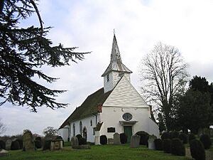
 The church of St. Mary and All Saints |
|
| Area | 10.5 km2 (4.1 sq mi) |
| Population | 1,828 (2001) 2,013 (2011) |
| • Density | 174/km2 (450/sq mi) |
| OS grid reference | TQ479961 |
| • London | 14.5 mi (23.3 km) SW |
| Civil parish |
|
| District | |
| Shire county | |
| Region | |
| Country | England |
| Sovereign state | United Kingdom |
| Post town | ROMFORD |
| Postcode district | RM4 |
| Dialling code | 020 01992 |
| Police | Essex |
| Fire | Essex |
| Ambulance | East of England |
| EU Parliament | East of England |
| UK Parliament |
|
Lambourne is a lovely area in Essex, England. It's not a single town or village, but a "civil parish." A civil parish is a local area with its own council that helps manage local services. Lambourne is part of the Epping Forest district.
You can find Lambourne about 7 kilometers (4.5 miles) south of Epping. It's also about 8 kilometers (5 miles) northwest of Romford. The area covers about 10.5 square kilometers (2,590 acres). In 2011, about 2,013 people lived here.
Contents
A Look Back in Time: Lambourne's History
Long ago, in the Middle Ages, Lambourne was mostly covered by thick forests. Over time, people slowly cleared parts of the forest. They used the land for farming.
Some small parts of the old Hainault Forest still exist today. These areas are now part of a country park. It's a great place to visit!
In 1801, about 505 people lived in Lambourne. By 1841, the population grew to 904. It stayed around that number for the next 100 years.
Lambourne has always been part of the Ongar area. It was managed by different local councils over the years. Since 1974, it has been part of the Epping Forest District.
Exploring Lambourne's Geography
Lambourne is mostly a countryside area with lots of farms. It sits in the valley of the River Roding, which forms the northern edge of the parish. The land here is quite hilly, rising to over 100 meters (328 feet) in the middle.
There isn't one main village called Lambourne. Instead, the biggest settlement is Abridge, located in the northwest. Another group of houses is found at the small settlement of Lambourne End to the south. You'll also see many farms and houses scattered throughout the rest of the area.
To the south, you'll find Hainault Forest Country Park. This park is managed by the Woodland Trust. It's a wonderful place for nature walks and outdoor activities.
Cool Places to See in Lambourne
The old parish church of St Mary is a special landmark. It's a medieval church, meaning it's very old, from the Middle Ages. It's in a quiet spot next to the Hall, which is common for churches in Essex.
Inside, the church has a unique Georgian style. This means it was updated in the 1700s, giving it a different look than many other medieval churches. A famous soldier and politician, Amelius Lockwood, 1st Baron Lambourne, is buried in the churchyard.
Getting Around: Transport in Lambourne
Stapleford Aerodrome is an airfield located in the eastern part of Lambourne. It's a place where small planes take off and land.
Lambourne also has an important connection to bigger airports. It's the location of LAM, which is a special navigation beacon. This beacon helps planes find their way to London Heathrow Airport. It's like a digital lighthouse for aircraft, guiding planes as they wait to land.
 | May Edward Chinn |
 | Rebecca Cole |
 | Alexa Canady |
 | Dorothy Lavinia Brown |


