Lanefield, Queensland facts for kids
Quick facts for kids LanefieldIpswich, Queensland |
|||||||||||||||
|---|---|---|---|---|---|---|---|---|---|---|---|---|---|---|---|

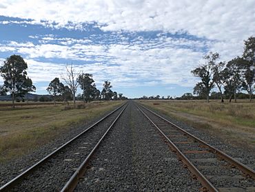
Lane Road crossing, Main Line railway, 2015
|
|||||||||||||||
| Population | 97 (2021 census) | ||||||||||||||
| • Density | 5.77/km2 (14.9/sq mi) | ||||||||||||||
| Postcode(s) | 4340 | ||||||||||||||
| Area | 16.8 km2 (6.5 sq mi) | ||||||||||||||
| Time zone | AEST (UTC+10:00) | ||||||||||||||
| Location |
|
||||||||||||||
| LGA(s) | City of Ipswich | ||||||||||||||
| State electorate(s) |
|
||||||||||||||
| Federal Division(s) | Blair | ||||||||||||||
|
|||||||||||||||
Lanefield is a small, quiet place in the countryside of Queensland, Australia. It's part of the City of Ipswich. In 2021, only about 97 people lived there, making it a very small community.
Contents
Exploring Lanefield's Landscape
Lanefield has some natural waterways. Western Creek flows through the area. It's a smaller stream that eventually joins the Bremer River. Another creek, called Brandy Gully, also starts in Lanefield and flows into Western Creek.
A main train line, called the Main Line railway, runs through Lanefield. There used to be a train stop called Lanefield railway station. However, this station is no longer used.
A Look Back: Lanefield's History
The name "Lanefield" comes from its old railway station. The railway department named the station after two early settlers, John and Clara Lane.
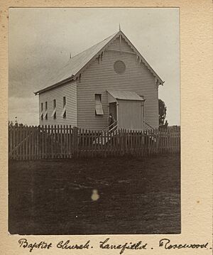
In the early days, churches were important for the community. A Wesleyan Methodist Church opened in the Brandy Gully area by 1873. Also in 1873, a Baptist church started in the same area.
In the 1890s, farming was a big part of life, especially dairy farming. A special building was set up for dairy farmers to work together. This cooperative dairy helped the local farmers. However, it closed down in 1905.
Later, from 1918 until about 1970, people mined for coal in Lanefield. You can still see signs of these old coal mines around the area today.
Who Lives in Lanefield?
The number of people living in Lanefield is quite small. In 2016, there were 107 people. By 2021, the population had slightly decreased to 97 people.
Learning in Lanefield
Lanefield itself does not have any schools. Children living here usually go to primary schools in nearby towns. Ashwell State School is to the north, and Rosewood State School is to the east. For high school, students attend Rosewood State High School in Rosewood.
 | Chris Smalls |
 | Fred Hampton |
 | Ralph Abernathy |


