Lanes and arcades of Melbourne facts for kids
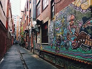
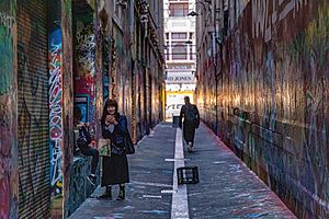
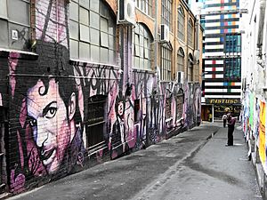
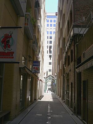
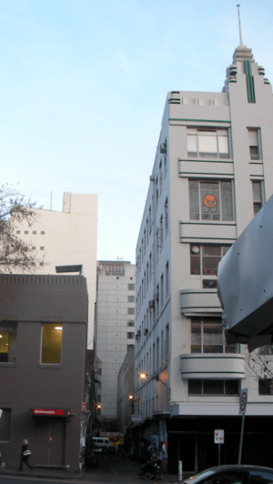
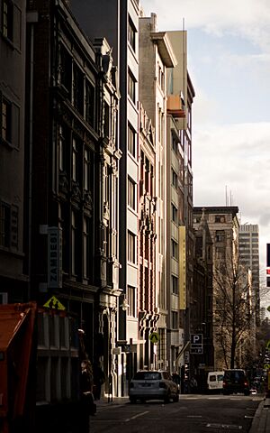
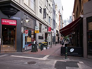
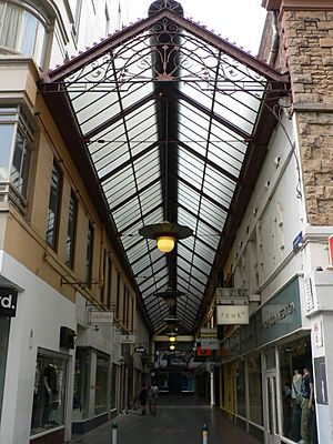
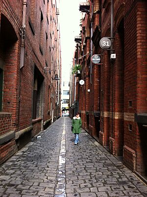
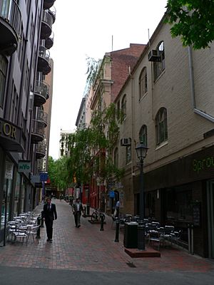
Melbourne, Australia, has many small streets and covered walkways called "laneways" and "arcades." These narrow paths are a big part of the city's culture. They are famous for their cool cafes, fun bars, and amazing street art.
Most of these laneways were created a long time ago, during the Victorian era. They were first designed in 1837 as service routes for buildings in Melbourne's original city plan, called the Hoddle Grid. By the 1850s, when many people came to Victoria for the gold rush, Melbourne had over a hundred laneways.
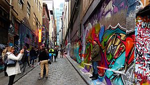
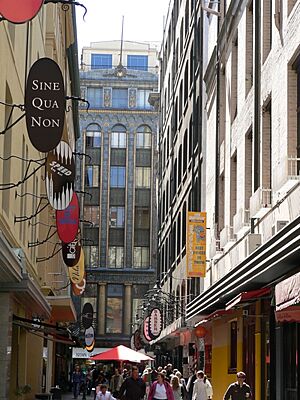
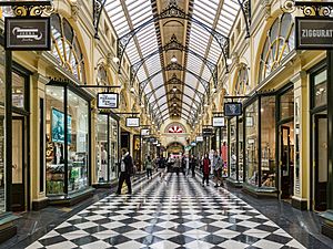
Some of the most beautiful shopping arcades, like the Block Arcade and the Royal Arcade, became very fancy during the late Victorian era. Since the 1990s, many laneways have been made into pedestrian-only areas. They have been updated and are now popular places to visit. People from all over Australia and the world come to see them. Some laneways, like Hosier Lane, are famous for their street art and are even called "laneway galleries."
The St Jerome's Laneway Festival, often called just Laneway, is a popular music festival. It started in 2004 in Melbourne's laneways.
Contents
- ACDC Lane: A Rock 'n' Roll Tribute
- Amphlett Lane: Honoring a Music Star
- Bank Place: Historic Buildings and Cafes
- Bligh Place: A Quiet University Path
- The Block Arcade: A Grand Shopping Experience
- Block Place: Cafes and Shops Galore
- Caledonian Lane: A Changing History
- Cathedral Arcade: A Stained-Glass Gem
- Causeway Lane: Shops and Cafes in the Heart of the City
- Centre Place: A Hub of Art and Food
- Corporation Lane: The Original Names
- Croft Alley: Chinatown's Hidden Gem
- Dame Edna Place: A Star's Legacy
- Degraves Street: A Busy Path to Coffee and Art
- Flinders Lane: Fashion, Cafes, and History
- Hardware Lane: Food, Fun, and Jazz
- Healeys Lane: Melbourne's Koreatown
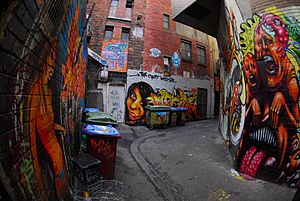
- Hosier Lane: A Canvas for Street Art
- Howey Place: A Historic Shopping Arcade
- Niagara Lane: Old Warehouses and City Views
- McKillop Street: Boutique Shops and Outdoor Dining
- Melbourne GPO: A Historic Post Office Turned Shops
- Royal Arcade: Melbourne's Oldest Arcade
- Tattersalls Lane: Oldest Lane with Food and Art
- See also
ACDC Lane: A Rock 'n' Roll Tribute
ACDC Lane is a short, narrow laneway in Melbourne. It runs south from Flinders Lane, between Exhibition Street and Russell Street.
This street used to be called Corporation Lane. But on October 1, 2004, it was renamed to honor the famous Australian rock band AC/DC. The Melbourne City Council voted to change the name, and everyone agreed! The band's name usually has a lightning bolt symbol, but street names can't use special symbols. So, the street sign just says "ACDC Lane."
Melbourne's Lord Mayor John So officially opened ACDC Lane. He said, "As the song says, there is a highway to hell, but this is a laneway to heaven. Let us rock." Then, musicians played "It's a Long Way to the Top (If You Wanna Rock 'n' Roll)" with bagpipes. A month later, a cool lightning bolt sign was put up above and below the street sign.
Corporation Lane was chosen for the renaming because AC/DC filmed their music video for "It's a Long Way to the Top (If You Wanna Rock 'n' Roll)" on Melbourne's Swanston Street, which is close by. The band is also seen as important cultural ambassadors for Australia, and the lane is in a busy area with many bars.
Amphlett Lane: Honoring a Music Star
Amphlett Lane is a laneway located off Little Bourke Street. It was renamed in 2014 to remember Chrissy Amphlett. Chrissy Amphlett was an Australian singer, songwriter, and actress. She was the lead singer of the Australian rock band Divinyls. Chrissy passed away in 2013.
The laneway is behind the Princess Theatre and the Palace on Bourke Street. These are places where Chrissy Amphlett performed many times.
Bank Place: Historic Buildings and Cafes
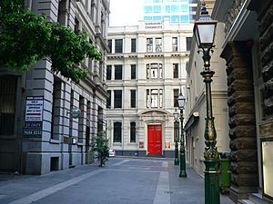
Bank Place is a short, narrow laneway. It runs south from Little Collins Street between Queen Street and William Street.
This area is in the middle of Melbourne's financial district. Bank Place is special because it has many old buildings from the 1860s to the 1920s. These buildings show off Melbourne's history. If you look north, you can see the Normanby Chambers building.
The area is protected because of its historical importance. Some important buildings here include:
- The Mitre Tavern: This is a historic pub that opened in 1868. It was a popular spot for many famous Australian artists in the early 1900s.
Other notable buildings include 12–16 Bank Place, built in 1884–85. The Melbourne Savage Club bought this building in 1923. The lane also has fancy old lamp posts and bluestone paths.
Bank Place has several popular bars and cafes. These places serve many of the people who work in the nearby offices. Some of the old, tall buildings have been turned into modern apartments.
Bligh Place: A Quiet University Path
Bligh Place is a short, quiet, and narrow laneway. It runs north from Flinders Lane between Elizabeth Street and Queen Street.
This lane is close to Victoria University and Melbourne's financial center. Bligh Place connects to University Place and University Arcade, which lead to Flinders Street. Because of this, it's a popular path for students. You can find small noodle shops, sushi places, cafes, and wine bars here.
The lane was developed in the 1990s when Victoria University moved to its city campus. It has a historic building at its eastern entrance that was restored in the late 1990s. Some old warehouses have also been turned into apartments. The Victoria University campus on Flinders Street creates a nice view at the south end of the lane.
The lane has a paved surface with a small bluestone gutter. It has lights hanging overhead and is mostly used by people walking, not cars.
The Block Arcade: A Grand Shopping Experience
The Block Arcade is a beautiful historic shopping arcade. It's a short, narrow laneway that connects Collins Street to Little Collins Street. It also connects to Elizabeth Street, forming an L-shape. You can even get to Block Place and then to the Royal Arcade from here.
Melbourne's Golden Mile heritage walk, which explores historic sites, goes through this arcade.
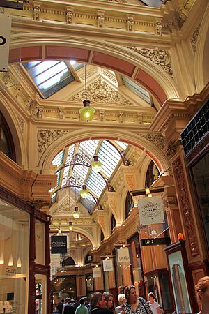
The arcade was built between 1891 and 1893. The architect, David C. Askew, wanted it to look like the famous Galleria Vittoria in Milan, Italy. He created one of Melbourne's most richly decorated indoor spaces. It has mosaic tiled floors, a glass roof, fancy ironwork, and carved stone details. The outside of the six-story office building looks almost the same on Collins and Elizabeth Streets. It's a great example of Victorian-era architecture.
This arcade was once called "Carpenter's Lane." But the area was already known as "The Block." After the arcade was finished, local shopkeepers asked to change the name to "The Block Arcade," and they succeeded.
It's a very important arcade from the Victorian era and is listed on the Victorian Heritage Register. Along with the Royal Arcade and Melbourne's other laneways, it's a famous tourist spot in the city.
Block Place: Cafes and Shops Galore
Block Place is a short, narrow laneway, partly covered. It runs south from Little Collins Street between Swanston Street and Elizabeth Street.
Block Place is only for people walking. It's a trendy and popular spot for both locals and tourists. It has cozy outdoor cafes close to Melbourne's main shopping area. The lane is full of cafes and shops in old buildings. Cafe Segovia is a popular lunch spot, and there's a cool record store in the basements.
This lane connects to the historic Block Arcade, which is a covered shopping arcade from the 1800s. Block Arcade and Block Place form a T-shape, running from Little Collins Street to Collins Street and Elizabeth Street.
The Royal Arcade is just across Little Collins Street and connects to Bourke Street.
Caledonian Lane: A Changing History
Caledonian Lane is a short, quiet, and narrow laneway, about 4 meters wide. It runs north from Little Bourke Street between Little Bourke Street and Lonsdale Street.
Caledonian Lane is most famous for being the original home of the St Jerome's Laneway Festival. It also had some changes in 2009 when parts of the Post Office and Department Store areas were redeveloped. This led to the festival moving from the lane.
In 2009, a group of companies wanted to make the lane 4 meters wider for delivery trucks. This meant they would have to knock down a historic building called Lonsdale House. Even though many people protested, permission was given, and the building was demolished in 2010. The lane was then made wider.
Before 2004, Caledonian Lane had many small, independent shops. However, the buildings were sold in 2007.
The lane has a paved surface with a small bluestone gutter. It has street lights and is used by both people walking and delivery trucks. Caledonian Lane offers views towards Loudon Place to the south and Drewery Lane to the north, which are almost directly opposite.
Cathedral Arcade: A Stained-Glass Gem
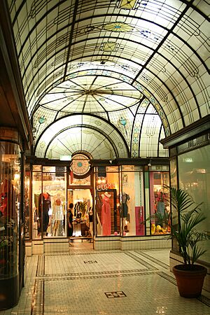
Cathedral Arcade is a historic shopping arcade. It's a short, narrow laneway that connects Swanston Street to Flinders Lane. It's shaped like a T, but one part of the laneway ends inside the building.
This arcade is special because it still has all its original features. The entire arcade is covered by beautiful stained glass and leadlights. These form a detailed arch that leads to a central dome. The floors have decorative ceramic tiles, and the shopfronts have richly carved wood panels.
This art deco arcade was built in 1925. It's part of the Nicholas Building, designed by Harry Norris. The building and the arcade are listed on the Victorian Heritage Register because of their historical importance.
Causeway Lane: Shops and Cafes in the Heart of the City
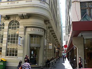
Causeway Lane (also known as The Causeway) is a short, quiet, and narrow laneway. It runs between Bourke Street Mall and Little Collins Street, between Elizabeth Street and Swanston Street.
Located in the middle of the shopping district, the Causeway currently has small boutique shops, indoor and outdoor cafes, and sushi bars.
The lane is known for the historic former Union Bank building. This tall, curved building was built in the 1920s and has a special entrance at the corner of the lane. Today, the building is home to Laurent, a fancy French bakery.
The lane is paved and lined by the plain sides of some historic buildings. No cars are allowed here.
At one end, you can see the Emporium Melbourne on Bourke Street Mall. At the other end, you can see the modern Novotel on Collins.
Centre Place: A Hub of Art and Food
Centre Place is a busy laneway and arcade. It runs between Flinders Lane and Collins Street.
This laneway is home to many lively bars, cafes, restaurants, unique shops, and sushi bars. It also has some of Melbourne's best examples of street art and graffiti, especially stencil art, which is known as "City Lights." This area has been used in tourism ads for the city because it's so vibrant.
Corporation Lane: The Original Names
Many smaller laneways in Melbourne were originally given the simple name "Corporation Lane." Often, these lanes weren't even shown on maps. Over time, some of them have been given new, more interesting names, often to remember someone or something. The most famous example is ACDC Lane, which used to be a Corporation Lane. Other examples include Menzies Lane in East Melbourne.
Because there were so many "Corporation Lanes," they were identified by numbers. For example, the lane that became Menzies Lane was once called "Corporation Lane (No. 1161)." An article in The Age newspaper once said that "Of the 1556 laneways in the City of Port Phillip, for example, most are numbered but few are named."
Croft Alley: Chinatown's Hidden Gem
Croft Alley is a narrow laneway in Chinatown. It connects Payne's Place and Little Bourke Street between Russell and Exhibition streets. In the 1800s, it led to other laneways, but now this part is a dead end. Today, it's mostly known for its bars and cool street art.
Dame Edna Place: A Star's Legacy
Dame Edna Place (formerly Brown Alley) is a lane off Little Collins Street. It was renamed in 2007 to honor Dame Edna Everage, a famous Australian character. Melbourne's Lord Mayor John So officially opened it. Dame Edna Place is across from Royal Arcade and The Causeway, between Elizabeth Street and Swanston Street. Before its renaming, it was a service alley for nearby buildings. Dame Edna herself wasn't at the ceremony, but ten people dressed like her were there!
Degraves Street: A Busy Path to Coffee and Art
Degraves Street is a short, narrow laneway. It runs north from Flinders Street to Flinders Lane.
It was named after Charles and William Degraves, who were important merchants who moved to Melbourne in 1849. William Degraves was also a large landowner and a member of Victoria's government from 1860 to 1874.
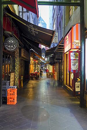
This bluestone-paved alley is a busy shortcut for people coming from Flinders Street station. They use it to get to the shopping areas of The Block on Collins Street and Bourke Street Mall. It also loosely connects with Centre Place, a similar lane just across Flinders Lane. The Degraves underpass was built in the 1950s. It allows people to walk from Flinders Street Station to Degraves Street without crossing the busy Flinders Street. The underpass is also home to the Platform Artists Group, which often shows new artworks. Cars can only access the lane with special permission.
The lane has bars, cafes, and restaurants. Many of the tall, old buildings were turned into modern apartments in the 1990s, making the street even livelier.
A redevelopment of the Mutual Store in 2006 added even more shops to the lane.
At the end of Degraves laneway, you can see "Majorca House," a fancy 1930s building decorated with special glazed tiles.
Many people use Degraves Street for a quick coffee before catching their train at Flinders Street station.
Flinders Lane: Fashion, Cafes, and History
Flinders Lane is a smaller street that runs next to and north of Flinders Street. It's a narrow one-way lane that shares the name of the wider main street. In the middle of the 20th century, this street was the center of Melbourne's fashion industry. It still has small fashion designers today.
Even though some important old buildings have been lost, the lane is now known for its cool, artistic vibe, like the SoHo area in New York. Today, the area has many unique hotels, apartments made from old buildings, cafes, and bars. It also connects to several smaller lanes, including Degraves Street, ACDC Lane, Manchester Lane, and Centreway, which wind through the city.
For one block between William Street and Market Street, Melbourne tram route 58 runs along Flinders Lane.
Hardware Lane: Food, Fun, and Jazz
Hardware Lane runs mostly north–south between Bourke Street and Little Lonsdale Street. You can find restaurants, ski shops, and hairdressers on this street. There's also a McDonald's at the south end and other fast food places.
The lane is closed to cars. At night, live jazz music entertains visitors at the bars and cafes.
Hardware Lane was named after Hardware House in the 1920s. It was built on land that used to be Kirk's Horse Bazaar, a place where horses were traded in 1840.
Dynon's Building at 63–73 Hardware Lane is a group of four warehouses. They were designed by William Pitt, who also designed some of the most beautiful gothic revival buildings in the city, like the Princess Theatre.
Healeys Lane: Melbourne's Koreatown
Healeys Lane is a cobblestone laneway in the central business district (CBD). It's on the northern edge of the CBD, between King Street and William Street. Healeys Lane runs north–south between Little Lonsdale Street and Lonsdale Street, close to Melbourne's legal area. Since September 2024, Healeys Lane has been officially known as Melbourne's Koreatown.
Hosier Lane: A Canvas for Street Art
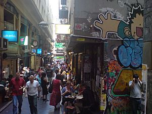
Hosier Lane is a bluestone-paved laneway for both cars and people. It's on the southern edge of the city center. Hosier Lane is a very famous landmark, mostly because of its amazing Urban art.
Hosier Lane is right across from the entrance to the Atrium at Federation Square on Flinders Street. This is a very noticeable spot in the city.
The lane is known for the high quality and often political messages in its art. It's even featured in a state-sponsored book called The Melbourne Design Guide and in Tourism Victoria's "Lose Yourself in Melbourne" advertising campaign. The walls covered in graffiti and art installations have become a popular background for fashion and wedding photos.
Hosier Lane is also known for its fancy cocktail lounges, including the popular Misty and MoVida. An outdoor cooking show with MoVida's chef Frank Camorra on Masterchef Australia season 2 showed off the lane as a major Melbourne attraction.
Howey Place: A Historic Shopping Arcade
Howey Place, once called "Cole's Walk," is a shopping arcade. It's a short, narrow covered laneway that runs south from Little Collins Street between Swanston Street and Elizabeth Street.
Located in the heart of the shopping area, Howey Place currently has small designer fashion shops. It connects to the Sportsgirl Centre, a shopping mall at 234 Collins Street, which goes through to Collins Street. It also forms an "L" shape towards the back of the Capitol Arcade, connecting it with Swanston Street.
Cars have limited access to this lane.
Before 1896, Howey Place was just a plain lane. In 1896, Edward William Cole, who created the famous Cole's Book Arcade, covered the lane with a glass roof. He also created glass display cases along the street to attract businesses. These included a Cole's wholesale bookstore, a toy department store, and a printing shop.
In the 1920s, the modern-style Presgrave building was added to the lane.
Howey House, a tall art-deco building from the 1930s, once connected the lane to Collins Street through an open laneway. However, Howey House was knocked down in the 1980s to build the Sportsgirl Centre, a modern shopping mall.
Niagara Lane: Old Warehouses and City Views
Niagara Lane is a small lane that runs mostly north–south between Bourke Street and Little Bourke Street. The lane is named after the Niagara buildings, which are old warehouses from the early 1900s. These buildings still have their original pulley and hook systems that were used to lift goods from horse and carts.
The lane is lined with old buildings and paved with bluestone. It's open to people walking and small vehicles. Looking south, you can see the copper-domed modern tower at 333 Collins Street and the Eureka Tower.
On the western corner of Lonsdale Street is the Niagara Hotel. This hotel was built in the 1870s, and its front was updated in the 1920s.
McKillop Street: Boutique Shops and Outdoor Dining
McKillop Street is a short, quiet, and narrow laneway. It runs between Bourke Street and Little Collins Street, and between Queen Street and Elizabeth Street in the central business district.
Located between the financial center and the shopping area, McKillop Street currently has small boutique shops and outdoor cafes.
The lane is paved with red brick and has several trees and old-style lampposts. Cars have limited access. Some historic buildings along the street have been turned into apartments.
Melbourne GPO: A Historic Post Office Turned Shops
The Melbourne General Post Office or GPO, is a famous building at the corner of Elizabeth Street and Bourke Street. It was restored in 2004 and is now a major shopping arcade. It runs from Bourke Street through to Little Bourke Street.
Royal Arcade: Melbourne's Oldest Arcade
Royal Arcade is a historic shopping arcade that was first built in 1869. The arcade connects Little Collins Street to the Bourke Street Mall. It also has a path that runs to Elizabeth Street in the west. It connects to the smaller Hub Arcade near the Little Collins Street end.
Designed by Charles Webb, the arcade has a high glass roof and shops with large windows. At the south end, you can see statues of mythical figures called Gog and Magog and a clock that chimes every hour. The arcade was restored between 2002 and 2004. This brought in more natural light and made the shopfronts look consistent.
It is a very important arcade from the Victorian era and is listed on the Victorian Heritage Register. Melbourne's Golden Mile heritage walk also goes through this arcade.
Along with Melbourne's other main arcade, the Block Arcade, and Melbourne's laneways, it's a famous tourist spot in the city. Royal Arcade is known for its fashion stores and special shops, like a tarot card reading store.
Tattersalls Lane: Oldest Lane with Food and Art
Tattersalls Lane is one of the oldest laneways in Melbourne. It's located between Swanston and Russell streets, connecting Lonsdale Street to Little Bourke Street. The lane was named before 1856 after the Tattersalls Hotel and Tattersalls Club nearby. Today, the lane is known for its mix of eateries, bars, and ever-changing street art.
See also
- Lanes and alleyways of Sydney
 | May Edward Chinn |
 | Rebecca Cole |
 | Alexa Canady |
 | Dorothy Lavinia Brown |


