Leith Links facts for kids
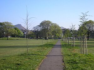
Leith Links is a big public park in Leith, which is a part of Edinburgh, Scotland. A road divides this park into two main areas: a western part and an eastern part. Both sections are mostly flat grassy areas surrounded by trees. Long ago, this area was much larger and stretched all the way to the sea. It used to be a place where people played golf, known as a "golf links."
Contents
What You Can Do There Now
The western part of Leith Links has fun things for kids, like play areas. There are also football pitches and courts for tennis and pétanque. Some old bowling greens are being turned into a new activity center and community space for everyone to enjoy.
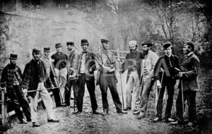
In the eastern part of the park, people have played cricket since 1826. A local cricket club, the Leith Franklin Academicals Beige, uses this pitch. This club started in 1852 and is named after Benjamin Franklin.
Every year, the Leith Festival Gala Day takes place here in the first week of June. It's a big celebration for the community. Also, the Edinburgh Mela, a festival celebrating different cultures, has been held on the Links in late August since 2010.
What It Was Used For Before
In the past, the park had a Victorian bandstand where music was played. There was also a pond for sailing model boats. The Links were also used for annual events like big parades and shows. Long ago, horse races called Leith Races happened on the sandy areas near the original Links.
A Look Back in History
Important Moments in Time
During a time of big changes in Scotland called the Scottish Reformation, a peace agreement was made at Leith Links on July 25, 1559. This agreement was between the Protestant leaders and the Catholic Queen Regent, Mary of Guise. She agreed to leave Edinburgh and Holyroodhouse.
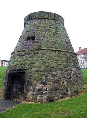
In 1560, during the Siege of Leith, English and Scottish soldiers used this area to dig trenches. You can still see two mounds on Leith Links today, known as "Giant's Brae" and "Lady Fyfe's Brae." These mounds are believed to be old artillery positions from the siege. They are now protected historical sites.
Golf's Special Place
Leith Links is very famous in the history of golf. Records show there was a 5-hole golf course here that people played for a long time. It was even revived in 1864. Both Charles I of England and the future James VII and II are said to have played golf on the Links when they stayed at Holyrood Palace.
The rules of golf that were developed in Leith were later adopted by the Royal and Ancient Company of Golfers when they moved to St. Andrews in 1777. This shows how important Leith Links was to the sport.
People believe the first international golf competition happened here. The Duke of Albany played against two English courtiers to decide which country could claim the game of golf. The Duke's partner, an Edinburgh shoemaker named John Paterson, later built Golfers Land on the Royal Mile because of this game.
Becoming a Public Park
The entire area officially became a public park in 1888 as part of a plan to improve Leith. At this time, the land was made flatter (except for the two old artillery mounds), and trees were planted around the edges. Paths were also added. Iron fences were put up around the park, but they were removed during World War II to help with the war effort. After it became a park, golf was not encouraged and was officially banned here in 1905.
During the changes in 1888, workers found two burial areas at each end of the Links. The one on the far west side was thought to be burial pits from a terrible outbreak of the plague in Leith in the mid-1600s.
The Plague of 1645
The plague that hit Leith in 1645 was one of many times this illness spread through Edinburgh and Leith between the 1300s and 1600s. Historians think the 1645 outbreak might have been a type of typhus and could have been brought north by Scottish soldiers.
Records from the South Leith Parish Church show that the first cases appeared in April 1645, and the illness was worst in the summer. The town was divided into sections, and people who were sick were moved to huts on the Links to keep them separate. These huts were cleaned by special workers who wore a unique uniform with a white St. Andrew's Cross on a black coat.
Most people who died were buried on the Links. After the illness ended, it was reported that 2,421 people died in South Leith alone, out of an estimated population of over 4,000.
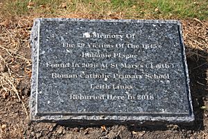
More recently, during work at St Mary's RC Primary School, the remains of 79 bodies were found. These were believed to be victims of the plague. They were reburied in Rosebank Cemetery in 2018, and a memorial plaque was placed there.
Buildings Around the Park
Leith Links was originally to the east of old Leith. People only started building outside the old town wall after 1770. The first houses were built around 1775 on the far north-west corner. Over time, more houses were built around the edges of the Links, especially grand ones from the early 1800s on the south-east side. Most buildings facing the Links today were built in the 1800s.
During World War II, small gardens called allotments were created on the north-east edge, and they are still there today.
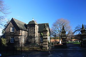
Seafield Cemetery was built at the far east end of Leith Links in 1887. Seafield Crematorium is next to the cemetery and opened in 1939.
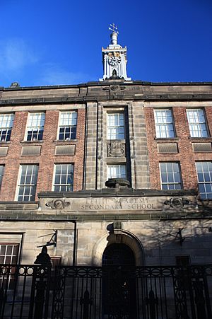
On the west side of the Links, you can see two large school buildings: Leith Primary and the old Leith Academy building, which has now been turned into homes.
Statues and Memorials
- A statue of John Rattray playing golf is on the north side.
- A stone monument (cairn) marks where golf was founded on the west side.
- Memorial plaques on Giant's Brae and Lady Fyfe's Brae explain their military history.
Trees and Plants
Leith Links is known for having many old elm trees, even though some have been lost to Dutch elm disease. In 2013, almost half of the park's 270 mature trees were elms. Most are wych elm, but there are also other types like Huntingdon Elm, Field Elm, and even rare kinds from other countries like European White Elm and Japanese Elm. Elms were originally chosen for planting because they can handle salty sea winds well.
Getting There
Buses from Lothian Buses stop all around the park on streets like Vanburgh Place, Hermitage Place, and Links Place.
The closest tram stop is called Foot of the Walk.
Images for kids
 | Valerie Thomas |
 | Frederick McKinley Jones |
 | George Edward Alcorn Jr. |
 | Thomas Mensah |


