
List of European archaeological sites on the National Register of Historic Places in Pennsylvania facts for kids
This page lists important historical places in Pennsylvania that show us how Europeans lived a long time ago. These places are special because they are listed on the National Register of Historic Places in the United States. This list helps protect places that are important to history.
To be on this list, a place must be very important. For archaeological sites, it means that digging there can teach us a lot about the past. In Pennsylvania, there are about 100 such sites. This list focuses on places where we find clues about European settlers and their lives.
Contents
What are Archaeological Sites?
Archaeological sites are places where people lived or worked a long time ago. Archaeologists are like history detectives. They dig carefully to find old objects, buildings, or even just traces in the ground. These clues, called artifacts, help us understand what life was like for people in the past.
Important European Sites in Pennsylvania
Pennsylvania has many cool archaeological sites that tell stories about European settlers. These sites include old factories, farms, forts, and even entire towns!
Old Factories and Mills
Many early European settlers built factories and mills. These places were important for making things people needed.
Iron Furnaces
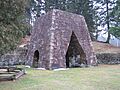
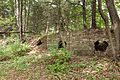
- Alliance Furnace in Fayette County has the remains of an old blast furnace. These furnaces were huge ovens used to melt iron ore to make metal.
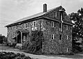
- The Barree Forge and Furnace in Huntingdon County is another example of an old iron-making complex.
- In Berks County, you can find the Dale Furnace and Forge Historic District and the Robesonia Furnace Historic District. These places show how important iron production was in early Pennsylvania.
- The Monroe Furnace in Huntingdon County and the Mount Hope Estate in Lancaster County also have parts of old blast furnaces.
- The Shade Furnace Archaeological District in Somerset County is another site with furnace remains. These sites help us understand how early industries worked.
Mills and Shops
- The Dreibelbis Mill and Geiger Mill in Berks County are examples of old gristmills from the 1800s. Gristmills were used to grind grain into flour.
- The Nicholas Johnson Mill and Kauffman Mill, also in Berks County, are other important gristmill sites.
- The Knabb-Bieber Mill in Oley Township, Berks County, is another early 1800s gristmill.
- The Yoder Mill in Pike Township, Berks County, is a 19th-century gristmill.
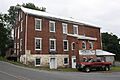
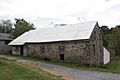
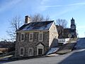
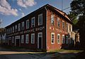
- The Brown-Moore Blacksmith Shop in Fayette County is a very old and well-kept blacksmith shop from the early 1800s. Blacksmiths made tools and other metal items.
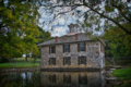
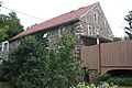
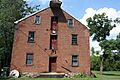
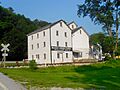
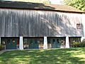
- The Crosley-Garrett Mill Workers' Housing, Store and Mill Site in Delaware County shows us what a whole town built around a mill looked like.
- The Chickies Historic District in Lancaster County includes an early mill site.
- The Muddy Creek Forks Historic District in York County also has parts of an 18th-century mill complex.
- The Millmont Farm in Franklin County includes a late 18th-century gristmill.
Other Industrial Sites
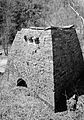
- The Minersville Coke Ovens in Huntingdon County are a group of ovens used to make coke, a type of fuel from coal.
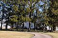
- The York Iron Company Mine in York County has remains of an iron mine from the 1800s.
- The Chester Creek Historic District and Mill Creek Historic District in Delaware and Montgomery Counties have many early industrial sites.
- The Kise Mill Bridge Historic District in York County shows parts of an early 1800s industrial area.
- The Jacobsburg Historic District in Northampton County was an industrial village in the 1700s.
- The North Warwick Historic and Archeological District in Chester County has industrial sites from the 1700s and 1800s.
Historic Towns and Settlements
Some archaeological sites are entire towns or parts of towns that tell us about how people lived together.
- The Boswell Historic District in Somerset County, Cairnbrook Historic District in Somerset County, Robertsdale Historic District in Huntingdon County, Slickville Historic District in Westmoreland County, and Smock Historic District in Fayette County were all "company towns." This means they were built by coal mining companies for their workers.
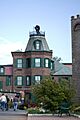
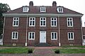
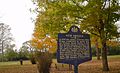
- The Beaver Historic District in Beaver County includes the site of Fort McIntosh.
- The Holicong Village Historic District in Bucks County is an 18th-century village.
- The Irwintown Site in Elk County has the remains of a logging town from the 1800s.
- The Saltsburg Historic District in Indiana County includes a part of the Pennsylvania Canal.
- The Upper Roxborough Historic District in Philadelphia and Montgomery Counties has parts of 18th-century industrial areas.
- The Rice's Landing Historic District in Greene County has remains of 19th-century industrial buildings.
Forts and Battlefields
Many sites are important for understanding wars and defense.
- The Forks of the Ohio in Pittsburgh includes the site of Fort Pitt. This was a very important fort during colonial times.
- The Fort Hunter Historic District in Dauphin County has the site of Fort Hunter, built in the 1750s.
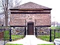
- The Fort McIntosh Site in Beaver County was the first official U.S. Army fort north of the Ohio River.
- Legionville in Beaver County was the first official U.S. Army training camp.
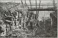
- The Gettysburg National Military Park in Adams County is the famous site of the Battle of Gettysburg during the American Civil War.
- The George Brinton House and Chad House in Chester and Delaware Counties have artifacts from the Battle of Brandywine during the American Revolutionary War.
- The Hower-Slote House in Northumberland County includes part of the site of Fort Freeland, built during the Revolutionary War.
- Dykeman's Spring in Cumberland County has military artifacts from the Civil War.
Other Important Sites
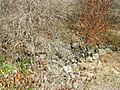
- The John Brown Tannery Site in Crawford County has the ruins of a tannery run by John Brown, a famous person who fought against slavery.
- The Jeremiah Burns Farm in Franklin County includes an early sawmill and a log cabin site.
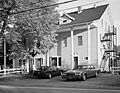
- The Independence National Historical Park in Philadelphia includes Independence Hall, where the Declaration of Independence was signed.
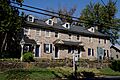
- The Locust Grove in Lancaster County is a late 18th-century farmhouse.
- The Israel and Samuel Lupfer Tannery Site and House in Perry County has remains of a 19th-century tannery.
- The Jacob Nicholas House in Easton is one of only six buildings in Easton built before the American Revolution.
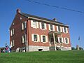
- Pennsbury Manor in Bucks County was the home of William Penn, who founded Pennsylvania.
- The Printzhof in Delaware County was a leading building of New Sweden, an early European colony.
- Ridley Creek State Park in Delaware County includes many old farms from the late 1600s.
- Rock Hill Farm in Franklin County has the ruins of a very early 17th-century farm building.
- Siegfried's Dale Farm in Berks County is a group of 18th-century farms.
- The Robert Wilson House in Chester County includes an early 19th-century tannery.
- The Sommerheim Park Archaeological District in Erie County has a 19th-century trash heap, which can tell us a lot about daily life.
These sites help us learn about the lives, work, and struggles of the European people who settled in Pennsylvania long ago.
Images for kids
-
Allegheny Aqueduct, a section of the Schuylkill Canal.
-
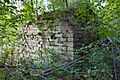
Remains of the Alliance Furnace.
-
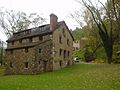
Buildings at the Juniata Ironworks, part of Barree Forge and Furnace.
-
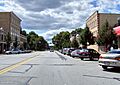
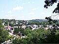
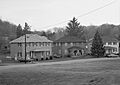
Downtown Beaver, Pennsylvania, including the site of Fort McIntosh.
-
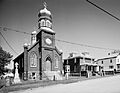
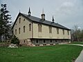
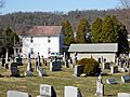
A church in Boswell Historic District, a coal mining company town.
-
Remains of the Bradys Bend Iron Company Furnace.
-
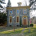
The George Brinton House.
-

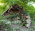
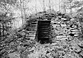
Foundation of the John Brown Tannery.
-
The Brown-Moore Blacksmith Shop.
-
The Jeremiah Burns Farm.
-
Office building in Cairnbrook Historic District.
-
The Chad House.
-
A view of Thornbury Township, part of Chester Creek Historic District.
-
Marietta, Pennsylvania, near the Chickies Historic District.
-
Codorus Furnace remains.
-
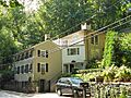
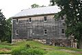
The Crosley-Garrett Mill.
-
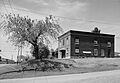
A horse barn at the Dale Furnace and Forge Historic District.
-
The Dreibelbis Mill.
-
Hatch House and Pond at Dykeman's Spring.
-
Etna Furnace remains.
-
Bouquet blockhouse at Forks of the Ohio.
-
Fort Hunter.
-
The site of Fort McIntosh.
-
Gettysburg Battlefield.
-
The Geiger Mill.
-
Greenwood Furnace.
-
The Guldin Mill.
-
Holicong Village Historic District.
-
The Hower-Slote House.
-
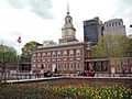
Independence Hall.
-
The Irwintown Site.
-
Jacobsburg Historic District.
-
The Nicholas Johnson Mill.
-
The Kauffman Mill.
-
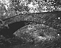
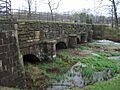
Kise Mill Bridge.
-
The Knabb-Bieber Mill.
-
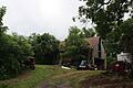
The Knipe-Johnson Farm.
-
Lehigh Canal at Glendon.
-
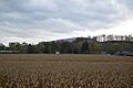
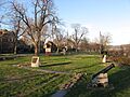
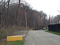
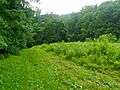
Fields at Legionville.
-
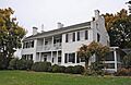
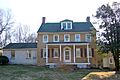
Locust Grove.
-
Mill Creek Historic District.
-
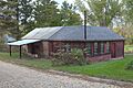
Minersville Coke Ovens.
-
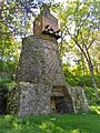
Monroe Furnace ruins.
-
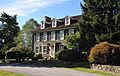
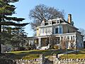
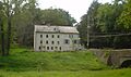
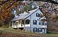
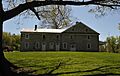
Mount Hope Estate.
-
Muddy Creek Forks Historic District.
-
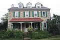
The Jacob Nicholas House.
-
Crow's Nest Visitor Center in North Warwick Historic and Archeological District.
-
Pennsbury Manor.
-
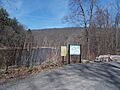
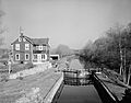
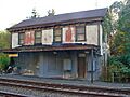
Pennsylvania Canal Guard Lock.
-
The Printzhof.
-
W.A. Young & Sons Foundry & Machine Shop in Rice's Landing Historic District.
-
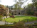
Mansion at Ridley Creek State Park.
-
Robertsdale Hotel in Robertsdale Historic District.
-
A building in Robesonia Furnace Historic District.
-
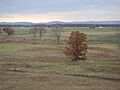
Saltsburg.
-
Shade Furnace.
-
John and Catherina Siegfried House.
-
First Avenue in Slickville Historic District.
-
Smock Historic District.
-
Sommerheim Park Archaeological District.
-
Nixon Lane in Upper Roxborough Historic District.
-
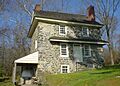
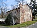
The Robert Wilson House.
-
The Yoder Mill.
-
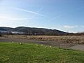
Raab Park, near York Iron Company Mine.
.jpg)


.jpg)


See also
