kids encyclopedia robot

List of ghost towns in Alberta facts for kids

Kids Encyclopedia Facts


The province of Alberta has several ghost towns that have been completely or partially abandoned. Many of Alberta's ghost towns exist as a result of a number of failed coal mining operations in the area during the early 20th century.

Ghost towns are communities that once had a considerable population, that have since dwindled in numbers causing some or all its business to close, either due to the rerouting of a highway, train tracks being pulled, or exhaustion of some natural resource.

Flowerdale, Alberta
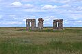
Remains of Flowerdale
Luscar hotel
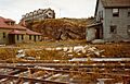
Hotel in Luscar in the 1950s
Sunset at Maybutt Alberta
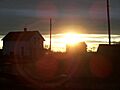
Sun setting on Maybutt
Mountainpark
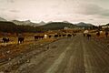
The road into Mountain Park
Empty store in Nemiscam Alberta
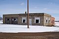
Vacant store in Nemiscam
OrionAlberta
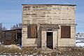
Vacant store in Orion

List of ghost towns

Ghost town Municipality Location About Peak population
(year)
Latest population
(year)
Alderson Cypress County 50°16′59″N 111°19′59″W / 50.283°N 111.333°W / 50.283; -111.333 (Alderson) &&&&&&&&&&&&0161.&&&&&0161
(1911)
Alexo Clearwater County 52°28′30″N 115°46′59″W / 52.475°N 115.783°W / 52.475; -115.783 (Alexo) Former coal mining community &&&&&&&&&&&&0113.&&&&&0113
(1951)
Allerston County of Warner No. 5 49°08′42″N 111°45′50″W / 49.145°N 111.764°W / 49.145; -111.764 (Allerston)
Allingham Kneehill County 51°42′00″N 113°36′00″W / 51.700°N 113.600°W / 51.700; -113.600 (Allingham)
Ardley Red Deer County 52°15′40″N 113°13′41″W / 52.261°N 113.228°W / 52.261; -113.228 (Ardley) &&&&&&&&&&&&&017.&&&&&017
(1991)
Altorado County of Forty Mile No. 8
Amber Valley Athabasca County 54°43′59″N 112°55′01″W / 54.733°N 112.917°W / 54.733; -112.917 (Altorado)
Ansell Yellowhead County 53°33′25″N 116°31′30″W / 53.557°N 116.525°W / 53.557; -116.525 (Ansell) &&&&&&&&&&&&0272.&&&&&0272
(1951)
Anthracite Improvement District No. 9 (Banff National Park) 51°11′56″N 115°30′00″W / 51.199°N 115.500°W / 51.199; -115.500 (Anthracite) &&&&&&&&&&&&&025.&&&&&025
(1911)
Ardenode Wheatland County 51°08′49″N 113°25′23″W / 51.147°N 113.423°W / 51.147; -113.423 (Ardenode) &&&&&&&&&&&&&&00.&&&&&00
(2016)
Bankhead Improvement District No. 9 (Banff National Park) 51°12′00″N 115°31′59″W / 51.200°N 115.533°W / 51.200; -115.533 (Bankhead) Former coal mining community &&&&&&&&&&&&0694.&&&&&0694
(1911)
Bardo Beaver County 53°18′07″N 112°41′06″W / 53.302°N 112.685°W / 53.302; -112.685 (Bardo)
Battle Bend Flagstaff County 52°26′02″N 111°26′38″W / 52.434°N 111.444°W / 52.434; -111.444 (Battle Bend)
Beazer Cardston County 49°06′58″N 113°28′52″W / 49.116°N 113.481°W / 49.116; -113.481 (Beazer) &&&&&&&&&&&&&011.&&&&&011
(2008)
Belloy Birch Hills County 55°45′00″N 118°15′00″W / 55.750°N 118.250°W / 55.750; -118.250 (Belloy)
Bickerdike Yellowhead County 53°32′38″N 116°38′31″W / 53.544°N 116.642°W / 53.544; -116.642 (Bickerdike) Post office closed in 1956 &&&&&&&&&&&&0150.&&&&&0150
(1911)
Bindloss Special Area No. 2 50°52′44″N 110°16′34″W / 50.879°N 110.276°W / 50.879; -110.276 (Bindloss) &&&&&&&&&&&&&014.&&&&&014
(1991)
Bingham County of Forty Mile No. 8 49°28′48″N 111°16′34″W / 49.480°N 111.276°W / 49.480; -111.276 (Bingham)
Bliss Yellowhead County 53°01′55″N 117°19′37″W / 53.032°N 117.327°W / 53.032; -117.327 &&&&&&&&&&&&0652.&&&&&0652
(1956)
Bow City Vulcan County 50°25′30″N 112°16′23″W / 50.425°N 112.273°W / 50.425; -112.273 http://www.ghosttowns.com/canada/alberta/bowcity.htm
Brush Hill County of Minburn No. 27 53°34′15″N 111°57′36″W / 53.5707167°N 111.9601167°W / 53.5707167; -111.9601167
Buffalo Special Area No. 2 50°48′00″N 110°40′01″W / 50.800°N 110.667°W / 50.800; -110.667 (Buffalo)
Bulwark County of Paintearth No. 18 52°15′00″N 111°34′59″W / 52.250°N 111.583°W / 52.250; -111.583 (Bulwark)
Butte Clearwater County 52°10′59″N 114°43′59″W / 52.183°N 114.733°W / 52.183; -114.733 (Butte)
Cadomin Yellowhead County 53°01′55″N 117°19′37″W / 53.032°N 117.327°W / 53.032; -117.327 (Cadomin) &&&&&&&&&&&01053.&&&&&01,053
(1941)
&&&&&&&&&&&&&040.&&&&&040
(2016)
Cambria Town of Drumheller 51°23′46″N 112°35′35″W / 51.396°N 112.593°W / 51.396; -112.593 (Cambria) &&&&&&&&&&&&0239.&&&&&0239
(1951)
Chisholm Mills Municipal District of Lesser Slave River No. 124 54°54′36″N 114°10′12″W / 54.910°N 114.170°W / 54.910; -114.170 (Chisholm Mills) &&&&&&&&&&&&0323.&&&&&0323
(1941)
&&&&&&&&&&&&&025.&&&&&025
(2016)
Coal Valley Yellowhead County 53°04′59″N 116°48′00″W / 53.083°N 116.800°W / 53.083; -116.800 (Coal Valley) &&&&&&&&&&&&0194.&&&&&0194
(1951)
Coalspur Yellowhead County 53°10′59″N 117°01′01″W / 53.183°N 117.017°W / 53.183; -117.017 (Coalspur) &&&&&&&&&&&&0133.&&&&&0133
(1951)
Commerce Lethbridge County 49°55′01″N 112°56′20″W / 49.917°N 112.939°W / 49.917; -112.939 (Commerce) &&&&&&&&&&&&0360.&&&&&0360
(1921)
Conquerville County of Forty Mile No. 8 49°40′12″N 111°13′26″W / 49.670°N 111.224°W / 49.670; -111.224 (Conquerville)
Conrad County of Forty Mile No. 8 49°31′01″N 111°58′01″W / 49.517°N 111.967°W / 49.517; -111.967 (Conrad)
Del Bonita Cardston County 49°01′44″N 112°47′20″W / 49.029°N 112.789°W / 49.029; -112.789 (Del Bonita) &&&&&&&&&&&&&&08.&&&&&08
(2008)
Dorothy Special Area No. 2 51°18′00″N 112°19′01″W / 51.300°N 112.317°W / 51.300; -112.317 (Dorothy) &&&&&&&&&&&&&014.&&&&&014
(1991)
East Coulee Town of Drumheller 51°20′10″N 112°29′20″W / 51.336°N 112.489°W / 51.336; -112.489 (East Coulee) &&&&&&&&&&&01831.&&&&&01,831
(1941)
&&&&&&&&&&&&0148.&&&&&0148
(2016)
Embarras Landing Yellowhead County 53°18′00″N 116°54′00″W / 53.300°N 116.900°W / 53.300; -116.900 (Embarras Landing)
Evarts Red Deer County 52°15′40″N 114°16′19″W / 52.261°N 114.272°W / 52.261; -114.272 (Evarts) &&&&&&&&&&&&&025.&&&&&025
(1911)
Flowerdale Special Area No. 2 51°21′58″N 111°33′54″W / 51.366°N 111.565°W / 51.366; -111.565 (Flowerdale) The settlement was abandoned in the early 1920s and destroyed by a prairie fire soon after. Flowerdale had a post office, Flowerdale Holdings, a general store, a schoolhouse and many other businesses.
Foothills Yellowhead County &&&&&&&&&&&&0224.&&&&&0224
(1956)
Frank Municipality of Crowsnest Pass 49°36′00″N 114°24′18″W / 49.600°N 114.405°W / 49.600; -114.405 (Frank) &&&&&&&&&&&01178.&&&&&01,178
(1906)
&&&&&&&&&&&&&085.&&&&&085
(2016)
Frankburg Municipal District of Foothills No. 31 50°31′44″N 113°38′38″W / 50.529°N 113.644°W / 50.529; -113.644 (Frankburg)
Georgetown Municipal District of Bighorn No. 8 51°06′29″N 115°23′38″W / 51.108°N 115.394°W / 51.108; -115.394 (Georgetown)
Harrisville Cardston County 49°09′32″N 113°38′28″W / 49.159°N 113.641°W / 49.159; -113.641 (Harrisville)
Judson Cardston County 49°31′59″N 112°21′00″W / 49.533°N 112.350°W / 49.533; -112.350 (Judson)
Kimball Cardston County 49°04′59″N 113°12′00″W / 49.083°N 113.200°W / 49.083; -113.200 (Kimball) &&&&&&&&&&&&&026.&&&&&026
(2008)
Kovach Kananaskis Improvement District 50°55′59″N 115°12′00″W / 50.933°N 115.200°W / 50.933; -115.200 (Kovach)
Legend County of Forty Mile No. 8 49°28′55″N 111°35′53″W / 49.482°N 111.598°W / 49.482; -111.598 (Legend)
Lehigh Town of Drumheller 51°21′14″N 112°30′50″W / 51.354°N 112.514°W / 51.354; -112.514 (Lehigh) &&&&&&&&&&&&0133.&&&&&0133
(1941)
Lille Municipal District of Ranchland No. 66 49°39′04″N 114°23′53″W / 49.651°N 114.398°W / 49.651; -114.398 (Lille) &&&&&&&&&&&&0413.&&&&&0413
(1906)
Luscar Yellowhead County 53°04′05″N 117°24′00″W / 53.068°N 117.400°W / 53.068; -117.400 (Luscar) Former coal mining community &&&&&&&&&&&&0620.&&&&&0620
(1941)
Mannix Brazeau County &&&&&&&&&&&&0369.&&&&&0369
(1961)
Maybutt County of Warner No. 5 49°31′05″N 112°31′41″W / 49.518°N 112.528°W / 49.518; -112.528 (Maybutt)
Mercoal Yellowhead County 53°10′01″N 117°04′59″W / 53.167°N 117.083°W / 53.167; -117.083 (Mercoal) Former coal mining community &&&&&&&&&&&&0977.&&&&&0977
(1951)
Mintlaw Red Deer County 52°13′19″N 113°54′50″W / 52.222°N 113.914°W / 52.222; -113.914 (Mintlaw)
Mitford Rocky View County 51°12′43″N 114°33′04″W / 51.212°N 114.551°W / 51.212; -114.551 (Mitford)
Mountain Park Yellowhead County 52°55′01″N 117°16′01″W / 52.917°N 117.267°W / 52.917; -117.267 (Mountain Park) Former coal mining community
Nordegg Clearwater County 52°28′05″N 116°04′52″W / 52.468°N 116.081°W / 52.468; -116.081 (Nordegg) Former coal mining community/National Historic Site &&&&&&&&&&&&0875.&&&&&0875
(1951)
&&&&&&&&&&&&&053.&&&&&053
(1986)
Pakowki County of Forty Mile No. 8 49°27′58″N 110°56′53″W / 49.466°N 110.948°W / 49.466; -110.948 (Pakowki)
Passburg Municipality of Crowsnest Pass 49°33′25″N 114°20′24″W / 49.557°N 114.340°W / 49.557; -114.340 (Passburg) &&&&&&&&&&&&0305.&&&&&0305
(1911)
Port Cornwall Municipal District of Lesser Slave River No. 124 55°10′01″N 114°03′29″W / 55.167°N 114.058°W / 55.167; -114.058 (Port Cornwall) &&&&&&&&&&&&0200.&&&&&0200
(1913)
Pendant d'Oreille County of Forty Mile No. 8 49°12′11″N 110°52′01″W / 49.203°N 110.867°W / 49.203; -110.867 (Pendant d'Oreille)
Queenstown Vulcan County 50°38′17″N 112°56′17″W / 50.638°N 112.938°W / 50.638; -112.938 (Queenstown) &&&&&&&&&&&&0666.&&&&&0666
(1911)
&&&&&&&&&&&&&&08.&&&&&08
(2007)
Raley Cardston County 49°17′28″N 113°10′55″W / 49.291°N 113.182°W / 49.291; -113.182 (Raley)
Retlaw Municipal District of Taber 50°04′01″N 112°16′01″W / 50.067°N 112.267°W / 50.067; -112.267 (Retlaw) &&&&&&&&&&&&0154.&&&&&0154
(1921)
Rowley Starland County 51°45′54″N 112°47′17″W / 51.765°N 112.788°W / 51.765; -112.788 (Rowley) &&&&&&&&&&&&&076.&&&&&076
(1951)
&&&&&&&&&&&&&&08.&&&&&08
(2013)
Royalties Foothills County 50°33′18″N 114°13′52″W / 50.555°N 114.231°W / 50.555; -114.231 (Royalties) &&&&&&&&&&&&0824.&&&&&0824
(1941)
St. Michael Lamont County 52°49′55″N 112°37′44″W / 52.832°N 112.629°W / 52.832; -112.629 (St. Michael) &&&&&&&&&&&&0342.&&&&&0342
(1951)
&&&&&&&&&&&&&039.&&&&&039
(1991)
Seebe Municipal District of Bighorn No. 8 51°05′46″N 115°03′53″W / 51.096°N 115.0648°W / 51.096; -115.0648 (Seebe) &&&&&&&&&&&&0147.&&&&&0147
(1951)
&&&&&&&&&&&&&&00.&&&&&00
(2016)
Sterco Yellowhead County 53°06′00″N 116°49′41″W / 53.100°N 116.828°W / 53.100; -116.828 (Sterco) &&&&&&&&&&&&0224.&&&&&0224
(1941)
Taylorville Cardston County 49°01′59″N 113°07′01″W / 49.033°N 113.117°W / 49.033; -113.117 (Taylorville)
Tollerton Yellowhead County 53°32′10″N 116°28′08″W / 53.536°N 116.469°W / 53.536; -116.469 (Tollerton) &&&&&&&&&&&&0180.&&&&&0180
(1916)
Travers Vulcan County 50°15′07″N 112°32′53″W / 50.252°N 112.548°W / 50.252; -112.548 (Travers) &&&&&&&&&&&&&&00.&&&&&00
(2007)
Twin River Cardston County
Violet Grove Brazeau County 53°09′47″N 115°02′17″W / 53.163°N 115.038°W / 53.163; -115.038 (Violet Grove) &&&&&&&&&&&&0712.&&&&&0712
(1956)
&&&&&&&&&&&&0141.&&&&&0141
(2005)
Wardlow Special Area No. 2 50°54′22″N 111°33′04″W / 50.906°N 111.551°W / 50.906; -111.551 (Wardlow) &&&&&&&&&&&&&028.&&&&&028
(1991)
Wayne Town of Drumheller 51°22′55″N 112°39′36″W / 51.382°N 112.660°W / 51.382; -112.660 (Wayne) &&&&&&&&&&&&0601.&&&&&0601
(1941)
Whiskey Gap Cardston County 49°01′59″N 113°01′59″W / 49.033°N 113.033°W / 49.033; -113.033 (Whiskey Gap)
Whitford Lamont County 53°52′01″N 112°13′01″W / 53.867°N 112.217°W / 53.867; -112.217 (Whitford) &&&&&&&&&&&&&&06.&&&&&06
(1981)
Whitla County of Forty Mile No. 8 49°52′01″N 111°03′00″W / 49.867°N 111.050°W / 49.867; -111.050 (Whitla)
Wimborne Kneehill County 51°51′54″N 113°35′38″W / 51.865°N 113.594°W / 51.865; -113.594 (Wimborne) &&&&&&&&&&&&&090.&&&&&090
(1951)
&&&&&&&&&&&&&020.&&&&&020
(2016)
Windfall Woodlands County 54°11′13″N 116°13′08″W / 54.187°N 116.219°W / 54.187; -116.219 (Windfall) Former gas plant community founded by Canadian Fina Oil Ltd. &&&&&&&&&&&&0101.&&&&&0101
(1961)
Winnifred County of Forty Mile No. 8 49°54′00″N 111°12′00″W / 49.900°N 111.200°W / 49.900; -111.200 (Winnifred) &&&&&&&&&&&&&080.&&&&&080
(1941)
Woolford Cardston County 49°10′59″N 113°07′59″W / 49.183°N 113.133°W / 49.183; -113.133 (Woolford) &&&&&&&&&&&&&013.&&&&&013
(1986)
Wostok Lamont County 53°51′00″N 112°28′01″W / 53.850°N 112.467°W / 53.850; -112.467 (Wostok) &&&&&&&&&&&&&015.&&&&&015
(1991)
Yates Yellowhead County 53°01′55″N 117°19′37″W / 53.032°N 117.327°W / 53.032; -117.327 (Yates) &&&&&&&&&&&&0301.&&&&&0301
(1951)

See also

BC
AB
SK
MB
ON
QC
NB
PE
NS
NL
YT
NT
NU
Canadian Provinces and Territories
Ghost towns in Canada by province or territory
kids search engine
List of ghost towns in Alberta Facts for Kids. Kiddle Encyclopedia.