List of islands of Arizona facts for kids

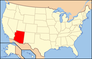
Location of Arizona within the United States
|
|
| Geography | |
|---|---|
| Location | Arizona |
| Total islands | 34 named |
| Administration | |
| State | |
Did you know that the state of Arizona has islands? Even though Arizona is a landlocked state, meaning it has no ocean coastline, it still has many islands! Arizona is the sixth-largest state in the United States by land area. It is also the third-largest state without an ocean.
Arizona has a small amount of water compared to other states. Only West Virginia and New Mexico have less water. Most of Arizona's islands are found in the Colorado River, especially in Lake Mead. You can also find several islands in Lake Roosevelt.
Contents
What is an Island?
An island is a piece of land completely surrounded by water. When we think of islands, we often imagine them in the ocean. But islands can also be found in rivers, lakes, and even artificial reservoirs. Arizona's islands are mostly in its large lakes and rivers. These islands were formed by natural processes or when valleys were flooded to create lakes.
Islands in Arizona's Waterways
Arizona's islands are mainly located in two major water systems: the Colorado River and its connected lakes, and the Salt River system, which includes Lake Roosevelt. These islands offer unique habitats for wildlife and interesting spots for people to explore.
Colorado River Islands
The Colorado River is a very important river in the southwestern United States. It flows through Arizona and forms many islands. Some of these islands are in the river itself, while others are in the large lakes created by dams on the river.
Lake Mead Islands
Lake Mead is a huge reservoir on the Colorado River. It is one of the largest man-made lakes in the world. Many islands are found here, especially in the Arizona part of the lake. These islands were once hilltops before the lake was filled.
Other Colorado River Islands
Besides Lake Mead, other parts of the Colorado River and its smaller lakes also have islands. These include islands in Lake Powell, Lake Mohave, and Lake Havasu. Each island has its own unique features and history.
Salt River System Islands
The Salt River system is another important water source in Arizona. It feeds into several lakes, including Lake Roosevelt and Bartlett Lake. These lakes also contain a number of islands.
Lake Roosevelt Islands
Lake Roosevelt is a large reservoir on the Salt River. It is a popular spot for boating and fishing. Several islands dot the surface of Lake Roosevelt, adding to its scenic beauty.
Other Lake Islands
Other lakes like Bartlett Lake and Saguaro Lake also have islands. These smaller islands are often rocky outcrops that rise above the water. They are important for local wildlife.
List of Islands in Arizona
Here is a list of some of the named islands found in Arizona. They are located in various bodies of water across different counties.
| Island | Body of water | County | Coordinates |
|---|---|---|---|
| Antelope Island | Lake Powell | Coconino | 36°59′00″N 111°26′00″W / 36.98333°N 111.43333°W |
| Beaver Island | Colorado River | Mohave | 34°25′18″N 114°17′28″W / 34.42167°N 114.29111°W |
| Beehive Island | Colorado River | Mohave | 36°04′20″N 114°43′34″W / 36.07222°N 114.72611°W |
| Bulls Head Rock | Lake Mohave | Mohave | 35°12′17″N 114°34′22″W / 35.20472°N 114.57278°W |
| Channel Island | Colorado River | Mohave | 36°01′42″N 114°08′30″W / 36.02833°N 114.14167°W |
| Decision Island | Lake Mead | Mohave | 36°02′22″N 114°17′04″W / 36.03944°N 114.28444°W |
| Deer Island | Colorado River | La Paz | 34°07′00″N 114°22′30″W / 34.11667°N 114.37500°W |
| Driftwood Island | Colorado River | Mohave | 36°11′34″N 114°01′31″W / 36.19278°N 114.02528°W |
| Haulapai Island | Colorado River | Mohave | 36°01′54″N 114°08′09″W / 36.03167°N 114.13583°W |
| Haystack Island | Lake Roosevelt | Gila | 33°41′47″N 111°07′45″W / 33.69639°N 111.12917°W |
| Heron Point | Lake Mead | Mohave | 36°02′51″N 114°18′41″W / 36.04750°N 114.31139°W |
| Hi Isle | Lake Havasu | Mohave | 34°18′57″N 114°08′35″W / 34.31583°N 114.14306°W |
| Hog Island | Bartlett Lake | Maricopa | 33°50′25″N 111°37′01″W / 33.84028°N 111.61694°W |
| Houseboat Island | Lake Mead | Mohave | 36°04′03″N 114°20′09″W / 36.06750°N 114.33583°W |
| Mohave Rock | Colorado River | Mohave | 34°36′46″N 114°25′28″W / 34.61278°N 114.42444°W |
| Napoleans Tomb | Lake Mead | Mohave | 36°07′09″N 114°21′27″W / 36.11917°N 114.35750°W |
| Panic Rock | Bartlett Lake | Maricopa | 33°49′29″N 111°37′18″W / 33.82472°N 111.62167°W |
| Pittsburg Point | Colorado River | Mohave | 34°27′37″N 114°21′36″W / 34.46028°N 114.36000°W |
| Plane Crash Island | Lake Mead | Mohave | 36°03′26″N 114°19′57″W / 36.05722°N 114.33250°W |
| Pool Islands (5 islands) | Lake Mead | Mohave | 36°05′54″N 114°27′58″W / 36.09833°N 114.46611°W |
| Punk Rock | Verde River | Yavapai | 34°25′33″N 111°46′43″W / 34.42583°N 111.77861°W |
| Rabbit Island | Lake Roosevelt | Gila | 33°41′49″N 111°08′49″W / 33.69694°N 111.14694°W |
| River Island | Colorado River | Mohave | 34°39′28″N 114°26′58″W / 34.65778°N 114.44944°W |
| Rock Island | Lake Roosevelt | Gila | 33°41′16″N 111°08′25″W / 33.68778°N 111.14028°W |
| Saddle Island | Lake Roosevelt | Gila | 33°39′32″N 111°04′16″W / 33.65889°N 111.07111°W |
| Shelter Island | Lake Roosevelt | Gila | 33°40′05″N 111°04′48″W / 33.66806°N 111.08000°W |
| Ship Rock | Saguaro Lake | Maricopa | 33°33′48″N 111°29′47″W / 33.56333°N 111.49639°W |
| Steamboat Rock | Lake Roosevelt | Gila | 33°40′50″N 111°05′03″W / 33.68056°N 111.08417°W |
| Two Rocks (2 islands) | Colorado River | Mohave | 35°43′30″N 114°42′00″W / 35.72500°N 114.70000°W |

