
Litchfield (borough), Connecticut facts for kids
Quick facts for kids
Litchfield, Connecticut
|
|
|---|---|
| Borough of Litchfield | |

First Congregational Church, at center of borough
|
|
_Highlighted_2010.svg) Litchfield County and Connecticut Litchfield County and Connecticut Northwest Hills Planning Region and Connecticut Northwest Hills Planning Region and Connecticut |
|
| Country | |
| U.S. state | |
| County | Litchfield |
| Region | Northwest Hills |
| Town | Litchfield |
| Incorporated as village | 1818 |
| Area | |
| • Total | 3.56 km2 (1.37 sq mi) |
| • Land | 3.56 km2 (1.37 sq mi) |
| • Water | 0.0 km2 (0 sq mi) |
| Elevation | 320 m (1,060 ft) |
| Population
(2010)
|
|
| • Total | 1,258 |
| • Density | 353.9/km2 (917/sq mi) |
| Time zone | UTC-5 (EST) |
| • Summer (DST) | UTC-4 (EDT) |
| ZIP Code |
06759
|
| Area code(s) | 860 |
| Exchange | 567 |
Litchfield is a small town center, also known as a borough, located in Litchfield County, Connecticut, United States. It's like the main village within the larger town of Litchfield. In 2010, about 1,258 people lived there.
Litchfield is special because its entire area was named a historic district in 1959. This means many of its old buildings and streets are protected. A part of the borough is even more important, being listed as a National Historic Landmark, called the Litchfield Historic District.
Contents
History of Litchfield
The borough of Litchfield became an official village in 1818. This was quite rare, as it was one of only two villages ever created in Connecticut. Later, in 1879, it was given a new official status as a borough.
Litchfield's Historic Status
|
Litchfield Historic District (Borough)
|
|

Location in Connecticut

Location in the United States
|
|
| Location | Litchfield, Connecticut |
|---|---|
| Area | 840 acres (340 ha) |
| Architectural style | Greek Revival, Late Victorian |
| NRHP reference No. | 78003456 |
| Added to NRHP | November 29, 1978 |
In 1959, the whole borough was named the "Old and Historic Litchfield Historic District" by the state of Connecticut. It was the very first historic district of its kind in the state!
Later, in 1968, a main part of the borough became a National Historic Landmark. This is an even higher level of protection for important historical places. Then, in 1978, the entire borough was added to the National Register of Historic Places (NRHP). This listing included 459 buildings across an area of about 840 acres.
Because of its historic status, if someone wants to change the outside of a building in the district, especially if it can be seen from a public road, they need permission. The Litchfield Historic District Commission reviews these changes. Their job is to make sure any changes fit with the old and special look of the district.
Geography of Litchfield
Litchfield borough is right in the middle of the larger town of Litchfield and also in the center of Litchfield County.
Several important roads pass through the borough. U.S. Route 202 goes through the center, near the Litchfield Green. From here, you can go northeast about 5 miles to Torrington or southwest about 18 miles to New Milford.
Connecticut Route 63 runs north from the Litchfield Green about 6 miles to Goshen and south about 10 miles to Watertown. Connecticut Route 118 heads east about 8 miles to Harwinton.
The borough covers a total area of about 3.6 square kilometers (or 1.4 square miles), and all of it is land.
People of Litchfield
In 2000, there were 1,328 people living in the borough. There were 573 households and 350 families. The population density was about 369 people per square kilometer.
The average age of people in the borough was 45 years old. About 22.6% of the population was under 18 years old, and 20.5% were 65 years or older.
Education in Litchfield
Students living in Litchfield attend schools that are part of the Litchfield Public Schools system. This includes Litchfield High School.
Images for kids
-
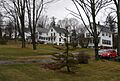
East Street houses, north side

See also
 In Spanish: Litchfield (condado de Litchfield, Connecticut) para niños
