Loon Mountain facts for kids
Quick facts for kids Loon Mountain |
|
|---|---|

Loon Mountain as seen from Mount Flume
|
|
| Highest point | |
| Elevation | 3,065 ft (934 m) |
| Prominence | 200 ft (61 m) |
| Geography | |
| Parent range | White Mountains |
| Topo map | USGS Mount Osceola and Lincoln quadrangles |
| Climbing | |
| Easiest route | chairlift |
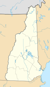
Loon Mountain is a mountain located in Lincoln and Livermore, New Hampshire. It is part of Grafton County and sits within the beautiful White Mountain National Forest.
This mountain is about 3,065 feet (934 meters) tall. It is most famous for the Loon Mountain Ski Resort. Like many resorts in New England, Loon Mountain offers fun activities all year round, not just for skiing.
Exploring Loon Mountain's Peaks
Loon Mountain has two main high points, called summits. The North Peak is the tallest, reaching about 3,065 feet (934 meters) above sea level. The South Peak is a bit lower, at around 2,807 feet (856 meters) high.
Between these two peaks, you'll find Loon Pond. This pond is located at an elevation of about 2,418 feet (737 meters). There's also another smaller peak called "Loon Peak." It's a part of the North Peak and is about 2,733 feet (833 meters) tall.
Each of these three peaks has chairlifts. These lifts help visitors easily reach the top for skiing or other activities.
Nearby Mountains and Waterways
Loon Mountain is at the western end of a ridge called Scar Ridge. This ridge stretches southeast towards Mount Osceola. Scar Ridge has many high points, with its tallest summit reaching about 3,774 feet (1,150 meters). To the southwest of Loon Mountain, you'll find Russell Mountain, which is about 2,424 feet (739 meters) high.
Water flows off Loon Mountain in different directions. On the north side, water from Boyle Brook and Loon Pond Brook flows into the East Branch of the Pemigewasset River. To the west of the South Peak, Horner Brook also flows directly into the Pemigewasset River.
The southern parts of Loon Mountain drain into Talford Brook. This brook then joins Eastman Brook, which also flows into the Pemigewasset River. The Pemigewasset River eventually flows south into the Merrimack River. From there, the water travels all the way to the Gulf of Maine in the Atlantic Ocean.
 | Precious Adams |
 | Lauren Anderson |
 | Janet Collins |


