Lost River (California) facts for kids
The Lost River is a unique river in the western United States. It starts and ends in a special type of area called a closed basin. This means its water doesn't flow out to the ocean. Instead, it stays within the basin, usually ending in a lake or drying up.
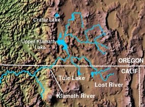
The river is about 60 miles (97 km) long. It flows in a big curve, starting in Clear Lake Reservoir in Modoc County, California. From there, it travels through Klamath County, Oregon, and finally reaches Tule Lake in Siskiyou County, California. Most of the Lost River, about 46 miles (74 km), is in Oregon. The remaining 14 miles (23 km) are in California.
Quick facts for kids Lost River |
|
|---|---|

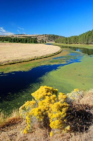
Lost River near Bonanza, Oregon
|
|

Map showing the course of the Lost River and tributaries
|
|
|
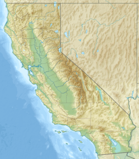
Location of the mouth of Lost River in California
|
|
| Country | United States |
| State | California, Oregon |
| County | Modoc, Klamath, Siskiyou |
| Physical characteristics | |
| Main source | Clear Lake Modoc County, California 4,479 ft (1,365 m) 41°55′34″N 121°04′33″W / 41.92611°N 121.07583°W |
| River mouth | Tule Lake Siskiyou County, California 4,035 ft (1,230 m) 41°56′24″N 121°30′19″W / 41.94000°N 121.50528°W |
| Length | 60 mi (97 km) |
| Basin features | |
| Basin size | 3,010 sq mi (7,800 km2) |
Contents
Where Does the Lost River Flow?
The Lost River starts its journey from Clear Lake Reservoir. It then flows into a place called Langell Valley. Here, another stream named Miller Creek joins it from the right side.
As it continues, the river reaches near Bonanza. It then turns west and goes through Olene Gap. This gap is about 10 miles (16 km) east of Klamath Falls. After this, the river turns southeast. It flows along the base of Stukel Mountain. Along this path, it helps supply water to small lakes like Nuss Lake. This water is used for watering crops and controlling floods. Finally, the river crosses back into California, south of Merrill.
How Water is Managed on the Lost River
The water in the Lost River basin is carefully managed. This is done using dams, canals, and pumps. These structures are part of a big plan called the Klamath Project. The U.S. Bureau of Reclamation runs this project.
The main goal is to manage water for farming and to prevent floods. The project provides water to about 210,000 acres (85,000 ha) of farmland. Most of this land, about 62%, is in Oregon. The other 38% is in California.
Water from the Lost River basin can also flow into the Klamath River basin. This happens mainly through the Lost River Diversion Channel. This channel is about 4 miles (6.4 km) downstream from Olene. The channel is 8 miles (13 km) long. It can even send water back from the Klamath River. This is useful when farms in the Tule Lake area need more water for irrigation.
History of the Lost River
The Lost River has an interesting history. After 1846, a famous route called the Applegate Trail crossed the river. People used a natural bridge made of stepping-stones to get across. Later, a dam built by the Bureau of Reclamation covered these stones.
Earlier in 1846, an explorer named John C. Frémont gave the river a different name. He called it McCrady River, after a friend from his childhood. However, over time, the name Lost River became more common. There was even a Lost River post office for a short time. It was likely near Olene, Oregon, operating from 1875 to 1876.
Fishing in the Lost River
The Lost River is a slow-moving stream. It offers good opportunities for fishing. You can find several types of fish here. These include bass, which can weigh up to 7 pounds (3.2 kg). Other fish you might catch are brown bullhead, crappie, yellow perch, and Sacramento perch. Trout are not very common in this river.
See also
 In Spanish: Río Lost (California) para niños


