
Maguayo facts for kids
Quick facts for kids
Maguayo
|
|
|---|---|
|
Barrio
|
|

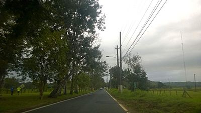
Puerto Rico Highway 22 in Maguayo
|
|

Location of Maguayo within the municipality of Dorado shown in red
|
|

Maguayo
Location in Caribbean
|
|
| Commonwealth | |
| Municipality | |
| Area | |
| • Total | 3.88 sq mi (10.0 km2) |
| • Land | 3.86 sq mi (10.0 km2) |
| • Water | 0.02 sq mi (0.05 km2) |
| Elevation | 135 ft (41 m) |
| Population
(2010)
|
|
| • Total | 4,496 |
| • Density | 1,164.8/sq mi (449.7/km2) |
| Source: 2010 Census | |
| Time zone | UTC−4 (AST) |
| ZIP Code |
00646
|
Maguayo is a neighborhood, also called a barrio, located in the town of Dorado, Puerto Rico. In 2010, about 4,496 people lived there.
Contents
Maguayo's History
Early History and Population Changes
After the Spanish–American War, Spain gave Puerto Rico to the United States in 1898. This happened under the Treaty of Paris of 1898. Puerto Rico then became an unincorporated territory of the United States. This means it is part of the U.S. but does not have the same rights as a state.
In 1899, the United States Department of War counted the people living in Puerto Rico. This count is called a census. The census found that 764 people lived in Maguayo barrio at that time. The population has grown quite a bit since then.
| Historical population | |||
|---|---|---|---|
| Census | Pop. | %± | |
| 1900 | 764 | — | |
| 1910 | 876 | 14.7% | |
| 1920 | 1,116 | 27.4% | |
| 1930 | 1,478 | 32.4% | |
| 1940 | 1,770 | 19.8% | |
| 1950 | 2,378 | 34.4% | |
| 1980 | 2,948 | — | |
| 1990 | 3,826 | 29.8% | |
| 2000 | 4,711 | 23.1% | |
| 2010 | 4,496 | −4.6% | |
| U.S. Decennial Census 1899 (shown as 1900) 1910-1930 1930-1950 1980-2000 2010 |
|||
Hurricane Maria's Impact
In 2017, Hurricane Maria caused a lot of damage in Puerto Rico. It destroyed buildings and stopped electricity and water services. Some people in Maguayo had to get water from a well. This well was on a special list called the List of Superfund sites. These are places where toxic substances have been found. Officials from the Environmental Protection Agency (EPA) quickly made sure the well area was safe for everyone.
Maguayo's Sectors
Understanding Barrios and Sectors
In Puerto Rico, a barrio is like a neighborhood or a small area within a town. These barrios are then divided into even smaller local areas. These smaller areas are called sectores (which means sectors in English).
Sectors can have different names, such as urbanización (a housing development), reparto (a land division), barriada (a settlement), or residencial (a residential area).
Main Sectors in Maguayo
The following sectors are part of Maguayo barrio:
Parcelas El Cotto, Sector Abra, Sector Calandria, Sector Camino Los Nieves, Sector Cotto Martell, Sector Cuatro Calles, Sector El Cotto, Sector Los Bloise, Sector Los Dávila, Sector Los Torres, Sector Maguayo Adentro, Sector Maracayo, Sector Martell, Sector Maysonet I y II, Sector Polvorín, Sector Río Nuevo (PR-693), Sector Santa Rosa (Jazmín, Guayabo, Combate), Urbanización Alturas de Plata, Urbanización Bosque Dorado, and Urbanización Valle del Dorado.
Maguayo barrio is also part of the Río Lajas comunidad.
Notable People from Maguayo
Edgar Martínez: Baseball Legend
Major League Baseball player Edgar Martínez grew up in Maguayo. He is a famous baseball player who played for the Seattle Mariners. In 2019, he was honored by being added to the Baseball Hall of Fame. When he was inducted, he thanked "his people," which included the people of Maguayo. The mayor of Dorado even said there would be a celebration to welcome him home.
Gallery
-
Puerto Rico Highway 694 between Maguayo and Higuillar
-
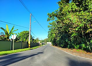
Puerto Rico Highway 6659 in Maguayo
.jpg)

See also
 In Spanish: Maguayo (Dorado) para niños
- List of communities in Puerto Rico
- List of barrios and sectors of Dorado, Puerto Rico
