Manila (province) facts for kids
Quick facts for kids Manila
Maynila
|
|||||||||||||
|---|---|---|---|---|---|---|---|---|---|---|---|---|---|
| Former province of the Philippines | |||||||||||||
| 1571–1901 | |||||||||||||
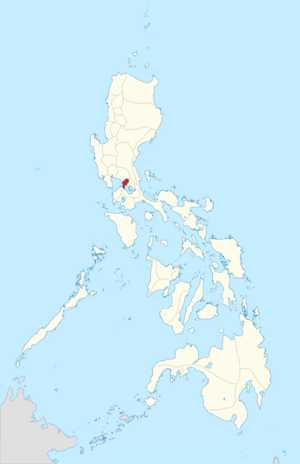
 Location of the historical province of Manila in 1899. |
|||||||||||||
| Capital | Manila Mariquina (1898–1899) |
||||||||||||
| Area | |||||||||||||
|
• 1898
|
683 km2 (264 sq mi) | ||||||||||||
| Historical era | Colonial Period | ||||||||||||
| 1571 | |||||||||||||
|
• Became capital of colonial Philippines
|
1595 | ||||||||||||
|
• Occupied by Great Britain
|
1762–1764 | ||||||||||||
|
• Sovereignty transferred to United States
|
1899 | ||||||||||||
|
• Disestablished
|
1901 | ||||||||||||
|
|||||||||||||
| Today part of | Philippines | ||||||||||||
Manila was once a very important province in the Philippines. Before it became a province, it was home to old kingdoms like Tondo, Maynila, and Namayan. For a long time, it was even called Tondo until 1859!
In 1898, the province included the main City of Manila (which was mostly the walled city now known as Intramuros) and 23 other towns. In 1901, Manila province joined with the District of Morong to form the Province of Rizal.
Contents
What Towns Were Part of Manila Province?
The province of Manila was made up of the main city and many other towns. These towns were often called "suburbs" or "neighborhoods" of Manila. The name "Manila" first meant only the "city within the walls" (today's Intramuros). But over time, it started to include the areas around it. This sometimes made it confusing to know what exactly was considered "Manila" in the late 1800s.
People often called the area "The City of Manila and its suburbs" or "Manila and the communities outside the walls." Today, the entire City of Manila includes all these historical areas.
Some towns like Antipolo, Boso-Boso, Cainta, and Taytay were also part of the province (when it was still called Tondo). But in 1853, they became part of a different district called Distrito Politico-Militar de Morong.
Towns and Their Populations in 1898
Here is a list of the towns that were part of Manila province in 1898, along with how many people lived there:
| City/Municipality | Population (1898) | Notes |
|---|---|---|
| Manila | 110,000 | The main city, often called "the city within the walls." |
| Caloocan | 9,843 | About 7 miles from Manila, with roads to other towns. |
| Dilao (Paco) | 4,625 | About 3 miles from Manila. |
| Ermita | 4,726 | About 1.25 miles from Manila. |
| Las Piñas | 4,000 | About 8 miles from Manila. |
| Malate | 2,319 | About 1.67 miles from Manila. |
| Malibay | 2,890 | About 4 miles from Manila. |
| Mariquina | 10,313 | About 7 miles from Manila, connected by a road to Caloocan. |
| Montalban | 3,055 | About 16 miles from Manila. |
| Muntinlupa | 5,068 | About 21 miles from Manila. |
| Navotas | 9,154 | About 6.25 miles from Manila. |
| Novaliches | 1,871 | About 10 miles from Manila, with roads to Caloocan and Manila. |
| Pandacan | 2,446 | About 2 miles from Manila. |
| Parañaque | 9,863 | About 6.125 miles from Manila. |
| Pasig | 22,000 | About 7 miles from Manila. |
| Pateros | 2,842 | About 3 miles from Manila. |
| Pineda (Pasay) | 9,825 | About 3.125 miles from Manila. |
| San Felipe Neri (Mandaluyong) | 5,465 | |
| San Juan del Monte | 2,011 | |
| San Mateo | 6,700 | About 17 miles from Manila. |
| San Pedro Macati (Makati) | 3,921 | About 3 miles from Manila. |
| Santa Ana | 2,194 | About 3 miles from Manila. |
| Tagig (Taguig) | 9,662 | About 4 miles from Manila. |
| Tambobong (Malabon) | 25,000 | About 3 miles from Manila. |
Where Was Manila Province Located?
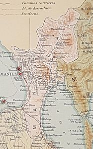
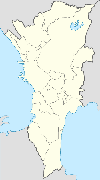
Below you can see a map showing where the towns of Manila province were in 1899. Most of these areas are now part of the cities in Metro Manila. Only Montalban and San Mateo are in the modern-day province of Rizal.
See also
 In Spanish: Corregimiento de Tondó para niños
- Geography of Manila
 | Precious Adams |
 | Lauren Anderson |
 | Janet Collins |


