
Taguig facts for kids
Quick facts for kids
Taguig
Tagig
|
|||||
|---|---|---|---|---|---|
|
Highly urbanized city
|
|||||
|
Bonifacio Global City
Napindan Parola
Minor Basilica of Saint Anne
Taguig City Hall
Fort Bonifacio
Mercado del Lago Lakeshore
|
|||||
|
|||||
| Etymology: Taga-giik (rice thresher) | |||||
| Nickname(s):
Probinsyudad
|
|||||
| Motto(s):
"I Love Taguig" "Think Big. Dream Big. Love Taguig."
|
|||||
| Anthem: Martsa ng Taguig ("Taguig March") | |||||

|
|||||
|
OpenStreetMap
|
|||||
.svg)
Taguig
Location in Philippines
|
|||||
| Country | Philippines | ||||
| Region | National Capital Region | ||||
| District | [[{{#property:P7938}} | — Lua error in Module:Wd at line 1804: attempt to index field 'wikibase' (a nil value).]] | ||||
| Established | April 25, 1587 | ||||
| Municipal corporation | January 31, 1901 | ||||
| City charter | December 8, 2004 | ||||
| Recent territorial change | October 26, 2023 | ||||
| Barangays | 38 (see Barangays) | ||||
| Government
|
|||||
| • Type | Sangguniang Panlungsod | ||||
| Area | |||||
| • Total | 47.28 km2 (18.25 sq mi) | ||||
| Elevation | 13 m (43 ft) | ||||
| Highest elevation | 179 m (587 ft) | ||||
| Lowest elevation | -1 m (−3.3 ft) | ||||
| Population
(2024 census)
|
|||||
| • Total | 1,308,085 | ||||
| • Rank | 5th | ||||
| • Density | 27,666.8/km2 (71,657/sq mi) | ||||
| • Households | 246,873 | ||||
| Demonym(s) | Taguigeño / Taguigeña | ||||
| Economy (excluding Embo) | |||||
| • Income class | 1st city income class | ||||
| • Poverty incidence |
|
||||
| • Revenue | ₱ 17,303 million (2023) | ||||
| • Assets | ₱ 52,803 million (2023) | ||||
| • Expenditure | ₱ 14,681 million (2023) | ||||
| • Liabilities | ₱ 28,202 million (2023) | ||||
| Utilities | |||||
| • Electricity | Manila Electric Company (Meralco) | ||||
| • Water | Manila Water | ||||
| Time zone | UTC+8 (PST) | ||||
| ZIP code |
1630–1649
|
||||
| PSGC |
[https://psa.gov.ph/classification/psgc/?q=psgc/barangays/{{#pro000®code={{&provcode=
|
||||
| IDD : area code | +63 (0)02 | ||||
| Native languages | Tagalog | ||||
| Currency | Philippine peso (₱) | ||||
| Feast date | July 26 | ||||
| Catholic diocese | Roman Catholic Archdiocese of Manila (Embo barangays) Roman Catholic Diocese of Pasig (rest of Taguig) |
||||
| Patron saint | Saint Anne | ||||
| Website | taguig |
||||


.jpg)


Taguig (Tagalog: [taˈɡiɡ]), officially the City of Taguig (Filipino: Lungsod ng Taguig), is a busy city in the Philippines. It is the fifth-most populated city in the country. Taguig is located on the eastern side of Metro Manila, which is the capital region.
This city is a major hub for many things. It's important for culture, money, and new technology. You'll also find entertainment, media, schools, and art here. Many countries have their embassies in Taguig, making it a key place for international relations.
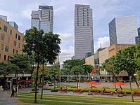
Bonifacio Global City is a big part of Taguig. Many large international companies have their main offices here. Taguig also has the fourth-largest skyline in the Philippines. It has 289 tall buildings, with 80 of them being over 100 meters (328 feet) high.
Taguig is next to the northwestern shores of Laguna de Bay, which is the largest lake in the Philippines. The city covers about 47.28 square kilometers (18.25 sq mi). It shares borders with Pasig and Pateros to the north. To the northwest are Makati and Mandaluyong. Pasay and Parañaque are to the west, Taytay, Rizal to the northeast, and Muntinlupa to the south.
Taguig was a small village during the Spanish colonial period. Later, during the American period, large parts of the city became a military area. In the 1990s, this military area was developed into a financial and business center. This led to the creation of areas like Bonifacio Global City (BGC). Taguig officially became a highly urbanized city in 2004.
Contents
- What's in a Name? The Story of Taguig
- A Look Back: Taguig's History
- Taguig's Location and Areas
- City Life: Districts and Landmarks
- People of Taguig: Demographics and Religion
- Taguig's Economy: A Growing City
- How Taguig is Governed
- Getting Around: Transportation in Taguig
- Learning and Health in Taguig
- Keeping Taguig Safe
- Culture and Fun in Taguig
- Sister Cities
- Images for kids
- See also
What's in a Name? The Story of Taguig
The name Taguig comes from the Tagalog words taga-giik. This means "rice threshers." In the 1570s, about 800 men in the town were very good at threshing rice after harvest. Because of this, people called them "mga taga-giik." The place became known as "pook ng mga taga-giik," meaning "place of the rice threshers."
When Spanish friar Fray Alonso de Alvarado arrived in 1571, he found "taga-giik" hard to say. So, "Tagui-ig" was later shortened to "Taguig." Sometimes it was also spelled "Tagui" or "Tagig."
A Look Back: Taguig's History
Early Beginnings

Before the Spaniards arrived, Taguig was a settled community of Tagalog people. There were also Moro and Chinese people living in the area. This is known from old cups, plates, and other items found there. These items had Chinese characters and are believed to be from China's Ming dynasty. The Tagalogs also raised ducks, especially in the areas where Taguig and Pateros are today.
Spanish Rule (1571-1898)
.jpg)
Taguig was one of the first areas in the Provincia de Tondo to become Christian. This happened when the Spaniards took control of Luzon in 1571. Taguig became a separate town on April 4, 1587. This was after the local Chinese community accidentally burned the old church in 1586.
Juan Basi, a relative of Lakan Dula, was the leader of Taguig from 1587 to 1588. He was part of a plan to overthrow the Spanish government, but it failed. Taguig had nine small villages back then. These included Bagumbayan, Bambang, Hagonoy, and Santa Ana. Santa Ana was the main center of Taguig.
Taguig was easy to reach by the Pasig River. This river connected to Manila Bay and Laguna de Bay. The town grew a lot of rice. The men fished, and the women made cotton cloth. The people of Taguig were known for resisting both Spanish and American rule. Many people from Taguig joined the Katipunan, a revolutionary group. They also joined the government of General Emilio Aguinaldo in 1898.
Santiago Bonifacio, the father of revolutionary leader Andres Bonifacio, was from Ligid Tipas. The Napindan Lighthouse in Barrio Napindan was a secret meeting place for the Katipunan.
American Rule (1898-1946)
,_Philippine_Islands_LCCN2011647777.jpg)

During the American occupation, Taguig residents fought against American forces. On February 6, 1899, Filipino fighters, including those from Taguig, attacked an American position. However, the Americans eventually won due to better weapons and training. Taguig officially became an independent municipality on March 29, 1900. It then became part of the new province of Rizal in 1901.
Later, Taguig, Muntinlupa, and Pateros were combined into one municipality. But this didn't last long. Pateros and Muntinlupa eventually became separate towns again.
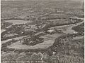
During this time, the United States government bought a large piece of land in Taguig for military use. This land became known as Fort William McKinley. It was named after William McKinley, the 25th U.S. president. When the Japanese occupied the Philippines in 1942, they took over Fort McKinley. They renamed it Sakura Heiyei (Cherry Blossom Barracks). It became an important base for them until 1945.
After World War II (1945-1986)
.jpg)
After the Philippines became independent in 1946, the U.S. gave Fort William McKinley back to the Philippine government in 1949. In 1957, it became the main headquarters for the Philippine Army. It was renamed Fort Bonifacio after Andres Bonifacio, a hero of the Philippine Revolution. In 1958, the main government office of Taguig moved from Santa Ana to Tuktukan.
In 1974, Taguig's smaller areas were renamed from "barrios" to "barangays." This increased Taguig's administrative divisions to 18 barangays. In 1975, Taguig became part of the new National Capital Region.
Recent History (1986-Present)

In 1986, there was a dispute over the Fort Bonifacio area. The Municipality of Taguig argued that it owned the land, not Makati. This led to a long territorial dispute.
In 1998, a law was passed to make Taguig a city. However, the people voted against it at first. After a recount ordered by the Supreme Court of the Philippines in 2004, it was found that most residents did want Taguig to become a city. So, Taguig officially became a city on December 8, 2004.
In 2008, Taguig created ten new barangays. This increased the total number of barangays in the city from 18 to 28. In 2011, Mayor Lani Cayetano called Taguig a "Probinsyudad." This word combines "province" and "city" because Taguig has both city features and natural areas like a province.
By the early 2000s, former military lands in Fort Bonifacio were developed into major business areas. This created Bonifacio Global City (BGC), one of the Philippines' top financial centers. Other areas like McKinley Hill were also developed. In 2018, the Philippine Stock Exchange moved its main office to BGC.
The long-running territorial dispute with Makati was finally decided in Taguig's favor in April 2023. This meant that Bonifacio Global City and ten surrounding barangays, known as the EMBO barangays, officially became part of Taguig. The management of 14 public schools in these areas also transferred to Taguig in January 2024.
Taguig's Location and Areas
Geography and Borders
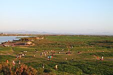
Taguig is located on the northwestern shores of Laguna de Bay, the largest lake in the Philippines. The city covers a total area of 47.28 square kilometers (18.25 sq mi). It is bordered by Pasig and Pateros to the north. To the northwest are Makati and Mandaluyong. Pasay and Parañaque are to the west, Taytay to the northeast, and Muntinlupa to the south.
The Pasig River and its smaller rivers flow through the northern part of the city. A small area called Ibayo Napindan is north of the river.
Barangays and Congressional Districts


Pateros–Taguig (District I)
Taguig (District II)
Taguig is divided into 38 barangays, which are like small neighborhoods or villages. This makes it the city with the fourth-highest number of barangays in Metro Manila. These barangays are grouped into two congressional districts. Each district has a representative in the House of Representatives.
The ten EMBO barangays were recently added to Taguig. This happened after the city won its territorial dispute with Makati. This increased Taguig's size and population. In September 2024, these ten EMBO barangays were assigned to Taguig's two legislative districts.
- Taguig–Pateros's Lone Congressional District (District I) covers the eastern part of the city. It also includes all of the Municipality of Pateros. This district covers 22.11 square kilometers (8.54 sq mi).
- Taguig's Lone Congressional District (District II) covers the western part of the city. It covers 25.17 square kilometers (9.72 sq mi).
Territorial Disputes

Taguig had a long-standing disagreement over land with Makati and Pateros. In 1993, Taguig claimed that all of Fort Bonifacio and the EMBO barangays belonged to its territory. The Supreme Court of the Philippines finally ruled in favor of Taguig in April 2023. This decision confirmed that Bonifacio Global City and the surrounding EMBO barangays are part of Taguig.
Taguig also settled a land dispute with Parañaque around 2001. They agreed that the Bicutan Market and the Bicutan Interchange would be part of Parañaque.
Climate and Natural Hazards
| Weather chart for Taguig | |||||||||||||||||||||||||||||||||||||||||||||||
|---|---|---|---|---|---|---|---|---|---|---|---|---|---|---|---|---|---|---|---|---|---|---|---|---|---|---|---|---|---|---|---|---|---|---|---|---|---|---|---|---|---|---|---|---|---|---|---|
| J | F | M | A | M | J | J | A | S | O | N | D | ||||||||||||||||||||||||||||||||||||
|
69
30
22
|
56
31
23
|
41
32
24
|
46
34
26
|
107
33
26
|
203
32
26
|
277
31
25
|
295
31
25
|
251
31
25
|
236
31
25
|
203
31
24
|
183
30
23
|
||||||||||||||||||||||||||||||||||||
| temperatures in °C precipitation totals in mm source: Weather Spark |
|||||||||||||||||||||||||||||||||||||||||||||||
|
Imperial conversion
|
|||||||||||||||||||||||||||||||||||||||||||||||
Taguig has a tropical monsoon climate. This means it has two main seasons: a dry season from November to April, and a wet season from May to October.
Tropical cyclones, or strong storms, are common. These can cause floods in low-lying areas, especially near rivers and Laguna de Bay. For example, in 2009, Typhoon Ketsana caused severe flooding in Taguig.
The West Valley Fault runs through 16 barangays in Taguig. This fault can cause strong earthquakes. Areas near Laguna de Bay and major rivers are also prone to flooding.
City Life: Districts and Landmarks


.jpg)

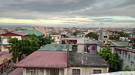
Taguig is divided into many different areas, each with its own feel. These areas developed over time, especially the 10 EMBO barangays.
Some of the main areas include:
- Poblacion: This is the historic center of the city. It has most of the local government buildings and old sites. It's also called Munisipyo.
- Tipas: This area is known for its fishermen because it's close to the Pasig River and Laguna de Bay.
- Bicutan: This is mostly a residential area. It has many schools and government offices. The new Arca South business district is also here.
- Tanyag: A residential area in the southwestern part of the city. It's named after a former mayor.
- Bagumbayan: Located at the southern tip of the city, this area has many industrial sites and a community along the lake.
- Maharlika Village: This is a Muslim community. It has the largest Muslim population in Metro Manila and is home to the Blue Mosque.
- Signal Village: This area was originally for military families.
- Fort Bonifacio/BGC: Once a military camp, this is now the city's main business district. It includes Bonifacio Global City, McKinley West, and McKinley Hill.
- Embo: These are the newly added barangays that Taguig gained from Makati. They include Cembo, South Cembo, East Rembo, West Rembo, Comembo, Pitogo, Pembo, and Rizal.
- C5/Pinagsama: These are residential areas and villages along Circumferential Road 5.
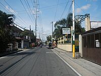
- Selection of places and neighborhoods in Taguig
-

Bicutan
-
Circumferential Road 6
-
Bonifacio High Street
-
Manila American Cemetery and Memorial
-

McKinley Hill
-
Kalayaan Avenue
-
Napindan
-
South Signal Village
-
Santa Monica–Lawton Bridge
-
Metro Manila Skyway
-
Bagumbayan
.jpg)


.jpg)
(2018-06-04).jpg)


People of Taguig: Demographics and Religion
.jpg)
In 2024, Taguig had a population of 1,308,085 people. This makes it the fifth most populated city in the Philippines. Most of the population, about 595,558 people, are between 15 and 64 years old.
In 2023, there were 12,890 live births recorded in Taguig. The city also saw 1,729 marriages in 2023, showing an increase over the years. As of 2022, Taguig had a high employment rate of 94%.
Many people have moved to Taguig over the years. After the Supreme Court ruling in 2023, Taguig gained ten more barangays from Makati. This further increased its population to an estimated 1.2 million.
Religion in Taguig
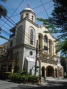
Most people in Taguig are Roman Catholics. Catholic churches in Taguig are mostly under the Roman Catholic Diocese of Pasig. However, the five parishes in the EMBO barangays are under the Roman Catholic Archdiocese of Manila. This is because they were previously part of Makati.
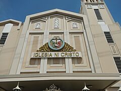
Maharlika Village is known for having the largest Muslim population in Metro Manila. It is home to the Blue Mosque, one of the oldest and most important Islamic sites in the region. Taguig is also the birthplace of Felix Manalo, who founded the Iglesia ni Cristo church.
-
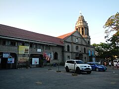
Taguig Church is a minor basilica and a declared historic site.
-
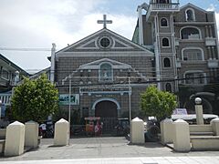
The Saint John the Baptist Parish Church, also known as the Dambanang Kawayan.
-
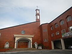
Saint Kim Dae Gun Personal Parish Church serves the Filipino-Korean community.
-
Iglesia Ni Cristo (INC) – Tipas Locale.
-
Our Mother of Perpetual Help Parish in Tanyag.


Helping Those in Need
|
||||
In 2007, Taguig was ranked as having a lower poverty rate compared to some other cities in Metro Manila. The city government has programs to help families in need. One program is called Lifeline Assistance for Neighbors In-need Care and Support (LANI CARES). This program gives financial and food help to residents.
The city also has socialized housing projects. The Fort Bonifacio Tenement, built in 1963, is famous for its basketball court. The Bases Conversion and Development Authority (BCDA) has also built housing for police personnel.
Taguig's Economy: A Growing City

_skyline_-_from_FTI_Tenement_(Taguig)(2018-04-02).jpg)
.jpg)
Taguig is a major center for business and trade in the Philippines. It's important for banking, finance, healthcare, and technology. It also plays a big role in retail, tourism, and real estate. Bonifacio Global City is Taguig's main business district. It is one of the five biggest business districts in Metro Manila.
Taguig's economy is growing fast. In 2023, its economy was valued at ₱566.19 billion. This makes it the 4th largest economy in the National Capital Region. The city is making it easier for businesses to operate there. It has lower taxes and a simpler business registration process.
Farming and Fishing
The Taguig City Agricultural Office helps with farming programs. The office has set up several urban farms, even in Bonifacio Global City. These programs have been praised by the national government.
Fishing is still important in communities along Laguna de Bay. The Department of Agriculture plans to build a new fishing facility in the city. This will include floating cages and a fish market.
The Santa Ana Bukid is a 113-hectare (280-acre) melon farm in Barangay Wawa. It can harvest a lot of melons. Taguig also celebrates its annual "Melon Festival."
Industries in Taguig
The industrial sector makes up 10.9% of Taguig's economy. The city has several industrial areas. Many are in barangays like Ibayo-Tipas, Palingon, and Western Bicutan. The Food Terminal Inc. (FTI) in Western Bicutan is a large government-owned industrial hub. It used to focus on food trading and storage. Now, it also leases space for other types of businesses.
Fun and Tourism


Tourism is a very important industry for Taguig. The city has many attractions for visitors. These include monuments, museums, and shopping malls.
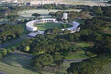
The Mind Museum is a science museum with over 250 exhibits. The Manila American Cemetery honors US soldiers who died during World War II. The Libingan ng mga Bayani (LMB) is the national cemetery of the Philippines. The Philippine Veterans Museum shows items from Filipino veterans of World War II.
Taguig is a great place for shopping. You can find many high-end malls in or near Bonifacio Global City. These include Bonifacio High Street, Mitsukoshi BGC, SM Aura, Uptown Mall, and Venice Grand Canal Mall. There are also malls for middle-class shoppers like Market! Market! and Vista Mall Taguig.
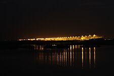
The city has many parks and plazas. These include TLC Park in Lower Bicutan and the Taguig People's Park in West Rembo. Bonifacio Global City also has several parks like Track 30th and Terra 28th. The Napindan Lighthouse is a historic lighthouse that was a meeting point for the Katipunan revolutionary group.
How Taguig is Governed
City Government
Taguig is a highly urbanized city. This means it has a lot of people and is very developed.
The Taguig City Hall in Barangay Tuktukan is where the city government operates. A new 17-story city hall is being built in Barangay Ususan. The Mayor of Taguig is Lani Cayetano. The current vice mayor is Arvin Alit. The mayor and vice mayor can serve up to three terms, with each term lasting three years.
The Taguig City Council has 26 members. They create the city's policies, called ordinances and resolutions. The current representatives for Taguig are Ricardo "Ading" Cruz Jr. for the 1st district and Jorge Daniel Bocobo for the 2nd district.
National Government Offices


As part of the National Capital Region, Taguig hosts many national government offices. The Senate of the Philippines is set to move its offices to Taguig. The House of Representatives is also considering moving its chamber to Taguig.
Several national government agencies are located in Taguig. These include the Departments of Science and Technology and Energy. The Philippine Army and Philippine Marine Corps also have their headquarters here.
The National Capital Region Police Office is based in Camp Bagong Diwa in Taguig.
City Finances
Based on a 2023 report, Taguig had a revenue of ₱17.303 billion. It had ₱52.803 billion in assets. Taguig is the fifth wealthiest city in the Philippines. It is Metro Manila's third top city for local revenue in 2023.
International Connections
(2018-08-26).jpg)
Many foreign countries have their embassies in Taguig, especially in the Fort Bonifacio area. The International Finance Corporation (IFC) and the World Bank also have offices here.
Several international schools are in Taguig. These include the British School Manila, International School Manila, and Manila Japanese School.
Here are some countries with embassies in Taguig:
 Angola
 Austria
 Colombia
 Denmark
 Finland
 Hungary
 Israel
 Italy
Italy Kuwait
 Laos
Laos Morocco
 Norway
 Oman
Oman Panama
 Poland
 Singapore
 South Korea
 Sweden
 United Arab Emirates
 United Kingdom
Getting Around: Transportation in Taguig
Roads and Highways
.jpg)
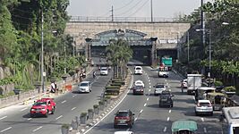
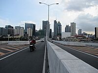
The main ways to get around Taguig are by jeepneys, buses, and tricycles. Major roads like Kalayaan Avenue, Lawton Avenue, and Circumferential Road 5 (C-5) run through the city. There are three bridges that cross the Pasig River in Taguig.
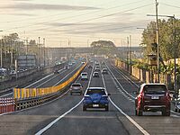
A new highway, the Southeast Metro Manila Expressway, is being built and will pass through parts of the city. The city is also planning a large bus station called the Taguig City Integrated Terminal Exchange. This will connect to the new North–South Commuter Railway.
Taguig has banned e-bikes and e-trikes on its national roads. The city also has a "no number coding" policy on most of its roads.
Biking in Taguig
.jpg)
Taguig is promoting biking as a way to get around. The city has 60 kilometers (37 miles) of bike lanes with safety barriers. These lanes are on roads like Bayani Road and Lawton Avenue. The city has also installed bike repair stations and bike racks. In 2020, Taguig passed a Bike Friendly Ordinance to encourage more biking and protect cyclists.
Trains and Ferries
(2017-08-11)_(2).jpg)
The Philippine National Railways (PNR) used to have a train line that passed through Taguig. This line is being replaced by the new North–South Commuter Railway (NSCR). The NSCR will have two stations in Taguig: Senate and FTI. The Metro Manila Subway is also building five stations in the city.
The MRT Line 3 has a station in Guadalupe, Makati, which is close to Taguig. This station helps people get to the Fort Bonifacio area.

The city also has a ferry terminal for the Pasig River Ferry Service in Cembo.
Learning and Health in Taguig
Education for All Ages


The Schools Division Office of Taguig City and Pateros (SDO-TAPAT) manages all public elementary and high schools in the city. As of the 2024–2025 school year, Taguig has 52 public schools serving over 192,000 students.
After the Supreme Court ruling, Taguig gained 14 public schools from Makati in the EMBO barangays. These schools are now managed by Taguig. The city has three science high schools: Taguig Science High School, Senator Renato "Compañero" Cayetano Memorial Science and Technology High School, and Makati Science High School.
There are many religious schools in Taguig, including Catholic schools like Colegio de Santa Ana. Taguig also has several Islamic schools, mostly near Maharlika Village.
Several international schools are located in Taguig. These include The Beacon School, British School Manila, and International School Manila.
Taguig invests a lot in its scholarship program. This program helps thousands of students with allowances. It has helped many people become licensed professionals like engineers and doctors. The city's scholarship program is seen as a good example for other cities.
The Taguig Yakap Center for Children with Disabilities helps children with special needs. It offers special education, therapy, and learning spaces.
Higher Education Opportunities
.Jpg)
The University of the Philippines Diliman and De La Salle University have campuses in Taguig. Other important colleges include Enderun Colleges.
Taguig also has two state university campuses: the Polytechnic University of the Philippines Taguig and the Technological University of the Philippines - Taguig Campus. The city also has its own university, the Taguig City University.
Healthcare Services


The Taguig City Health Office manages the city's healthcare programs. The city government runs 39 health centers, 7 primary care facilities, and other medical centers. As of 2022, Taguig has 3 government hospitals and 5 private hospitals.
There are two city-run hospitals: the Taguig–Pateros District Hospital (TPDH) and the Taguig City General Hospital (TCGH). TPDH was expanded in 2022 to focus on women and children's health. TCGH started its operations in January 2025. The Army General Hospital serves military personnel.
The city also has special healthcare facilities. The Taguig City Dialysis Center offers free treatments for residents. The Taguig Yakap Center helps children with special needs get therapy.
Notable private hospitals include the Bicutan Medical Center and St. Luke's Medical Center – Global City. The Healthway Cancer Care Center in Arca South is the first hospital in the Philippines dedicated to cancer care.
Keeping Taguig Safe

The Taguig City Police Station is the local police force. Its main office is at the Taguig City Hall complex. There are 12 police precincts around the city. Two of these, West Rembo and Comembo Police Stations, were recently transferred from Makati to Taguig.
The Taguig City Police Station has received national recognition for its efforts. In 2024, 19 out of 38 barangays in Taguig were declared free from illegal substances.
| Precinct | Image | Address | Ref. |
|---|---|---|---|
| Fort Bonifacio Police Sub-station (SS1) | 40th Street corner 9th Avenue, Bonifacio Global City, Fort Bonifacio | ||
| Western Bicutan Police Sub-station (SS2) | Radian Street, Arca South, Western Bicutan | ||
| Pinagsama Police Sub-station (SS3) | C5 Service Road, Palar Village, Pinagsama | ||
| STUB Police Sub-station (SS4) | Tomasa Avenue, Ususan | ||
| Tipas Police Sub-station (SS5) |  |
Dr. A. Natividad Street, Ibayo-Tipas | |
| Signal Village Police Sub-station (SS6) | Ballecer Street, Central Signal Village | ||
| MCU Police Sub-station (SS7) | A. Bonifacio Avenue corner Maharlika Road, Upper Bicutan | ||
| Tanyag-Daang Hari Police Sub-station (SS8) | Mañalac Avenue, Tanyag | ||
| Hagonoy Police Sub-station (SS9) | Cadena de Amor Street, Wawa | ||
| SPD Police Precinct 1 (SS10) |  |
J.P. Rizal Avenue Extension corner T. Alonzo Street, West Rembo | |
| SPD Police Precinct 2 (SS11) |  |
Anahaw Street, Comembo | |
| Bagumbayan-Lower Bicutan Police Sub-station (SS12) | M.L. Quezon Street, Cayetano Complex, Purok 3, Bagumbayan |
Culture and Fun in Taguig
Local Food
The food inutak is a popular snack from the Pateros area. It's a rice cake made with coconut milk and sugar. Another famous food is Tipas Hopia, created by Belen Flores to compete with Chinese hopia. Fried duck is also popular because of the city's history of raising ducks. Pastil, a dish from Mindanao, is popular in Maharlika Village.
Sports and Recreation

Basketball in Taguig

The Taguig Generals are the city's basketball team in the National Basketball League-Philippines. They are very successful, with five championship titles. Their home games are played at the Hagonoy Sports Complex.
Taguig is also home to the famous Tenement basketball court in Western Bicutan. It's known for its cool art and murals. Many National Basketball Association players like LeBron James have visited this court. In 2022, it was voted FIBA's best basketball court in the world!
Baseball and Football
The Felino Marcelino Sr. Baseball Stadium in Ususan is a venue for baseball games. It can hold 1,000 spectators.
In football, Taguig is represented by One Taguig F.C. and Maharlika Taguig F.C.. The city has two football stadiums: McKinley Hill Stadium and University of Makati Stadium. There are also many other football fields for training and casual play.
Festivals and Celebrations
The Taguig River Festival is celebrated every July 26. It's a way to thank the city's patron saint, Saint Anne. The festival includes street dances and tributes to Taguig's fishermen and farmers. It ends with a parade of boats on the river.
Sister Cities
| Sister cities of Taguig |
|---|
Africa
Americas
|
Images for kids
-
Fort William McKinley, now Fort Bonifacio, was surrendered by the United States to the Philippines in 1946.
-
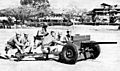
Philippine Scouts at Fort McKinley firing a 37-mm. antitank gun in training.

See also
 In Spanish: Taguig para niños
