Angola facts for kids
Quick facts for kids
Republic of Angola
República de Angola (Portuguese)
|
|
|---|---|
|
Motto:
|
|
| Capital and largest city
|
Luanda 8°50′S 13°20′E / 8.833°S 13.333°E |
| Official language | Portuguese |
| National languages | |
| Ethnic groups
(2021)
|
|
| Religion
(2020)
|
|
| Demonym(s) | Angolan |
| Government | Unitary presidential republic |
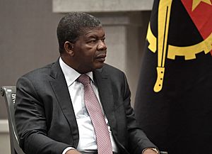
| João Lourenço | |
| Esperança da Costa | |
| Legislature | National Assembly |
| Formation | |
|
• Independence from Portugal, under Communist rule
|
11 November 1975 |
|
• United Nations full membership
|
22 November 1976 |
|
• Current constitution
|
21 January 2010 |
| Area | |
|
• Total
|
1,246,700 km2 (481,400 sq mi) (22nd) |
|
• Water (%)
|
negligible |
| Population | |
|
• 2023 estimate
|
37,290,193 (41st) |
|
• Density
|
24.97/km2 (64.7/sq mi) (157th) |
| GDP (PPP) | 2023 estimate |
|
• Total
|
|
|
• Per capita
|
|
| GDP (nominal) | 2023 estimate |
|
• Total
|
|
|
• Per capita
|
|
| Gini (2018) | 51.3 high |
| HDI (2022) | medium · 150th |
| Currency | Angolan kwanza (AOA) |
| Time zone | UTC+1 (WAT) |
| Driving side | right |
| Calling code | +244 |
| ISO 3166 code | AO |
| Internet TLD | .ao |
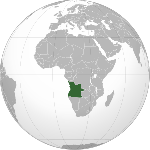
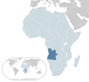
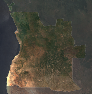
Angola ( an-GOH-lə), officially called the Republic of Angola, is a country on the west-central coast of Southern Africa. It is the second-largest country where Portuguese is spoken, after Brazil. Angola is also the seventh-largest country in Africa.
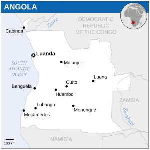
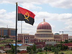
It shares borders with Namibia to the south, the Democratic Republic of the Congo to the north, and Zambia to the east. The Atlantic Ocean is to its west. Angola also has a special part called Cabinda, which is separated from the main country. It borders the Republic of the Congo and the Democratic Republic of the Congo. The capital and biggest city is Luanda.
People have lived in Angola since ancient times. The country became what it is today because of Portugal. Portuguese settlers started building towns and trading posts along the coast in the 1500s. Later, in the 1800s, they moved further inland. Angola's current borders were not set until the early 1900s. This was because local groups like the Cuamato and Kwanyama fought against the Portuguese.
Angola fought a long war to gain independence from Portugal in 1975. After becoming independent, the country faced a difficult civil war that lasted for many years. This war ended in 2002. Since then, Angola has become a more stable country.
Angola has many valuable minerals and a lot of oil. Its economy has grown quickly, especially since the civil war ended. However, most of the country's wealth is held by a small number of people. The main trading partners are China and the United States. Many Angolans still have a low standard of living. Life expectancy is low, and many babies do not survive. Since 2017, the government has been working to fight corruption.
Angola is a member of the United Nations and the African Union. It is also part of the Community of Portuguese Language Countries, which connects Portuguese-speaking nations. In 2021, Angola's population was about 32.87 million people. Angola is a country with many different cultures and ethnic groups. Its culture shows a mix of Portuguese influences, like the language and the Catholic Church, and local traditions.
Contents
What Does the Name Angola Mean?
The name Angola comes from the Portuguese colonial name "Reino de Angola," which means 'Kingdom of Angola'. This name was first used in 1571. The Portuguese got the name from the title "ngola." This was the title for the kings of the Ndongo and Matamba region. Ndongo was a kingdom in the highlands that wanted to be more independent from the Kingdom of Kongo in the 1500s.
Angola's History
Angola has a rich and long history. It includes ancient times, the period of Portuguese rule, and the struggles for independence. After gaining independence, Angola went through a long and difficult civil war. The country is now working to rebuild and grow.
Angola's Geography
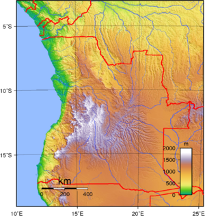
Angola is a large country, covering about 1,246,700 square kilometers (481,354 square miles). This makes it the twenty-fourth largest country in the world. It is about twice the size of France or the state of Texas in the USA. Angola is located between 4° and 18° South latitude, and 12° and 24° East longitude.
Angola borders Namibia to the south, Zambia to the east, and the Democratic Republic of the Congo to the northeast. The Atlantic Ocean is to its west.
The small coastal area of Cabinda is in the north. It is separated from the rest of Angola by a strip of land belonging to the Democratic Republic of the Congo. Cabinda borders the Republic of the Congo to the north and the Democratic Republic of the Congo to the east and south. Angola has a good coastline for shipping, with four natural harbors: Luanda, Lobito, Mocamedes, and Porto Alexandre. These natural bays are different from many of Africa's coastlines, which often have rocky cliffs. Angola's capital, Luanda, is on the Atlantic coast in the northwest.
What is Angola's Climate Like?
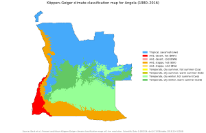
Like other tropical parts of Africa, Angola has clear rainy and dry seasons. In the north, the rainy season can last for seven months, from September to April. In the south, the rainy season starts later, in November, and ends around February. The dry season, called cacimbo, often has heavy morning mist.
Generally, there is more rain in the north. Rain also increases the further inland you go and with higher altitude. Temperatures drop as you move away from the equator and go higher up. They tend to rise closer to the Atlantic Ocean. For example, the average temperature in Soyo, near the Congo River, is about 26°C (79°F). But in Huambo, on the central plateau, it is under 16°C (61°F). The coolest months are July and August, during the dry season. Sometimes, frost can form in higher areas.
How is Angola Divided?
Angola is divided into 18 provinces. These provinces are then split into 162 municipalities, and those are further divided into 559 communes (townships). The provinces are:
| Number | Province | Capital | Area (km2) | Population (2014 Census) |
|---|---|---|---|---|
| 1 | Bengo | Caxito | 31,371 | 356,641 |
| 2 | Benguela | Benguela | 39,826 | 2,231,385 |
| 3 | Bié | Cuíto | 70,314 | 1,455,255 |
| 4 | Cabinda | Cabinda | 7,270 | 716,076 |
| 5 | Cuando Cubango | Menongue | 199,049 | 534,002 |
| 6 | Cuanza Norte | N'dalatando | 24,110 | 443,386 |
| 7 | Cuanza Sul | Sumbe | 55,600 | 1,881,873 |
| 8 | Cunene | Ondjiva | 87,342 | 990,087 |
| 9 | Huambo | Huambo | 34,270 | 2,019,555 |
| 10 | Huíla | Lubango | 79,023 | 2,497,422 |
| 11 | Luanda | Luanda | 2,417 | 6,945,386 |
| 12 | Lunda Norte | Dundo | 103,760 | 862,566 |
| 13 | Lunda Sul | Saurimo | 77,637 | 537,587 |
| 14 | Malanje | Malanje | 97,602 | 986,363 |
| 15 | Moxico | Luena | 223,023 | 758,568 |
| 16 | Namibe | Moçâmedes | 57,091 | 495,326 |
| 17 | Uíge | Uíge | 58,698 | 1,483,118 |
| 18 | Zaire | M'banza-Kongo | 40,130 | 594,428 |
What is the Exclave of Cabinda?
Cabinda is a special part of Angola. It is separated from the rest of the country by a strip of land belonging to the Democratic Republic of the Congo. Cabinda is about 7,283 square kilometers (2,812 sq mi) in size. It borders the Republic of the Congo to the north and the Democratic Republic of the Congo to the east and south. The main city in Cabinda is also called Cabinda.
Cabinda is mostly tropical forest. It produces wood, coffee, cocoa, rubber, and palm oil. But it is most famous for its oil. Because of its large oil reserves, it is sometimes called "the Kuwait of Africa." Oil from Cabinda makes up more than half of all the oil produced in Angola.
After Portugal gave Angola its independence in 1975, there have been groups in Cabinda who want it to be a separate country. They have sometimes fought against the Angolan government.
How is Angola Governed?
Angola's government has three main parts:
- The executive branch, led by the President and Vice-Presidents.
- The legislative branch, which makes laws.
- The judicial branch, which handles legal matters.
The legislative branch is called the National Assembly. It has 220 members who are elected by the people. For many years, the President has held most of the political power.
Angola's Constitution
Angola's Constitution of 2010 explains how the government works. It also sets out the rights and duties of citizens. The country's legal system is based on Portuguese law and traditional local laws. However, the court system is still developing.
The highest court for appeals is the Supreme Court. The Constitutional Court deals with constitutional issues. The governors of Angola's 18 provinces are chosen by the president. After the civil war, there was pressure for Angola to become more democratic. The government made some changes, but the president still has a lot of control over the state.
The new constitution from 2010 changed how the president is chosen. Now, the leader of the political party that wins the parliamentary elections automatically becomes president. This means the president has a lot of power.
Angola's Armed Forces
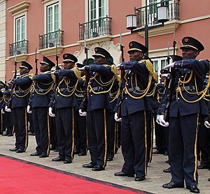
The Angolan Armed Forces (FAA) are led by a Chief of Staff. They report to the Minister of Defence. The armed forces have three parts: the Army, the Navy, and the National Air Force. In 2015, there were about 107,000 people in the military. There were also 10,000 paramilitary forces.
Angola's military equipment includes planes from Russia and Brazil. A small number of Angolan soldiers are stationed in the Democratic Republic of the Congo. They also help with peace missions in other African countries, like Mozambique.
Angola's Police Force
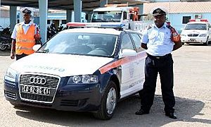
The National Police in Angola has different departments. These include public order, criminal investigation, and traffic. They also have special units like the Riot Police. The police force is working to improve its abilities. They are getting new vehicles, aircraft, and equipment. They are also building new police stations and improving training.
Angola's Justice System
The Supreme Court is the highest court for appeals. The Constitutional Court deals with questions about the constitution. Angola's legal system is based on Portuguese and traditional laws. In 2014, a new set of laws was put in place. One important change was making money-laundering a crime.
Angola's Foreign Relations
Angola is a founding member of the Community of Portuguese Language Countries (CPLP). This group connects nations around the world where Portuguese is an official language.
In 2014, Angola was chosen to be a temporary member of the United Nations Security Council. This was the second time Angola held this important role. Its term lasted from January 2015 to December 2016.
Angola has also led the International Conference for the Great Lakes Region (CIRGL) since 2014. This organization works for peace and stability in the Great Lakes area of Africa.
Angola's Economy
Natural Resources in Angola
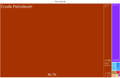
Angola is rich in natural resources. It has diamonds, oil, gold, and copper. It also has forests and fossil fuels. Since Angola became independent, oil and diamonds have been its most important economic resources.
Agriculture in Angola
Agriculture and forestry have great potential in Angola. Before 1975, Angola was a major food producer for southern Africa. It exported bananas, coffee, and sisal. However, the civil war (1975–2002) damaged farms and left many landmines. Millions of people moved to cities.
Now, Angola buys a lot of its food from other countries, mainly South Africa and Portugal. Most farming is done by families for their own needs. Many small-scale farmers in Angola live in poverty.
Transport in Angola
Angola has several ways to travel:
- Three separate railway systems that are about 2,761 km (1,716 mi) long.
- About 76,626 km (47,613 mi) of highways, with 19,156 km (11,903 mi) paved.
- 1,295 km (805 mi) of rivers that can be used for boats.
- Five major sea ports.
- 243 airports, with 32 of them paved.
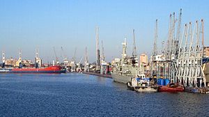
Angola's main ports are Namibe, Lobito, Soyo, Cabinda, and Luanda. The port of Luanda is the biggest and one of the busiest in Africa.
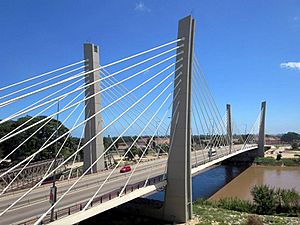
Driving on highways outside of cities in Angola can be challenging. Many roads have potholes and broken asphalt due to time and war. Drivers often create new paths to avoid the worst parts. It is important to watch for landmine warning signs. The Angolan government is working to repair many roads. For example, the road between Lubango and Namibe was recently finished with help from the European Union. It is now similar to main roads in Europe. Improving all the roads will take many years, but a lot of effort is being made.
Telecommunications in Angola
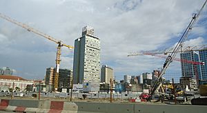
The telecommunications industry is very important in Angola. In 2014, Angola announced plans to build an optic fiber underwater cable. This project aims to make Angola a major hub for internet connections in Africa.
Angola launched its first satellite, AngoSat-1, in 2017. It was meant to provide telecommunications services, TV, internet, and e-government across the country. However, the satellite stopped working shortly after launch. A replacement satellite, AngoSat-2, was launched in October 2022.
Technology in Angola
In 2015, Angola took over the management of its internet domain, '.ao', from Portugal. This change helps improve internet access and use within Angola.
Angola's People
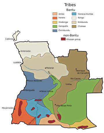
In 2014, Angola had a population of about 24.3 million people. The main ethnic groups are the Ovimbundu (37%), Ambundu (23%), and Bakongo (13%). Other groups make up 32% of the population. There are also people of mixed European and African heritage (2%), Asian people (2%), and Europeans (1%). The Ovimbundu and Ambundu groups together make up most of the population. By 2016, Angola's population was estimated to be 25.7 million.
In 2008, there were about 400,000 migrant workers from the Democratic Republic of the Congo in Angola. There were also about 220,000 Portuguese people and 259,000 Chinese living in Angola. About 1 million Angolans are of mixed race. There are also about 40,000 Vietnamese in the country.
Many Portuguese people left Angola after its independence in 1975. However, in recent years, more Portuguese have moved back to Angola. This is partly because of economic problems in Portugal and growth in Angola.
Languages Spoken in Angola
| Languages in Angola (2014 Census) | ||||
|---|---|---|---|---|
| Languages | percent | |||
| Portuguese | 71.1% | |||
| Umbundu | 23.0% | |||
| Kikongo | 8.2% | |||
| Kimbundu | 7.8% | |||
| Chokwe | 6.5% | |||
| Nyaneka | 3.4% | |||
| Ngangela | 3.1% | |||
| Fiote | 2.4% | |||
| Kwanyama | 2.3% | |||
| Muhumbi | 2.1% | |||
| Luvale | 1.0% | |||
| Other | 4.1% | |||
The languages in Angola include those spoken by different ethnic groups and Portuguese. Portuguese was brought to Angola during the time of Portuguese rule. The most common local languages are Umbundu, Kimbundu, and Kikongo. Portuguese is the official language of the country.
A 2014 census showed that 71.1% of Angolans, or about 18.3 million people, use Portuguese as their first or second language.
Religion in Angola
There are about 1,000 religious groups in Angola, mostly Christian. More than half of the population are Catholics. About a quarter belong to Protestant churches. These include Congregationalists, Methodists, and Baptists.
Religion in Angola (2015) Roman Catholicism (56.4%) Protestantism (23.4%) Christian (13.6%) Traditional faiths (4.5%) Irreligion (1%) Others (1.1%)
In cities, many new Christian churches have started. Some of these churches are from Brazil.
In 2008, the U.S. Department of State estimated that there were 80,000 to 90,000 Muslims in Angola. This is less than 1% of the population. Most Muslims are migrants from West Africa and the Middle East. Some are local Angolans who have converted. The Angolan government does not officially recognize Muslim organizations. Mosques are sometimes closed or not allowed to be built.
Before Angola's independence in 1975, foreign missionaries were very active. However, the Portuguese authorities expelled some Protestant missionaries. This was because they believed the missionaries were encouraging independence. Missionaries have been able to return to Angola since the early 1990s.
The Catholic Church and some large Protestant churches help poor people. They provide things like seeds for farming, farm animals, medical care, and education.
Angola's Largest Cities
|
Largest cities or towns in Angola
According to the 2014 Census |
||
|---|---|---|
| Rank | Name | Pop. |
| 1 | Luanda | 6,759,313 |
| 2 | Lubango | 600,751 |
| 3 | Huambo | 595,304 |
| 4 | Benguela | 555,124 |
| 5 | Cabinda | 550,000 |
| 6 | Malanje | 455,000 |
| 7 | Saurimo | 393,000 |
| 8 | Lobito | 357,950 |
| 9 | Cuíto | 355,423 |
| 10 | Uíge | 322,531 |
Education in Angola
Education in Angola is supposed to be free and required for eight years. However, the government says that some students do not attend school. This is because there are not enough school buildings or teachers. Students often have to pay for things like books and supplies.
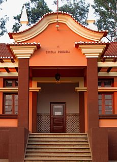
In 2015, about 71.1% of adults in Angola could read and write. This was an increase from 70.4% in 2011. More men (82.9%) can read and write than women (54.2%). Since 1975, some Angolan students have gone to high schools and universities in Portugal and Brazil. These students usually come from wealthier families.
In 2014, Angola's Ministry of Education planned to invest 16 million Euros to add computers to over 300 classrooms. This project also includes training teachers. The goal is to use new technology in primary schools to improve teaching quality.
Since 2010, the Angolan government has been building the Angolan Media Libraries Network. These libraries are in different provinces. They help people access information and knowledge. Each library has books, multimedia resources, and computers with internet access. They also have areas for reading, research, and socializing.
Angolan Culture
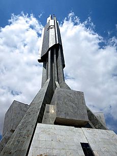
Angolan culture has been greatly shaped by Portuguese culture. This is especially true for language and religion. It is also influenced by the cultures of Angola's local ethnic groups, mainly the Bantu.
Different ethnic groups, like the Ovimbundu, Ambundu, and Bakongo, keep their own traditions and languages. But in the cities, where more than half of the people live, a mixed culture has grown. This started during colonial times. In Luanda, the capital, Portuguese heritage has become very strong. However, African roots are clear in music and dance. They also influence how Portuguese is spoken. This mix of cultures is shown in Angolan literature.
In 2014, Angola brought back its National Festival of Angolan Culture after 25 years. The festival took place in all provincial capitals. It lasted for 20 days, with the theme "Culture as a Factor of Peace and Development."
Angolan Cinema
In 1972, one of Angola's first feature films was released. It was called Sambizanga. This film was made with international partners. It was praised by critics and won a top award at the Carthage Film Festival.
Sports in Angola

Basketball is the second most popular sport in Angola. The national team has won the AfroBasket (African basketball championship) 11 times. This is a record for most titles. As a top team in Africa, Angola often competes in the Summer Olympic Games and the FIBA World Cup. Angola also has one of Africa's first professional basketball leagues.
In football (soccer), Angola hosted the 2010 Africa Cup of Nations. The Angola national football team played in the 2006 FIFA World Cup for the first time. They were eliminated after the group stage. They have also won the COSAFA Cup three times.
Angola has participated in the World Women's Handball Championship many times. The country has also been in the Summer Olympics seven times. Angola also regularly competes in the FIRS Roller Hockey World Cup. Some people believe that the martial arts "Capoeira Angola" and "Batuque" have historical roots in Angola. These were practiced by enslaved Angolans who were taken to other countries.
|
See also
 In Spanish: Angola para niños
- Outline of Angola
- Index of Angola-related articles
 | William Lucy |
 | Charles Hayes |
 | Cleveland Robinson |


