Lubango facts for kids
Quick facts for kids
Lubango
Sá da Bandeira
|
|
|---|---|
|
Municipality
|
|
| Country | Angola |
| Province | Huíla |
| Area | |
| • Total | 360.0 km2 (139.0 sq mi) |
| Elevation | 1,720 m (5,640 ft) |
| Population
(2014 Census)
|
|
| • Total | 776,246 |
| • Density | 2,156.24/km2 (5,584.6/sq mi) |
| Time zone | UTC+1 (WAT) |
| Climate | Cwb |
Lubango, once called Sá da Bandeira, is an important city in Angola. It is the capital of the Huíla Province. In 2022, about 914,456 people lived there. The city center itself had over 600,000 residents in 2014. This makes Lubango the second-largest city in Angola, after the capital, Luanda.
Contents
Lubango's Past
When Portugal Ruled
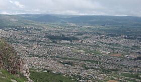
Around 1882, about a thousand Portuguese settlers arrived from the island of Madeira. These farmers helped build up the area. They founded the settlement that became Lubango. The city started in 1885 for these settlers. It sits high up at 1,760 meters in a valley. This area is part of the beautiful Huíla Plateau.
By 1910, over 1,700 Portuguese people lived in the settlement. It was known as "Lubango." In 1923, the Moçâmedes Railway connected Lubango to the coastal town of Moçâmedes. The Portuguese government then made it a city. They renamed it "Sá da Bandeira" after a famous Portuguese leader.
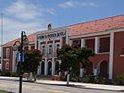
Sá da Bandeira became a major center for Portuguese settlers. It was built in a Portuguese style. The city had a cathedral, a hall for commerce, and a secondary school. Like other Portuguese towns, it had a town hall, a hospital, and a post office. Banks and other services were also available. The city grew into an important place for agriculture and transportation. It had its own airport and railway station.
Some people called Basters also moved to Lubango. They were of African and Cape Colony Dutch descent from Namibia. They are known as the Ouivamo in Lubango. Many were later forced to return to Namibia between 1928 and 1930. In 1951, Angola became an official "Overseas Province of Angola" of Portugal.
After Independence
Angola gained independence from Portugal after the Carnation Revolution in Lisbon in 1974. After this, the city was once again named Lubango. During the Angolan Civil War (1975–2002), Lubango was a key base. Troops from Cuba, SWAPO, and the Angolan government used it. The city's strong economy suffered greatly during this time.
Lubango's Economy
Lubango's economy mainly relies on agriculture. Farmers in the fertile region grow cereals, sisal, tobacco, fruits, and vegetables. They also produce a lot of meat.
Industries in Lubango focus on processing food. They also work with leather tanning and make consumer goods.
You can find good financial services from Angolan banks like BAI or BPC. It's possible to receive money from outside Angola through electronic transfers. ATMs are available in the city. They give out kwanza, which is the local money. In the markets, both US dollars and kwanza are accepted.
The main shopping area in Lubango is a new mall called "Milleneum." Here, you can find most daily products. Things like cosmetics, shoes, and clothes are also available.
Getting Around Lubango
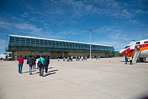
Lubango has an airport (Lubango Airport, IATA code: SDD). It is also home to a fighter bomber regiment of the Angolan Air Force. The airport has daily flights from Luanda. There are also flights three times a week from Windhoek, Namibia. These flights are operated by TAAG, Angola's airline.
The city is served by the Moçâmedes Railway, also known as CFM. This railway connects to a branch line that goes to Chiange. Taxis are common in Lubango. Most are shared taxis that drive around the city. You can also hire private taxis marked "PARTICULAR." Walking is a great way to explore Lubango. Bus services are available from Lubito. The buses run by a company called "SGO" are quite comfortable.
Learning and Science
Lubango is home to two public universities. These are the Mandume ya Ndemufayo University and the Higher Institute of Education Sciences of Huíla.
The city also has a Portuguese international school, the Escola Portuguesa do Lubango. Another institution is the Instituto Superior Politécnico Gregório Semedo. It offers degree courses in many different subjects.
Lubango's Climate
Lubango is high up, at 1,760 meters (5,774 feet) above sea level. This makes it one of the highest places in Angola. The city has a subtropical highland climate (Cwb). This means it has mild summers and cool winters.
During the day, the climate is warm and humid. At night, it becomes cool or cold. The average yearly temperature is about 18.6°C (65.5°F). Temperatures can range from 0°C (32°F) to 34.4°C (93.9°F). June and July are the coldest months. Frosts are possible then, but they are rare. The heaviest rains happen between December and March. September and October are the warmest months.
| Climate data for Lubango (1931–1960) | |||||||||||||
|---|---|---|---|---|---|---|---|---|---|---|---|---|---|
| Month | Jan | Feb | Mar | Apr | May | Jun | Jul | Aug | Sep | Oct | Nov | Dec | Year |
| Record high °C (°F) | 30.1 (86.2) |
30.7 (87.3) |
30.1 (86.2) |
29.1 (84.4) |
29.8 (85.6) |
28.1 (82.6) |
27.7 (81.9) |
30.1 (86.2) |
31.4 (88.5) |
34.4 (93.9) |
32.0 (89.6) |
31.1 (88.0) |
34.4 (93.9) |
| Mean daily maximum °C (°F) | 25.0 (77.0) |
24.6 (76.3) |
24.6 (76.3) |
24.9 (76.8) |
24.8 (76.6) |
23.6 (74.5) |
24.2 (75.6) |
26.2 (79.2) |
28.2 (82.8) |
28.0 (82.4) |
26.3 (79.3) |
25.3 (77.5) |
25.5 (77.9) |
| Daily mean °C (°F) | 19.0 (66.2) |
18.8 (65.8) |
18.8 (65.8) |
18.7 (65.7) |
17.3 (63.1) |
15.8 (60.4) |
16.2 (61.2) |
18.6 (65.5) |
20.8 (69.4) |
20.7 (69.3) |
19.8 (67.6) |
19.2 (66.6) |
18.6 (65.5) |
| Mean daily minimum °C (°F) | 13.1 (55.6) |
12.9 (55.2) |
13.0 (55.4) |
12.5 (54.5) |
9.8 (49.6) |
7.9 (46.2) |
8.3 (46.9) |
11.0 (51.8) |
13.4 (56.1) |
13.4 (56.1) |
13.2 (55.8) |
13.2 (55.8) |
11.8 (53.2) |
| Record low °C (°F) | 5.3 (41.5) |
5.4 (41.7) |
2.0 (35.6) |
3.2 (37.8) |
0.6 (33.1) |
−1.0 (30.2) |
−1.0 (30.2) |
0.0 (32.0) |
4.6 (40.3) |
4.1 (39.4) |
5.1 (41.2) |
3.9 (39.0) |
−1.0 (30.2) |
| Average precipitation mm (inches) | 139.7 (5.50) |
152.8 (6.02) |
171.6 (6.76) |
93.5 (3.68) |
5.5 (0.22) |
0.1 (0.00) |
0.0 (0.0) |
0.4 (0.02) |
4.3 (0.17) |
70.4 (2.77) |
118.0 (4.65) |
152.6 (6.01) |
909.0 (35.79) |
| Average precipitation days (≥ 0.1 mm) | 15 | 14 | 17 | 10 | 1 | 0 | 0 | 0 | 2 | 10 | 14 | 17 | 100 |
| Average relative humidity (%) | 65 | 67 | 69 | 63 | 47 | 40 | 34 | 30 | 33 | 49 | 59 | 63 | 52 |
| Mean monthly sunshine hours | 164.3 | 163.9 | 173.6 | 204.0 | 272.8 | 285.0 | 282.1 | 282.1 | 240.0 | 213.9 | 207.0 | 201.5 | 2,690.2 |
| Mean daily sunshine hours | 5.3 | 5.8 | 5.6 | 6.8 | 8.8 | 9.5 | 9.1 | 9.1 | 8.0 | 6.9 | 6.9 | 6.5 | 7.4 |
| Source: Deutscher Wetterdienst | |||||||||||||
Lubango is known as the coldest city in Angola. Temperatures as low as -2°C (28°F) have been recorded there.
Famous People from Lubango
- Marco Abreu (born 1974), a footballer who played for the Angola national football team.
See also
 In Spanish: Lubango para niños
 | Toni Morrison |
 | Barack Obama |
 | Martin Luther King Jr. |
 | Ralph Bunche |


