Pasig facts for kids
Quick facts for kids
Pasig
|
|||||
|---|---|---|---|---|---|
|
Highly urbanized city
|
|||||
|
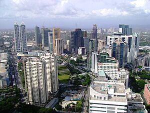
F. Ortigas Jr. Road
Montefalco Church
Pasig Cathedral
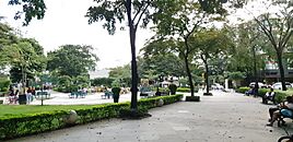
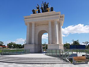
Plaza Rizal
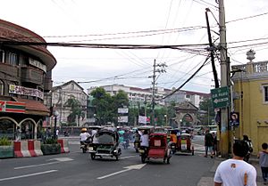
Ortigas Avenue
Caruncho Avenue
Capitol Commons
|
|||||
|
|||||
| Motto(s):
Pasig: Umaagos ang Pag-asa
English: "Pasig: Hope Flows!" |
|||||
| Anthem: Martsa ng Pasig (Pasig March) |
|||||
|
|||||
|
OpenStreetMap
|
|||||
| Country | Philippines | ||||
| Region | National Capital Region | ||||
| Province | None | ||||
| District | [[{{#property:P7938}} | — Lua error in Module:Wd at line 1804: attempt to index field 'wikibase' (a nil value).]] | ||||
| Established | July 2, 1573 | ||||
| Cityhood and HUC | January 21, 1995 | ||||
| Barangays | 30 (see Barangays) | ||||
| Government
|
|||||
| • Type | Sangguniang Panlungsod | ||||
| Area | |||||
| • Total | 48.46 km2 (18.71 sq mi) | ||||
| Elevation | 9.0 m (29.5 ft) | ||||
| Highest elevation | 136 m (446 ft) | ||||
| Lowest elevation | -1 m (−3.3 ft) | ||||
| Population
(2020 census)
|
|||||
| • Total | 803,159 | ||||
| • Rank | 9th | ||||
| • Density | 16,573.6/km2 (42,926/sq mi) | ||||
| • Households | 212,895 | ||||
| Demonym(s) | Pasigueño (Male) Pasigueña (Female) |
||||
| Economy | |||||
| • Income class | 1st city income class | ||||
| • Poverty incidence |
|
||||
| • Revenue | ₱ 14,913 million (2022) | ||||
| • Assets | ₱ 51,688 million (2022) | ||||
| • Expenditure | ₱ 9,779 million (2022) | ||||
| • Liabilities | ₱ 6,539 million (2022) | ||||
| Service provider | |||||
| • Electricity | Manila Electric Company (Meralco) | ||||
| • Water | Manila Water | ||||
| Time zone | UTC+8 (PST) | ||||
| PSGC |
[https://psa.gov.ph/classification/psgc/?q=psgc/barangays/{{#pro000®code={{&provcode=
|
||||
| IDD : area code | +63 (0)02 | ||||
| Native languages | Tagalog | ||||
| Major religions | Roman Catholic Church, Protestantism, Iglesia ni Cristo, Evangelicalism | ||||
| Feast date | December 8 | ||||
| Catholic diocese | Roman Catholic Diocese of Pasig | ||||
| Patron saint | Immaculate Conception | ||||
| Website | pasigcity |
||||
Pasig, officially known as the City of Pasig, is a large city in the National Capital Region of the Philippines. It is a highly urbanized city. In 2024, about 853,050 people lived there.
Pasig is located on the eastern side of Metro Manila, next to Rizal province. The city is named after the Pasig River. Pasig used to be mostly farms and factories. Now, it has many businesses, especially in the Ortigas Center area. The city is home to the Roman Catholic Diocese of Pasig. Its main church, Pasig Cathedral, was built around the same time the town was founded in 1573.
Pasig was once part of Rizal province. But in 1975, it became part of Metro Manila. The old government building for Rizal province was in Pasig. In 2009, a new capitol was built in Antipolo, which is in Rizal province. On June 19, 2020, Antipolo officially became the capital of Rizal.
Contents
- What's in a Name? The Meaning of Pasig
- Pasig's Past: A Look at History
- Pasig's Location and Surroundings
- Pasig's Population and People
- Pasig's Economy and Business
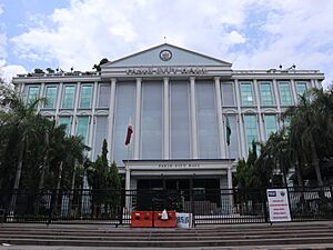
- How Pasig is Governed
- Sports in Pasig
- Getting Around Pasig: Transportation
- Learning in Pasig: Education
- Famous People from Pasig
- Sister Cities
- International Relations
- See also
What's in a Name? The Meaning of Pasig
The name Pasig comes from a Tagalog word. It means "a river that flows into the sea" or "sandy bank of a river."
The word is related to other words like Tagalog dalampasigan (meaning "shore") and Malay pasir (meaning "beach" or "sand").
Pasig's Past: A Look at History
Early Days of Pasig
We don't have many written records from before the Spanish arrived in 1573. That's when they started the settlement called Ciudad-Municipal de Pasig.
However, old family records and stories tell us about a busy village. It was located along the Bitukang Manok River. This river is now mostly gone and is called Parian Creek. This village eventually grew into modern-day Pasig.
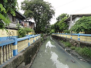
The creek was called Bitukang Manok (which means "Chicken Gut" in Tagalog). This was because of its winding, snake-like shape. Early people living there included Tagalogs and people from South China. The Bitukang Manok used to be a main branch of the Marikina River. The Spanish called it Rio de Pasig, but locals still used its original name.
The first part of the Bitukang Manok became known as "Pariancillo." Chinese and Malay traders used to meet there to trade with Tagalogs. This area later became the city's main public market. The creek also helped Pasig's economy grow during the Spanish colonial era. It helped water the rice fields and was a busy trading spot.
Pasig During Spanish Rule
From the early 1600s, many Catholic visitors traveled through the Parian Creek. They came from places like Manila and Mandaluyong. They were going to the pilgrimage church in Antipolo.
Even the famous religious parades for the Our Lady of Peace and Good Voyage used this route many times.
In the 1600s, a priest named Fray Joaqin Martinez de Zuñiga counted the people in Pasig. He found about 3000 families. Half were native Filipinos, and half were Chinese Filipinos. Spanish soldiers from Mexico also patrolled the Pasig River. Some of these soldiers settled in Pasig after their service.
During the British Occupation of Manila (1762-1764), the British army used the creek. They traveled upstream to take over nearby villages. They even attacked the main plaza in front of the Pasig Cathedral. They used the church as their military base.
Some Indian soldiers, called Sepoys, who came with the British, later joined forces with the Spanish and local people. After the British left, many Sepoys stayed. They married Filipina women. This is why some people in Pasig, especially in Cainta and Taytay, have features from India.
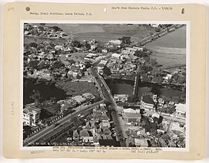
In 1742, a bridge called "Puente del Pariancillo" was built over the creek. It was later renamed "Puente de Fray Felix Trillo."
On May 2, 1896, over 300 Filipino revolutionaries, called Katipuneros, secretly used this creek. They met at a house in Barangay San Nicolas. Three months later, on August 29, nearly 2,000 Pasig residents joined the Katipunan. They attacked the Spanish government building in Pasig.
This was the first successful rebellion by the Katipunan. It is known as the "Nagsabado sa Pasig" (the Saturday Uprising on Pasig). After this victory, the Katipuneros moved on to San Juan. There, they launched another attack to fight against unfair Spanish officials.
Pasig in the 20th Century
On June 11, 1901, the province of Rizal was created. Pasig became its capital. In 1939, a part of Pasig called Ugong (Ugong Norte) became part of the new Quezon City.
After World War II, the Bitukang Manok creek became very polluted. In the late 1960s, it was separated from the Marikina River. It became an open sewage ditch.
Pasig as Part of Metro Manila
Pasig was home to people who fought for human rights during the time of President Ferdinand Marcos (1965-1986). One of them was Jovito Salonga, a Pasig native who spoke out against Marcos's policies.
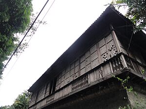
When Marcos declared Martial Law in September 1972, many students and activists in Pasig protested. A house called Bahay Na Tisa in Barangay San Jose became a safe place for them to meet. It was known as Pasig's "Freedom House."
On November 7, 1975, Pasig was separated from Rizal province. It became part of Metro Manila.
Becoming a City
In July 1994, Pasig officially became a highly urbanized city. This was made law in December 1994 and approved by a public vote on January 21, 1995.
Recent Events in Pasig
On February 4, 2006, a sad event happened at the PhilSports Arena (formerly ULTRA). Many people gathered for a TV show's anniversary. A stampede occurred, and 71 people died.
Pasig was hit hard by Typhoon Ondoy on September 26, 2009. This typhoon caused the worst flood in Philippine history. The Pasig River and Manggahan Floodway helped channel the floodwaters.
In August 2012, heavy monsoon rains caused more flooding. This affected Pasig and other areas in Luzon. The Marikina River overflowed, damaging places that were also hit by Typhoon Ondoy.
On June 19, 2020, a law was signed that officially moved the capital of Rizal province from Pasig to Antipolo. This change took effect on July 7, 2020.
Pasig's Location and Surroundings
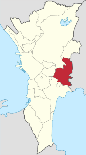
Pasig is surrounded by other cities and towns. To its west are Quezon City and Mandaluyong. To the north is Marikina. To the south are Pateros and Taguig. To the east are Cainta and Taytay in Rizal province.
The Pasig River flows through the city. It forms parts of Pasig's southern borders with Taguig. The Marikina River forms its western border with Quezon City. The Manggahan Floodway, built in 1986, starts where the Marikina River meets the Pasig River in the northeast.
Barangays: Pasig's Neighborhoods
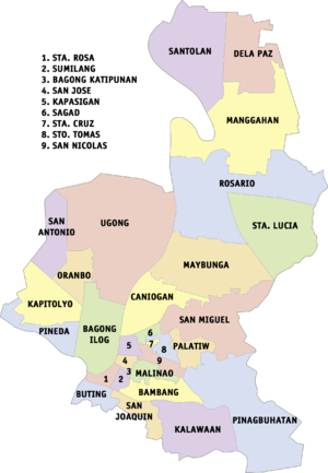
Pasig is divided into 30 smaller areas called barangays. These barangays are grouped into two districts for city council elections. The first district covers the southern and western parts of the city. The second district covers the northern and eastern parts.
Most of the barangays (27 of them) are on the northern side of the Pasig River. Only three (Buting, San Joaquin, and Kalawaan) are on the southern side.
| Barangays | District | Population | Area (ha) | Density (/ha) | |||||||||||||||||||||||||||||||||||||||||||||||||||||||||||||||||||||||||||||||||||||||||||||||||||||||
|---|---|---|---|---|---|---|---|---|---|---|---|---|---|---|---|---|---|---|---|---|---|---|---|---|---|---|---|---|---|---|---|---|---|---|---|---|---|---|---|---|---|---|---|---|---|---|---|---|---|---|---|---|---|---|---|---|---|---|---|---|---|---|---|---|---|---|---|---|---|---|---|---|---|---|---|---|---|---|---|---|---|---|---|---|---|---|---|---|---|---|---|---|---|---|---|---|---|---|---|---|---|---|---|---|---|---|---|
| Bagong Ilog |
|
20,344 | 124.95 | 124 | |||||||||||||||||||||||||||||||||||||||||||||||||||||||||||||||||||||||||||||||||||||||||||||||||||||||
| Bagong Katipunan |
|
879 | 4.78 | 248 | |||||||||||||||||||||||||||||||||||||||||||||||||||||||||||||||||||||||||||||||||||||||||||||||||||||||
| Bambang |
|
20,801 | 38.41 | 501 | |||||||||||||||||||||||||||||||||||||||||||||||||||||||||||||||||||||||||||||||||||||||||||||||||||||||
| Buting |
|
10,348 | 20.33 | 446 | |||||||||||||||||||||||||||||||||||||||||||||||||||||||||||||||||||||||||||||||||||||||||||||||||||||||
| Caniogan |
|
28,084 | 167.94 | 130 | |||||||||||||||||||||||||||||||||||||||||||||||||||||||||||||||||||||||||||||||||||||||||||||||||||||||
| Dela Paz |
|
19,804 | 199.79 | 65 | |||||||||||||||||||||||||||||||||||||||||||||||||||||||||||||||||||||||||||||||||||||||||||||||||||||||
| Kalawaan |
|
32,145 | 209.91 | 112 | |||||||||||||||||||||||||||||||||||||||||||||||||||||||||||||||||||||||||||||||||||||||||||||||||||||||
| Kapasigan |
|
4,774 | 21.15 | 311 | |||||||||||||||||||||||||||||||||||||||||||||||||||||||||||||||||||||||||||||||||||||||||||||||||||||||
| Kapitolyo |
|
9,203 | 95.24 | 215 | |||||||||||||||||||||||||||||||||||||||||||||||||||||||||||||||||||||||||||||||||||||||||||||||||||||||
| Malinao |
|
4,817 | 28.02 | 213 | |||||||||||||||||||||||||||||||||||||||||||||||||||||||||||||||||||||||||||||||||||||||||||||||||||||||
| Manggahan |
|
88,078 | 327.03 | 227 | |||||||||||||||||||||||||||||||||||||||||||||||||||||||||||||||||||||||||||||||||||||||||||||||||||||||
| Maybunga |
|
45,555 | 177.37 | 201 | |||||||||||||||||||||||||||||||||||||||||||||||||||||||||||||||||||||||||||||||||||||||||||||||||||||||
| Oranbo |
|
3,267 | 43.61 | 101 | |||||||||||||||||||||||||||||||||||||||||||||||||||||||||||||||||||||||||||||||||||||||||||||||||||||||
| Palatiw |
|
27,499 | 24.24 | 698 | |||||||||||||||||||||||||||||||||||||||||||||||||||||||||||||||||||||||||||||||||||||||||||||||||||||||
| Pinagbuhatan |
|
163,598 | 152.35 | 692 | |||||||||||||||||||||||||||||||||||||||||||||||||||||||||||||||||||||||||||||||||||||||||||||||||||||||
| Pineda |
|
19,499 | 79.85 | 188 | |||||||||||||||||||||||||||||||||||||||||||||||||||||||||||||||||||||||||||||||||||||||||||||||||||||||
| Rosario |
|
73,979 | 414.54 | 122 | |||||||||||||||||||||||||||||||||||||||||||||||||||||||||||||||||||||||||||||||||||||||||||||||||||||||
| Sagad |
|
6,036 | 12.00 | 574 | |||||||||||||||||||||||||||||||||||||||||||||||||||||||||||||||||||||||||||||||||||||||||||||||||||||||
| San Antonio |
|
11,727 | 82.07 | 142 | |||||||||||||||||||||||||||||||||||||||||||||||||||||||||||||||||||||||||||||||||||||||||||||||||||||||
| San Joaquin |
|
13,823 | 45.07 | 277 | |||||||||||||||||||||||||||||||||||||||||||||||||||||||||||||||||||||||||||||||||||||||||||||||||||||||
| San Jose |
|
1,817 | 9.33 | 252 | |||||||||||||||||||||||||||||||||||||||||||||||||||||||||||||||||||||||||||||||||||||||||||||||||||||||
| San Miguel |
|
40,199 | 80.05 | 376 | |||||||||||||||||||||||||||||||||||||||||||||||||||||||||||||||||||||||||||||||||||||||||||||||||||||||
| San Nicolas |
|
2,602 | 30.38 | 51 | |||||||||||||||||||||||||||||||||||||||||||||||||||||||||||||||||||||||||||||||||||||||||||||||||||||||
| Santa Cruz |
|
5,610 | 7.28 | 600 | |||||||||||||||||||||||||||||||||||||||||||||||||||||||||||||||||||||||||||||||||||||||||||||||||||||||
| Santa Lucia |
|
43,749 | 178.31 | 227 | |||||||||||||||||||||||||||||||||||||||||||||||||||||||||||||||||||||||||||||||||||||||||||||||||||||||
| Santa Rosa |
|
1,015 | 12.06 | 126 | |||||||||||||||||||||||||||||||||||||||||||||||||||||||||||||||||||||||||||||||||||||||||||||||||||||||
| Santo Tomas |
|
12,904 | 10.43 | 611 | |||||||||||||||||||||||||||||||||||||||||||||||||||||||||||||||||||||||||||||||||||||||||||||||||||||||
| Santolan |
|
57,933 | 199.25 | 217 | |||||||||||||||||||||||||||||||||||||||||||||||||||||||||||||||||||||||||||||||||||||||||||||||||||||||
| Sumilang |
|
4,334 | 17.18 | 314 | |||||||||||||||||||||||||||||||||||||||||||||||||||||||||||||||||||||||||||||||||||||||||||||||||||||||
| Ugong |
|
28,737 | 375.38 | 59 | |||||||||||||||||||||||||||||||||||||||||||||||||||||||||||||||||||||||||||||||||||||||||||||||||||||||
Pasig's Climate and WeatherPasig has two main seasons:
The wet season usually has the most rain in August. The most rain generally falls from June to September. Pasig gets about 2,014.8 millimeters (79.32 inches) of rain each year. July is the wettest month, and April is the driest. The hottest months are April and May, with temperatures around 34°C (93°F). The coolest months are January and February, with temperatures around 24°C (75°F). The Philippines is often affected by typhoons because of its location. Typhoon season usually runs from June to November. However, typhoons can happen at any time of the year.
Pasig's Population and PeoplePasig's population has grown steadily over the years. It has grown faster than the average for the whole Metro Manila region. In 1960, less than 3% of Metro Manila's population lived in Pasig. By 2015, this number grew to almost 6%. Experts believe Pasig's population could reach one million people between 2025 and 2030. Religion in PasigThe main religion in Pasig is Roman Catholicism. The Roman Catholic Diocese of Pasig was created in 2003. Its main church is the Immaculate Conception Parish. Pasig is also the main office for the Presbyterian Church of the Philippines. Pasig's Economy and Business
From Farms to FactoriesA long time ago, Pasig was mostly an agricultural town. People grew rice, fruits, and sugarcane. Pasig's Modern EconomyToday, the western part of Pasig is a major business hub. It has many factories, warehouses, and shops. These are mostly found in Ortigas Center, Pasig proper, and along E. Rodriguez Jr. Avenue (C-5) and Ortigas Avenue. New buildings and businesses are also growing along Mercedes Avenue. The eastern part of Pasig used to be mostly homes. Now, many new businesses are being built there, especially along Marcos Highway. Ortigas Center is one of the most important business areas in the Philippines. It has many tall office buildings, apartments, shops, schools, and malls. The University of Asia and the Pacific is also located here. Big companies like San Miguel Corporation have their main offices in Ortigas Center. Next to Ortigas Center is Capitol Commons. This is a new area with different types of buildings. It was built where the old Rizal Provincial Capitol used to be. Other important developments include Arcovia City, The Grove by Rockwell, and Ortigas East. Ortigas East is home to the Tiendesitas market. There are also places like El-Pueblo and Metrowalk with cafes, restaurants, and shops. Bridgetowne Destination Estates and Parklinks are also large new developments that connect Pasig with Quezon City. How Pasig is GovernedLocal Government LeadersPasig is run by its city mayor, vice mayor, and city councilors. The mayor is the main leader of the city. The city councilors make the laws. The vice mayor leads the city council and takes over if the mayor is temporarily away. Each of Pasig's two districts has six elected councilors. The current mayor is Vico Sotto. The current vice mayor is Robert Jaworski Jr.. The City SealThe woman on the city seal represents the "Mutya ng Pasig" (Muse of Pasig). The church on the lower left is the Pasig Cathedral. It is the main church of the Roman Catholic Diocese of Pasig. The factory on the lower right shows the city's growth and success. Current City Leaders
City Council Members
Sports in PasigThe PhilSports Complex is one of the country's most important sports centers. It is located near Meralco Avenue. The offices of the Philippine Sports Commission are here. Its main building is the PhilSports Arena, also known as ULTRA. It has hosted many basketball games. A new sports venue, the Home of the UAAP, is being built in Bridgetowne. It is expected to open in 2027. Other sports places in the city include the Ynares Sports Arena and the Pasig Sports Center. As of 2025, Pasig has one professional sports team, the Pasig City team in the Maharlika Pilipinas Basketball League. Pasig will also help host the first ever FIFA Futsal Women's World Cup in late 2025. Getting Around Pasig: TransportationMajor Roads in PasigPasig is connected by several important roads:
Water TravelThe Pasig River runs through the city. You can travel on the river using the Pasig River Ferry Service. There are 7 ferry stations in Pasig, named after the barangays along the river:
Bridges Connecting PasigPasig has eleven bridges that cross the Pasig River and the Marikina River:
Train LinesPasig is served by the LRT Line 2. The Santolan and Marikina–Pasig Stations are near the Pasig-Marikina border. The train's maintenance area is in Barangay Santolan, Pasig. The Metro Manila Subway is currently being built and will have two stations in Ortigas Center. The MRT Line 4 has also been approved for construction. Before the modern train lines, steam trains used to serve Pasig before World War II. There are streets named "Daangbakal" (meaning "railroad" in Tagalog) in Marikina and San Mateo. These streets were once part of a railway line that connected Manila to Montalban (now Rodriguez, Rizal). This line operated until 1936. Another railway line, the Antipolo Line, also existed in Pasig but stopped operating in 1917. Today, people in Pasig use tricycles, jeepneys, taxis, UV Express vans, and buses to get around. Learning in Pasig: EducationThe Schools Division Office (SDO) of Pasig City manages 44 public schools. This includes 28 elementary schools, 14 high schools, and one senior high school (Buting Senior High School). It also oversees the Rizal Experimental Station and Pilot School of Cottage Industries (RESPSCI). The national office of Parents for Education Foundation, Inc. is located in Pasig. This group runs several schools. Colegio del Buen Consejo (CBC) is one of the oldest schools in Pasig. It is a Catholic school. High Schools in Pasig
Colleges and Universities in Pasig
Technical and Vocational TrainingMFI Foundation Inc. (formerly Meralco Foundation Institute) is located near Ortigas Center. It helps train people for technical jobs. It works with the Philippine government's Technical Education and Skills Development Authority (Philippines) (TESDA). International Schools
Famous People from Pasig
Sister Cities
International Relations
See also
|
|||||||||||||||||||||||||||||||||||||||||||||||||||||||||||||||||||||||||||||||||||||||||||||||||||||||||||
 | Madam C. J. Walker |
 | Janet Emerson Bashen |
 | Annie Turnbo Malone |
 | Maggie L. Walker |







 In Spanish: