Maple Spring Brook facts for kids
Quick facts for kids Maple Spring Brook |
|
|---|---|

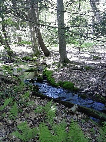
Headwaters of Maple Spring Brook
|
|
| Other name(s) | Maple Spring Branch, Maple Spring Run |
| Physical characteristics | |
| Main source | mountain in Fairmount Township, Luzerne County, Pennsylvania between 2,100 and 2,120 feet (640 and 650 m) |
| River mouth | Kitchen Creek in Fairmount Township, Luzerne County, Pennsylvania 1,325 ft (404 m) 41°18′34″N 76°16′34″W / 41.30950°N 76.27615°W |
| Length | 0.6 mi (0.97 km) |
| Basin features | |
| Progression | Kitchen Creek → Huntington Creek → Fishing Creek → Susquehanna River → Chesapeake Bay |
| Basin size | 0.40 sq mi (1.0 km2) |
Maple Spring Brook is a small stream in Luzerne County, Pennsylvania. It's also called Maple Spring Branch or Maple Spring Run. This brook flows into Kitchen Creek. It's about 0.6 miles (0.97 km) long and runs through Fairmount Township. The area of land that drains into this stream is about 0.40 square miles (1.0 km2). You can find a cool waterfall in the upper part of the stream. There are also many hemlock trees nearby. The ground around the brook has different types of soil and rocks, like till, sandstone, and shale.
Contents
Where Maple Spring Brook Flows
Maple Spring Brook starts on a mountain in Fairmount Township. This is not far from Red Rock Mountain. The stream first flows southeast for a short distance. Then, it enters a deep valley. After that, it turns south. The stream then turns east-southeast for a short bit. Finally, it meets Kitchen Creek. Maple Spring Brook joins Kitchen Creek about 6.40 miles (10.30 km) before Kitchen Creek ends.
Land and Rocks Around the Brook
The land near where Maple Spring Brook meets Kitchen Creek is about 1,325 feet (404 m) above sea level. Where the stream begins, the land is higher. It's between 2,100 and 2,120 feet (640 and 650 m) above sea level.
The ground around the lower part of Maple Spring Brook has a type of soil called Wisconsinan Till. This soil was left behind by glaciers. Further upstream, you'll find solid bedrock. This bedrock is made of sandstone and shale. Near the very start of the stream, there's more Wisconsinan Bouldery Till. You can also find a small wetland area there.
Nature and Wildlife
The entire area that drains water into Maple Spring Brook is called its watershed. This watershed covers about 0.40 square miles (1.0 km2). The stream is completely within the Red Rock area. This area is mapped by the United States Geological Survey.
There is a beautiful waterfall on Maple Spring Brook. It is 15 feet (4.6 m) tall. This waterfall is in the upper part of the stream. It's located a few hundred feet downstream from the Ganoga View Trail.
On September 15, 2004, a very tall white ash tree was seen near Maple Spring Brook. It was 139.7 feet (42.6 m) tall! Its height was measured using a special laser tool. There are also many hemlock trees near the upper parts of the stream.
History and Fun Activities
Maple Spring Brook was officially added to the Geographic Names Information System on August 2, 1979. This system helps keep track of names for places like streams. Its special ID number there is 1180366.
Maple Spring Branch is located inside Ricketts Glen State Park. This is a popular park for outdoor activities. The Ganoga View Trail, which is in Ricketts Glen State Park, crosses over the stream near its beginning. It's a great spot for hiking and enjoying nature.

