Marion, Massachusetts facts for kids
Quick facts for kids
Marion, Massachusetts
|
||
|---|---|---|
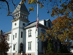
Marion Town House
|
||
|
||
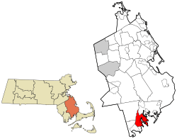
Location in Plymouth County in Massachusetts
|
||
| Country | United States | |
| State | Massachusetts | |
| County | Plymouth | |
| Settled | 1679 | |
| Incorporated | 1852 | |
| Government | ||
| • Type | Open town meeting | |
| Area | ||
| • Total | 26.1 sq mi (67.7 km2) | |
| • Land | 14.0 sq mi (36.2 km2) | |
| • Water | 12.1 sq mi (31.4 km2) | |
| Elevation | 20 ft (6 m) | |
| Population
(2020)
|
||
| • Total | 5,347 | |
| • Density | 204.56/sq mi (78.98/km2) | |
| Time zone | UTC-5 (Eastern) | |
| • Summer (DST) | UTC-4 (Eastern) | |
| ZIP code |
02738
|
|
| Area code(s) | 508 / 774 | |
| FIPS code | 25-38540 | |
| GNIS feature ID | 0618345 | |
| Website | www.marionma.gov | |
Marion is a town located in Plymouth County, Massachusetts, in the United States. In 2020, about 5,347 people lived here.
Marion is part of the South Coast area of Massachusetts. This region includes towns around Buzzards Bay. It's a beautiful place known for its connection to the water.
If you want to learn about the specific village of Marion Center, you can find information in the article Marion Center, Massachusetts.
Contents
Discovering Marion's Past
Marion was first settled in 1679. Back then, it was called "Sippican" and was part of Rochester, Massachusetts. The name "Sippican" came from the Wampanoag people, who were the local Native American tribe.
The town was famous for its many sea captains and sailors. They lived here and sailed the seas. There were also small businesses that built ships in the harbor.
Becoming an Independent Town
By the late 1840s, there were some disagreements between Sippican Village and the nearby town of Mattapoisett. The people of Sippican wanted to become their own town.
So, they formed a group and went to Boston to ask for independence. With help from a powerful local friend, Marion officially became its own town on May 14, 1852. It was renamed Marion to honor Francis Marion, a hero from the American Revolutionary War. Mattapoisett became a separate town a few years later, in 1857.
Since then, Marion's economy has mostly depended on the waters of Buzzards Bay. Fishing has been important, and many visitors come for summer tourism. Sailing is a very popular activity for both residents and tourists.
Exploring Marion's Geography
Marion covers about 67.7 square kilometers (26.1 square miles). About 36.2 square kilometers (14.0 square miles) is land, and 31.4 square kilometers (12.1 square miles) is water. This means almost half of the town's area is water!
Marion is next to Mattapoisett to the southwest. To the northwest is Rochester, and to the north and northeast is Wareham. The town is about 24 kilometers (15 miles) west of the Cape Cod Canal. It's also about 19 kilometers (12 miles) east of New Bedford.
Waterways and Natural Features
Marion is located right on Buzzards Bay, and water greatly shapes its landscape. Sippican Harbor divides much of the town into two parts. Converse Point is to the west, and Sippican Neck is to the east.
Many coves branch off Sippican Harbor. These include Sprague's Cove, Hammetts Cove, Blankenship Cove, and Planting Island Cove. The Weweantic River forms part of the town's northeastern border with Wareham. The Sippican River also flows into the Weweantic River.
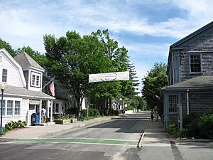
Marion has several parks, beaches, and wharves. You can find The Beverly Yacht Club and two golf courses here: Little Marion G.C. (public) and The Kittansett Club G.C. (private). Marion is a charming old New England town. It has a small, quaint village with many traditional Cape Cod style homes. The Marion General Store, which dates back to the 1800s, is a local landmark.
Marion's Climate
Marion, Massachusetts, has a Humid continental climate. This type of climate means it has warm, humid summers. Winters are cold, with temperatures often dropping below freezing.
Because Marion is on Buzzards Bay, the ocean helps to keep temperatures more moderate. This means winters are a bit milder and summers are a bit cooler than places further inland.
Who Lives in Marion?
In 2000, there were 5,123 people living in Marion. There were 1,996 households and 1,441 families. The average household had about 2.51 people.
About 25.1% of the population was under 18 years old. About 17.7% were 65 years or older. The average age in town was 42 years.
In 2021, the average income for a household in Marion was about $105,813. About 2.2% of people were living below the poverty line. Most adults (95.8%) have a high school degree, and many (48.5%) have a college degree or higher.
Learning in Marion
Marion is part of the Old Rochester Regional School District, which has about 2,700 students. Marion, along with Mattapoisett and Rochester, share a single school system. Each town has its own school committee.
Local Schools
In Marion, students from pre-kindergarten to grade 6 attend Sippican School. For grades 7 and 8, students go to Old Rochester Regional Junior High School. High school students attend Old Rochester Regional High School. Both of these regional schools are located in Mattapoisett, very close to the Marion town line.
The high school's sports teams are called the Bulldogs, and their colors are red, black, and white. Their big football rival on Thanksgiving Day is Apponequet Regional High School.
Other School Options
Students from Marion can also choose to attend Upper Cape Cod Regional Technical School. This is a technical high school in Bourne, which teaches job skills.
Marion is also home to Tabor Academy. This is a private school for students in grades 9 through 12.
Town Facilities and Services
As a small New England town, Marion has important services like roads, water, and waste disposal.
Harbor and Recreation
Marion has an excellent harbor facility. It features a large concrete jetty where boats can easily load and unload. A wooden ramp connects the jetty to the Harbormaster's office. There is also a big parking lot nearby.
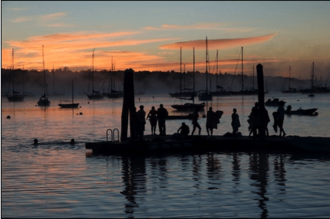
Marion's inner harbor is often filled with many sailboats, creating a "forest of masts." Next to the Harbormaster's office is a small area where the town stocks shellfish.
There is a public beach at the end of Front Street. It is well-maintained and has a lifeguard station. It also has a large parking lot for visitors.
Community Resources
The town's library, called the Elizabeth Taber Library, is located on the ground floor of a colonial building. It is right next to the Town offices on Spring Street.
Getting Around Marion
Interstate 195 goes through Marion, with an exit for Massachusetts Route 105. Route 105 also connects with U.S. Route 6, which runs through the town.
For bus or regional flights, you can go to New Bedford. For national flights, the closest airport is T. F. Green Airport in Rhode Island. For international flights, you would use Logan International Airport in Boston.
There are no train services directly in Marion. The closest passenger train service is in Middleborough, which is part of the MBTA commuter rail. Freight trains can be found in Wareham.
Military Industry in Marion
Until 2022, Marion was home to Lockheed Martin Sippican. This company created technology for undersea warfare, such as drones, torpedoes, and special antennae.
The company started in 1940 as Francis Associates. It became a public company called Sippican Ocean Systems, Inc. in 1981. Later, in 2004, it was bought by Lockheed Martin.
Famous People from Marion
Many interesting people have connections to Marion:
- Benjamin Briggs – He was the captain of the famous ship Mary Celeste.
- Richard E. Byrd – A Rear Admiral who was the first person to fly over both the North and South Poles. He spent summers in Marion.
- Grover Cleveland – A President of the United States who was a summer resident.
- Dom DiMaggio – A centerfielder for the Red Sox baseball team.
- Charles Dana Gibson – A famous artist who created the "Gibson Girl" look.
- Greg F. Gifune – A novelist, editor, and film producer who grew up in Marion.
- Andrew A. Harwood – A career naval officer and Rear Admiral.
- Henry James – A well-known novelist.
- Lucy Myers Wright Mitchell – The first female classical archaeologist.
- Frances Folsom Cleveland Preston – The former First Lady to President Grover Cleveland, also a summer resident.
- Geraldo Rivera – A TV personality who spent summers here.
- Franklin Delano Roosevelt – Another President of the United States who was a summer resident.
- Carl Ruggles – An American composer born in Marion.
- Augustus Saint-Gaudens – A famous sculptor who spent summers in town.
- James Spader – An actor who is a summer resident.
See also
 In Spanish: Marion (Massachusetts) para niños
 | William L. Dawson |
 | W. E. B. Du Bois |
 | Harry Belafonte |


