
Mariposa Creek facts for kids
Quick facts for kids Mariposa Creek |
|
|---|---|

Mariposa Creek in the town of Mariposa
|
|
| Other name(s) | Mariposa River |
| Country | United States |
| State | California |
| Region | Merced County |
| Cities | Mariposa, Le Grand |
| Physical characteristics | |
| Main source | Western Sierra Nevada foothills 3,092 ft (942 m) 37°32′10″N 120°00′40″W / 37.53611°N 120.01111°W |
| River mouth | Duck Slough 0 ft (0 m) 37°14′55″N 120°18′34″W / 37.24861°N 120.30944°W |
| Basin features | |
| Tributaries |
|
Mariposa Creek, also known as the Mariposa River, is a stream that starts in Mariposa County, California. It flows through the town of Mariposa and then southwest through the Sierra Nevada foothills. The creek continues across the San Joaquin Valley in Merced County. Finally, it empties into the sloughs of the San Joaquin River south of Merced.
Contents
History of Mariposa Creek
Mariposa Creek got its name from a Spanish explorer named Gabriel Moraga. On September 27, 1806, his group found many butterflies in the area. The Spanish word for butterflies is "mariposas".
Moraga wrote about how many butterflies there were: "We named this place Mariposas because these abounded, especially at night and during the morning. These butterflies became quite a nuisance." He even mentioned one butterfly flying into a soldier's ear!
Today, people in Mariposa still celebrate these beautiful insects. Every year, on the first weekend in May, they have a "Butterfly Days" festival and parade. This event marks the arrival of migrating monarch butterflies.
During the California Gold Rush, Mariposa Creek was famous for its gold. Many mining camps were set up along the creek, including Logtown, Mariposa, and Mariposita. People came from all over to search for gold here.
Where the Water Flows: Mariposa Creek's Watershed
A watershed is an area of land where all the water drains into a single river, lake, or ocean. Mariposa County has three main watersheds. These include the Merced River, the Chowchilla River/Fresno River, and a group of smaller streams called the Lower Mariposa group.
All these streams and rivers are part of the much larger San Joaquin River system. This system collects water from the western side of the Sierra Nevada mountains. Near the end of its journey, Mariposa Creek is held back by the Mariposa Creek Dam. This dam is 88 feet (27 m) high.
Another important dam is the Stockton Creek Dam. It is 95 feet (29 m) tall and is on Stockton Creek. Stockton Creek is a smaller stream that flows into Mariposa Creek. The Mariposa Public Utilities District (MPUD) manages this dam.
Fun at Mariposa Creek Parkway
Mariposa County has a special park along the creek in downtown Mariposa. It's called the Mariposa Creek Parkway. This park is a great place to visit!
It has an Art Park where you can see different art pieces. There's also an amphitheater, which is an outdoor stage for performances. The park also features a special garden that shows off California native plants. This garden is supported by local Master Gardeners.
Images for kids
-
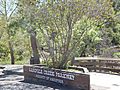
Mariposa Creek Parkway
-
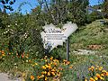
Mariposa Creek Parkway, Demonstration Garden
-
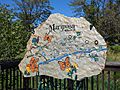
Mariposa Creek Parkway, combined stone art and map


