
Mathews County, Virginia facts for kids
Quick facts for kids
Mathews County
|
||
|---|---|---|

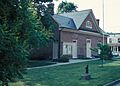
Mathews County Courthouse Square
|
||
|
||

Location within the U.S. state of Virginia
|
||
 Virginia's location within the U.S. |
||
| Country | ||
| State | ||
| Founded | 1791 | |
| Seat | Mathews | |
| Area | ||
| • Total | 252 sq mi (650 km2) | |
| • Land | 86 sq mi (220 km2) | |
| • Water | 166 sq mi (430 km2) 65.9% | |
| Population
(2020)
|
||
| • Total | 8,533 | |
| • Density | 33.86/sq mi (13.074/km2) | |
| Time zone | UTC−5 (Eastern) | |
| • Summer (DST) | UTC−4 (EDT) | |
| Congressional district | 1st | |


Mathews County is a special place in Virginia, a state in the United States. It's known for being almost surrounded by water! In 2020, about 8,533 people lived here. The main town, where the county government is, is called Mathews.
This county is located on a piece of land called the Middle Peninsula. It's also part of a larger area that includes cities like Virginia Beach, Norfolk, and Newport News.
Contents
Discovering Mathews County's Past
Early Days and Founding
Long ago, when Virginia was a colony of Great Britain, the area that is now Mathews County was part of Gloucester County. Around the year 1700, a community called Westville grew up along Put-in Creek. This creek flows into the East River, which then connects to Mobjack Bay and the big Chesapeake Bay.
In 1776, during the American Revolutionary War, Virginia's last British governor, Lord Dunmore, left Virginia. He was pushed to Gwynn's Island by American forces led by General Andrew Lewis. General Lewis's soldiers fired cannons at Gwynn's Island from a place called Fort Cricket Hill.
After Virginia became independent from Great Britain, Mathews County was created in 1791. It was separated from Gloucester County. The county was named after Brigadier General Thomas Mathews, who was an important leader in the Virginia government at the time. Westville became the county seat, later known simply as Mathews.
Life by the Water
Being so close to the water, trade by sea, fishing, and oyster farming were always very important here. Lighthouses were built to help ships find their way. The Old Point Comfort Lighthouse was built in 1802, and later, the New Point Comfort Light and Smith Point Light were also built. During the War of 1812, British ships anchored nearby and raided coastal areas.
Farming was also a big part of life in the 1800s. People learned new ways to make the soil better for crops. During the American Civil War, many men from Mathews County joined the Confederate Army. Union soldiers also visited the area during the war.
In the late 1800s, there were some disagreements about who could fish for oysters. This was sometimes called an "oyster war" because of the arguments over fishing rights.
Mathews County in Modern Times
During World War I, many people from Mathews County volunteered to serve. The war also changed jobs in the county, as people found new work in bigger cities.
In the 1930s, during the Great Depression, a woman named Emma Lee Smith White was elected to represent Mathews County in the Virginia government. She helped the county recover after a huge hurricane and flood in 1933.
More recently, in 2012, Hurricane Sandy also caused a lot of damage in Mathews County. After rebuilding, leaders decided to make the town center a historic district. This means it's a special place with old buildings that are protected. The Mathews County Courthouse Square has been a National Historic District since 1977.
Exploring Mathews County's Geography
Mathews County covers about 252 square miles. A large part of this area, about 166 square miles (65.9%), is water! This makes it the second-smallest county in Virginia by land area.
Mathews County is famous for its many miles of waterfront. It's almost completely surrounded by water and sits right on the Chesapeake Bay. To the north, it borders Middlesex County, separated by the Piankatank River. To the west, it borders Gloucester County. The southern side of the county touches Mobjack Bay.
Neighboring Counties
- Middlesex County - to the north
- Gloucester County - to the south and west
- York County - to the south
People and Population
| Historical population | |||
|---|---|---|---|
| Census | Pop. | %± | |
| 1800 | 5,806 | — | |
| 1810 | 4,227 | −27.2% | |
| 1820 | 6,920 | 63.7% | |
| 1830 | 7,664 | 10.8% | |
| 1840 | 7,442 | −2.9% | |
| 1850 | 6,714 | −9.8% | |
| 1860 | 7,091 | 5.6% | |
| 1870 | 6,200 | −12.6% | |
| 1880 | 7,501 | 21.0% | |
| 1890 | 7,584 | 1.1% | |
| 1900 | 8,239 | 8.6% | |
| 1910 | 8,922 | 8.3% | |
| 1920 | 8,447 | −5.3% | |
| 1930 | 7,884 | −6.7% | |
| 1940 | 7,149 | −9.3% | |
| 1950 | 7,148 | 0.0% | |
| 1960 | 7,121 | −0.4% | |
| 1970 | 7,168 | 0.7% | |
| 1980 | 7,995 | 11.5% | |
| 1990 | 8,348 | 4.4% | |
| 2000 | 9,207 | 10.3% | |
| 2010 | 8,978 | −2.5% | |
| 2020 | 8,533 | −5.0% | |
| U.S. Decennial Census 1790-1960 1900-1990 1990-2000 2010-2013 |
|||
Population Changes Over Time
The number of people living in Mathews County has changed over many years. In 1800, there were about 5,806 people. The population grew and shrank at different times. By 2020, the population was 8,533.
Who Lives in Mathews County?
| Race / Ethnicity (NH = Non-Hispanic) | Pop 2010 | Pop 2020 | % 2010 | % 2020 |
|---|---|---|---|---|
| White alone (NH) | 7,835 | 7,250 | 87.27% | 84.96% |
| Black or African American alone (NH) | 822 | 658 | 9.16% | 7.71% |
| Native American or Alaska Native alone (NH) | 18 | 7 | 0.20% | 0.08% |
| Asian alone (NH) | 30 | 49 | 0.33% | 0.57% |
| Pacific Islander alone (NH) | 2 | 15 | 0.02% | 0.18% |
| Some Other Race alone (NH) | 1 | 25 | 0.01% | 0.29% |
| Mixed Race or Multi-Racial (NH) | 166 | 332 | 1.85% | 3.89% |
| Hispanic or Latino (any race) | 104 | 197 | 1.16% | 2.31% |
| Total | 8,978 | 8,533 | 100.00% | 100.00% |
As of 2020, most people in Mathews County are White. There are also people who identify as Black or African American, Asian, Native American, Pacific Islander, or from two or more races. Some people also identify as Hispanic or Latino.
In 2010, about 24% of households had children under 18 living with them. The average age of people in the county was 46 years old.

Many jobs in Mathews County are related to tourism, fun activities, and fishing. It's one of the few counties in Virginia that doesn't have a traffic light! There is a small drawbridge on State Route 223 at Gwynn's Island that opens for boats.
Communities in Mathews County
Main Towns and Areas
Other Small Communities
Gwynn's Island is a very popular spot for people who enjoy boating and sailing. It's located where the Piankatank River meets the Chesapeake Bay. You can also see the historic New Point Comfort Lighthouse nearby.
Sports and Fun Events
Mathews County hosts an event called the Tour De Chesapeake. This is a bicycle ride that helps raise money for the Chesapeake Bay Foundation. The county also has an annual event called Mathews Market Days, which features local artists.
Mathews High School is known for its successful sports teams. They have strong teams in Crew (rowing), Cross Country, Volleyball, Wrestling, Softball, and Track and Field. The wrestling team won state championships in 1990 and 1991. The boys' track team won in 1969 and 1986. The baseball team won a state championship in 2004, and the volleyball team won two state championships in a row in 2011 and 2012. The Crew team has also won many championships, including the Stotesbury Cup.
Famous People from Mathews County
- Captain Sally Tompkins was born in Mathews County.
- William B. Livermon Sr., from Gwynn's Island, was known as "The Circuit Rider" on television.
- Stuart Anderson was an NFL football player for the Washington Redskins.
- Keith Atherton was a baseball player for the Minnesota Twins.
- Former Beatle John Lennon and his wife Yoko Ono once owned two historic waterfront homes in Mathews.
Images for kids
-
Mathews County Courthouse Square
See also
 In Spanish: Condado de Mathews para niños
