Meridan Plains, Queensland facts for kids
Quick facts for kids Meridan PlainsCaloundra, Queensland |
|||||||||||||||
|---|---|---|---|---|---|---|---|---|---|---|---|---|---|---|---|

Meridan Plains, 2015
|
|||||||||||||||
| Postcode(s) | 4551 | ||||||||||||||
| Area | 19.0 km2 (7.3 sq mi) | ||||||||||||||
| Time zone | AEST (UTC+10:00) | ||||||||||||||
| Location |
|
||||||||||||||
|
|||||||||||||||
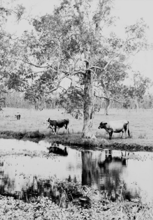
Meridan Plains is a growing area, or locality, located on the edge of the Caloundra urban area in Queensland, Australia. It's part of the Sunshine Coast Region. This place used to be mostly farms and open land. However, it is now becoming a popular spot for new homes as Caloundra expands. In 2021, about 4,589 people lived in Meridan Plains.
Contents
Exploring Meridan Plains' Location
Meridan Plains is located about 8 kilometers (5 miles) west-northwest of Caloundra. A big part of its western border follows the Mooloolah River. A smaller section of its border runs alongside the Bruce Highway, which is a major road. Caloundra Road is another important road that goes through the area from west to south-east.
The Story of Meridan Plains
The name Meridan Plains might come from an old Kabi language word. This word could have meant "place of kangaroos" or "place of dingoes." Another idea is that it was named after the birthplace of John Westaway in Devonshire, England.
In early 1861, a man named Edmund Lander was given permission to use a large area of land. This land was about 25 square miles (65 square kilometers) and was called Mooloolah Plains. It was used for raising livestock. A year later, the right to use this land was given to John Westaway.
In 1869, Lander chose a smaller piece of land, about 80 acres (32 hectares). This land was on the main coach road between Brisbane and Gympie, near the Mooloolah Bridge. The Mooloolah Post Office was located on this property.
In 1874, a postal office was set up at Mooloolah Plains. Mr. W. H. Westaway was in charge of it. Later, in 1890, the name of this office was changed to Meridan.
A school called Pacific Lutheran College opened its doors on September 26, 2001.
Another school, Meridan State College, opened its primary campus on January 1, 2006. The junior secondary part opened in 2008, and the senior secondary campus opened in 2010.
On June 14, 2019, the borders of Meridan Plains and a nearby area called Bells Creek were changed. This was done to create new areas for future suburban growth. These new areas are called Banya, Corbould Park, Gagalba, and Nirimba.
Population of Meridan Plains
In 2016, the population of Meridan Plains was 3,675 people. By 2021, the population had grown to 4,589 people. This shows that more and more people are choosing to live in Meridan Plains.
Schools in Meridan Plains
Meridan Plains is home to two important schools that serve the community.
Meridan State College
Meridan State College is a government school that teaches students from Prep (the first year of school) all the way through to Year 12. It is located at 214 Parklands Boulevard (26°46′25″S 153°06′10″E / 26.7737°S 153.1028°E). In 2017, the school had a large number of students, with 2,711 enrolled. It also had 194 teachers and 94 non-teaching staff. The school offers a special education program for students who need extra support.
Pacific Lutheran College
Pacific Lutheran College is a private school that also teaches students from Prep to Year 12. It is located on Woodlands Boulevard (26°45′23″S 153°06′19″E / 26.7565°S 153.1053°E). In 2017, this school had 948 students. It was supported by 75 teachers and 60 non-teaching staff.
 | Calvin Brent |
 | Walter T. Bailey |
 | Martha Cassell Thompson |
 | Alberta Jeannette Cassell |


