Newtok, Alaska facts for kids
Quick facts for kids
Newtok
Niugtaq
|
|
|---|---|

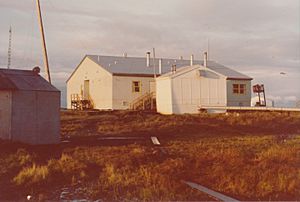
Newtok school in 1974
|
|

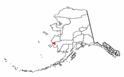
Location of Newtok, Alaska
|
|
| Country | United States |
| State | Alaska |
| Census Area | Bethel |
| Area | |
| • Total | 1.45 sq mi (3.74 km2) |
| • Land | 1.33 sq mi (3.45 km2) |
| • Water | 0.11 sq mi (0.29 km2) |
| Population
(2020)
|
|
| • Total | 209 |
| • Density | 156.67/sq mi (60.51/km2) |
| Time zone | UTC-9 (Alaska (AKST)) |
| • Summer (DST) | UTC-8 (AKDT) |
| ZIP code |
99559
|
| Area code(s) | 907 |
| FIPS code | 02-53820 |
Newtok (Central Yupik: Niugtaq) is a small village in Alaska, United States. It is located on the Ningliq River in the Bethel Census Area. Most of the people living here are Central Yup'ik, who are Alaska Native people. The village is facing a big challenge: climate change is forcing its residents to move to a new location. This new place is called Mertarvik.
Contents
About Newtok Village
Newtok is a small community. In 2020, about 209 people lived there. The village first appeared on the U.S. Census in 1950. Back then, it was called "Keyaluvik." The name changed to Newtok in 1960.
In 2000, there were 321 people living in Newtok. Most households had children under 18. The average family size was quite large, with almost six people per family. The median age in the village was 21 years old. This means that half the population was younger than 21, and half was older.
Why Newtok is Moving
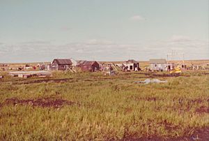
Newtok is in danger because of climate change. The land it sits on is eroding, which means it's slowly being washed away.
Erosion and Permafrost
The village is built on permafrost, which is ground that stays frozen all year round. As the Earth's climate gets warmer, this permafrost is melting. When it melts, the ground becomes soft and unstable.
The Ningliq River, which flows next to Newtok, is also getting wider. This is causing the land to wear away even faster. Coastal storms also contribute to the erosion. Because the village is below sea level and sinking, experts worried it could be washed away completely.
For example, the United States Army Corps of Engineers predicted that the highest point in town, the high school, could be underwater by 2017. This shows how serious the problem is.
Newtok in Documentaries
The challenges faced by Newtok have been shown in several TV shows and documentaries:
- In 2009, the village was featured in the History Channel show Tougher in Alaska.
- In 2015, it was part of the Al Jazeera English documentary Fault Lines, called When the Water Took the Land.
- In 2022, a company called Patagonia released a full-length documentary about Newtok.
Education in Newtok
The Lower Kuskokwim School District runs the Ayaprun School in Newtok. This school teaches students from kindergarten all the way through 12th grade. In 2018, the school had 128 students and 12 teachers. As people move, a new school called Mertarvik Pioneer School is being built in the new village.
Moving to Mertarvik
Because Newtok is no longer safe, the community decided to move to a new place called Mertarvik. This new town is about 9 miles (14 kilometers) away on Nelson Island.
The people of Newtok voted to move in 2003, but the process has been slow. Land was set aside for Mertarvik, and money was received to build a dock. This dock helps bring in building supplies for the new homes.
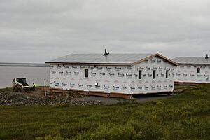
In 2018, a large community center and eight new houses were built in Mertarvik. The plans for 2019 included finishing the community center so it could be used as a school. They also planned to build more houses, roads, pipes, and a water treatment plant. The goal is for everyone to move by 2023.
In September 2022, a strong storm called Typhoon Merbok caused more damage to Newtok. It moved the shoreline closer to the village. The first residents began moving to Mertarvik in 2019.
See also
 In Spanish: Newtok (Alaska) para niños
 | James Van Der Zee |
 | Alma Thomas |
 | Ellis Wilson |
 | Margaret Taylor-Burroughs |


