Columbus and Franklin County Metro Parks facts for kids
The Columbus and Franklin County Metro Parks are a fantastic group of 19 parks located in and around Columbus, Ohio. Think of them as special natural areas that are protected for everyone to enjoy! These parks are managed by the Columbus and Franklin County Metropolitan Park District.
The Metro Parks system started way back in 1945. It's set up as its own special part of the state government in Ohio. A group of three citizens, called the Board of Park Commissioners, helps oversee the parks. They are chosen by a judge and work without pay. This Board then picks an Executive Director who is in charge of running and managing all the parks day-to-day.
These parks protect over 27,500 acres (about 111 square kilometers) of land and water. They stretch across seven counties in Central Ohio and even into the Hocking Hills area. In the parks, you can find lots of fun things to do! There are trails for hiking, places for picnics, nature centers to learn about animals and plants, and even spots for boating. The parks also help manage natural resources and stormwater, keeping the environment healthy.
Contents
- Exploring the Metro Parks
- Battelle Darby Creek Metro Park
- Blacklick Woods Metro Park
- Blendon Woods Metro Park
- Chestnut Ridge Metro Park
- Clear Creek Metro Park
- Glacier Ridge Metro Park
- Heritage Trail Metro Park
- Highbanks Metro Park
- Homestead Metro Park
- Inniswood Metro Gardens
- Pickerington Ponds Metro Park
- Prairie Oaks Metro Park
- Rocky Fork Metro Park
- Scioto Audubon Metro Park
- Scioto Grove Metro Park
- Sharon Woods Metro Park
- Slate Run Metro Park
- Three Creeks Metro Park
- Walnut Woods Metro Park
- Future Metro Parks
Exploring the Metro Parks
Battelle Darby Creek Metro Park
Battelle Darby Creek is the biggest Metro Park, covering over 7,103 acres! It's located southwest of Franklin County. This park is special because it has restored prairie areas where you can see a group of 10 American bison roaming free. There's also a large nature center with cool exhibits about the amazing variety of life in Big Darby Creek. You can also find an old Fort Ancient mound, which is a historical site. Over 13 miles of the Big Darby Creek and Little Darby Creek flow through the park. Much of the land for this park was given by the Battelle Memorial Institute. 39°53′17″N 83°12′57″W / 39.8880556°N 83.2158333°W
Blacklick Woods Metro Park
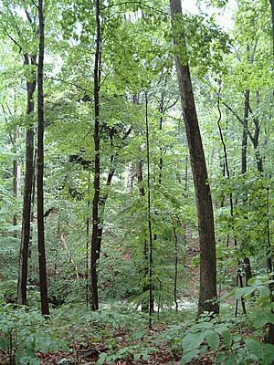
Opened in 1948, Blacklick Woods is the oldest park in the system, covering 643 acres in Reynoldsburg. Inside the park, there's a special area called the Walter A. Tucker State Nature Preserve. This preserve protects one of the oldest forests in central Ohio, filled with beech and maple trees. You can also find white and pin oak trees, along with red maple and hickory. The park has wetlands and seasonal ponds where you might spot salamanders, frogs, and wood ducks. Fox, rabbits, and white-tailed deer also live here. It's a great place for bird watching! The golf course at Blacklick Woods is also recognized for being a wildlife-friendly area. The Blacklick Woods Nature Center has naturalists who can answer your questions about the park. Blacklick Creek flows along the park's eastern side, and trails let you explore fields, meadows, and forests. In 1974, Blacklick Woods was named a National Natural Landmark. 39°56′14″N 82°48′28″W / 39.9372222°N 82.8077778°W
Blendon Woods Metro Park
Located northeast of Columbus near Westerville, Blendon Woods covers 653 acres. It has rolling forest land and the 118-acre Walden Waterfowl Refuge, which includes the 11-acre Thoreau Lake. This park also features a nature center, a natural play area for kids, and a disc golf course. 40°04′22″N 82°52′45″W / 40.0727778°N 82.8791667°W
Chestnut Ridge Metro Park
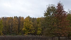
Opened in 1988, Chestnut Ridge is southeast of Columbus near Carroll. It sits on the first ridge of the Appalachian Mountains foothills. At 1,116 feet (340 meters) above sea level, it rises about 300 feet above the land around it. On clear days, you can even see the skyline of Downtown Columbus from one of the park's overlooks! The park also has picnic areas and awesome mountain biking trails. 39°48′23″N 82°45′37″W / 39.8063889°N 82.7602778°W
Clear Creek Metro Park
Clear Creek is the most remote of the Columbus Metro Parks. It's located near Rockbridge in the Hocking Hills area of southeast Ohio. Almost the entire park is a State Nature Preserve, which means you need to stay on the trails to protect the natural environment. Unique features here include tall hemlock trees, many deep hollows, and beautiful wildflowers. 39°35′31″N 82°36′02″W / 39.5919444°N 82.6005556°W
Glacier Ridge Metro Park
Just northwest of Dublin, Glacier Ridge opened in 2002. This park has a paved multi-use trail, a disc golf course, a bridle trail for horses, and a large wetland area. 40°09′20″N 83°11′43″W / 40.1555556°N 83.1952778°W
Heritage Trail Metro Park
This long, narrow park in Hilliard opened in 1995. Its main feature is a 7-mile (11 km) multi-use trail, perfect for walking, running, or biking. 40°03′43″N 83°11′58″W / 40.0619444°N 83.1994444°W
Highbanks Metro Park
Highbanks is the most visited park in the system and has amazing natural features. It's even been named a National Natural Landmark! Located near Lewis Center, the park gets its name from the tall shale bluffs that look out over the Olentangy River. Inside the park, you'll find a large nature center, a sledding hill for winter fun, and a Natural Play Area where you can explore off the trails. There are also ancient Adena culture mounds and the Edward F. Hutchins State Nature Preserve. 40°08′38″N 83°01′42″W / 40.143889°N 83.028333°W
Homestead Metro Park
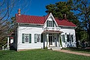
Homestead is a 44-acre park in Hilliard. It features a cool covered bridge, a replica train station, and an outdoor amphitheater. It has a 0.75-mile paved trail that connects to the 7-mile Heritage Trail, which runs along the park's western edge. 40°03′09″N 83°11′10″W / 40.052485°N 83.1859766°W
Inniswood Metro Gardens
Inniswood Metro Gardens is special because it's mainly a beautiful botanical garden. Located in Westerville, it has many different themed gardens that show off various plant communities. It's a great place to see all kinds of flowers and plants! 40°06′07″N 82°53′52″W / 40.101944°N 82.897778°W
Pickerington Ponds Metro Park
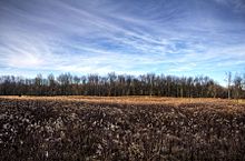
Pickerington Ponds is a 1,608-acre park with several trails and 5 overlooks for watching birds and other wildlife. This State Nature Preserve in Southeast Columbus was first acquired in 1986. It's mainly focused on providing a home for many different birds and has lots of wetland areas. Audubon Ohio has named Pickerington Ponds an Important Bird Area because more than 260 species of birds have been seen here! 39°53′10″N 82°48′11″W / 39.885988°N 82.803151°W
Prairie Oaks Metro Park
Prairie Oaks opened in 2000 and is located on the border of Franklin and Madison Counties. As its name suggests, the park has large areas of restored Oak Savannah. These were common in the area before European settlers arrived in the 1800s. An old quarry area in the eastern part of the park offers opportunities for boating and even a swimming area for dogs! 39°59′47″N 83°15′30″W / 39.996389°N 83.258333°W
Rocky Fork Metro Park
Located in Westerville, Rocky Fork features more than 1,000 acres of woods and fields. The park includes a bridle trail for horses, a dog park, an off-leash dog trail, a paved trail, and nature trails. There's also a picnic shelter and wetlands. Rocky Fork Creek runs through the park. This park is a partnership with New Albany, the City of Columbus, and Plain Township. 40°06′57″N 82°48′56″W / 40.1157984°N 82.8154987°W
Scioto Audubon Metro Park
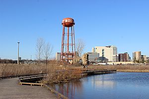
Scioto Audubon is the most urban of the Metro Parks. It's located in the Brewery District near Downtown Columbus. This park is a major stopover for migrating birds, and it's home to the Grange Insurance Audubon Center. Opened in 2008, the park is on a piece of land stretching into the Scioto River and has many wetland areas. Other features include trails that connect to other areas, a climbing wall, and an old water tower with a viewing deck. 39°56′58″N 83°00′35″W / 39.949444°N 83.009722°W
Scioto Grove Metro Park
Located in Grove City, Ohio, Scioto Grove is the 19th Metro Park, opened in May 2016. It offers five backpacking sites for overnight stays and seven miles of trails through woods and along the river. 39°51′15″N 83°01′36″W / 39.8541996°N 83.0266979°W
Sharon Woods Metro Park
Named for Sharon Township where it is located, this park is one of the most visited. It includes the 320-acre Edward S. Thomas Nature Preserve, which has eight different kinds of old growth oak trees, some over 250 years old! The northern part of the preserve has the Spring Hollow Outdoor Education Center. Around Spring Creek, you can find many different trees like sycamore, black walnut, and Ohio buckeye. The southern part of the preserve has fields, meadows, and forests with oak-hickory trees.
Schrock Lake offers opportunities for fishing and lots of chances to watch birds. A multi-use trail runs around the edge of the park, along with 4 other trails that go through different areas of Sharon Woods Metro Park. 40°07′00″N 82°57′49″W / 40.116667°N 82.963611°W
Slate Run Metro Park
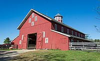
South of Canal Winchester, Slate Run Metro Park's most famous feature is a working historical farm from the 1880s. Volunteers work at the farm, showing visitors what farm life was like in the 19th century. You can interact with the farm animals and learn about old ways of preserving food. Other parts of the park include many hiking trails and a restored wetland area. 39°45′43″N 82°50′53″W / 39.7619444°N 82.8480556°W
Three Creeks Metro Park
Managed with the City of Columbus, Three Creeks is located near Groveport and Bexley. On the confluence trail, visitors can see where Alum, Big Walnut, and Blacklick Creeks all meet. The park also has picnic areas, lakes, and many trails to explore. 39°53′48″N 82°54′45″W / 39.8966667°N 82.9125°W
Walnut Woods Metro Park
Opened in 2011, this park used to be a tree nursery. Located just east of Groveport, Walnut Woods also has two dog parks – one for large dogs and one for small dogs! They are also working to restore wetlands in the middle of the park. 39°50′18″N 82°52′00″W / 39.8383333°N 82.8666667°W
Future Metro Parks
The Columbus Metro Parks system is still growing! They are always looking to add more land. One new area is planned for Blendon Township. This new park will stay wild and natural. It's currently managed by the team from Blendon Woods Metro Park.
The Metro Parks are also working on a cool project to turn an old stone quarry and landfill into a new park. This new park, called Quarry Trails Metro Park, will be in Columbus on the west side of the Scioto River. It will be located between Griggs Dam and Downtown Columbus. Plans for Quarry Trails include hiking, biking, picnicking, fishing, and even more adventurous activities like climbing and paddle boarding! An official opening date for Quarry Trails has not been announced yet.
 | James Van Der Zee |
 | Alma Thomas |
 | Ellis Wilson |
 | Margaret Taylor-Burroughs |


