
Middle Cove, New South Wales facts for kids
Quick facts for kids Middle CoveSydney, New South Wales |
|||||||||||||||
|---|---|---|---|---|---|---|---|---|---|---|---|---|---|---|---|

View of Sugarloaf Bay from Harold Reid Reserve
|
|||||||||||||||
| Population | 1,327 (2021 census) | ||||||||||||||
| • Density | 416.0/km2 (1,077/sq mi) | ||||||||||||||
| Established | 1958 | ||||||||||||||
| Postcode(s) | 2068 | ||||||||||||||
| Area | 3.19 km2 (1.2 sq mi) | ||||||||||||||
| Location | 9 km (6 mi) from CBD | ||||||||||||||
| LGA(s) | City of Willoughby | ||||||||||||||
| State electorate(s) | Willoughby | ||||||||||||||
| Federal Division(s) | North Sydney | ||||||||||||||
|
|||||||||||||||

Middle Cove is a lovely suburb located on the Lower North Shore of Sydney, New South Wales, Australia. It's about 9 kilometers north of the main city area, known as the Sydney CBD. This suburb is part of the City of Willoughby, which is a local government area.
Middle Cove is special because it's surrounded by water on three sides. Middle Harbour borders it to the north, east, and south. To the west, you'll find Eastern Valley Way. Middle Cove shares its postcode, 2068, with the nearby suburbs of Castlecrag and Willoughby North. In 2016, Middle Cove was even ranked among Sydney's top 30 most enjoyable suburbs to live in.
Contents
History of Middle Cove
Middle Cove gets its name from its location. It sits between two smaller water areas called coves: Castle Cove and Crag Cove. For a long time, this area was just undeveloped bushland. But in 1957, a man named Dick Dusseldorp bought most of the land from the New South Wales government. He then divided it into the Middle Cove we know today.
Dick Dusseldorp was a very important person. He started big companies like Lend Lease, GPT, and MLC. The Dusseldorp family lived in Middle Cove for many years. The house Dick Dusseldorp built there is considered one of Australia's top five house designs. It was inspired by Frank Lloyd Wright's unique "honeycomb" design. It's a great example of Organic Architecture, which means the building fits in with nature.
In recent years, homes in Middle Cove have sold for record prices. This is because people love its amazing location and views. Many new homes combine these views with excellent architectural design. For example, a house designed by Glynn Nicholls (whose father was a partner of famous architect Walter Burley Griffin) is on The Quarterdeck. Another house, designed by James Pedersen on Highland Ridge Road, set a new record in 2016. It sold for more than A$4.3 million!
Aboriginal Culture in Middle Cove
Before Europeans arrived, the Aboriginal people lived in this area. The local tribe was called the Cammeraygal. You can still see their name in the nearby suburb of Cammeray.
In 1790, Governor Phillip wrote about them. He said the Cammeraygal tribe was very strong. This was either because they had many people or because their chief was very skilled. The area was called Cammerra, and the tribe's leader was named Cammerragal. The men of the tribe were known by this name. We know a lot about the Cammeraygals. They were known for being powerful and having the most people. They were also very strong and muscular. They had a special custom of removing a tooth from people in other tribes who lived along the coast.
Population of Middle Cove
The latest count from the 2021 Census shows there were 1,327 people living in Middle Cove. Most people, about 63.1%, were born in Australia. Also, 76.7% of people spoke only English at home. When asked about their religion, the most common answers were: No Religion (43.0%), Catholic (24.9%), Anglican (13.6%), and Buddhism (2.1%).
Shopping and Services
Middle Cove has a small shopping center on Eastern Valley Way. It has a few local businesses. However, Middle Cove is very close to Chatswood. This means residents have easy access to many shops, restaurants, and services. Chatswood is one of the best-serviced suburbs in all of Australia.
Parks and Nature
Harold Reid Reserve is a large and beautiful park in Middle Cove. It overlooks Sugarloaf Bay and attracts many visitors. The park is named after Harold J. Reid, who was a town clerk for the Municipality of Willoughby for over 50 years.
This park offers amazing lookouts, walking trails, and places for picnics. It's also a protected area for wildlife. You might spot animals like goannas, sugar gliders, buff-banded rails, swamp wallabies, snakes, and eastern spinebills here. It's a great place to enjoy nature!
Getting Around (Transport)
Busways and CDC NSW provide bus services in Middle Cove. These buses run along Eastern Valley Way.
Busways
- Bus routes 206 (during peak hours only, via freeway), 207, and 208 (via Northbridge) travel through Castlecrag and Cammeray. They go to the Gresham Street bus stop in the Sydney central business district.
- During peak hours, bus route 209 follows a similar path to Milsons Point via Miller Street.
- A limited bus service, route 275, goes to Chatswood railway station. This station is on the North Shore line.
CDC NSW
- Route 194 offers services all day. It goes to the Queen Victoria Building via Northbridge Junction and the Warringah Freeway.
Gallery
-
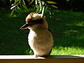
Kookaburra in North Arm Road
-
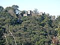
View of Innisfail Castle from North Arm Road
-
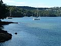
Sugarloaf Bay seen from Harold Reid Reserve


