Mill Creek (Whitelock Creek tributary) facts for kids
Quick facts for kids Mill Creek |
|
|---|---|

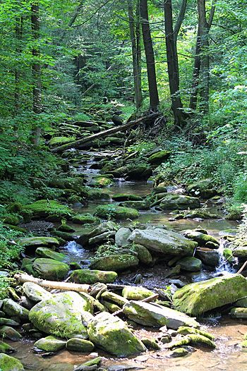
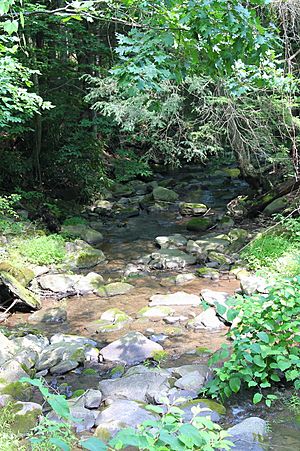
Mill Creek looking upstream
|
|
| Physical characteristics | |
| Main source | unnamed lake in Northmoreland Township, Wyoming County, Pennsylvania between 1,120 and 1,140 feet (341 and 347 m) |
| River mouth | Susquehanna River in Exeter Township, Wyoming County, Pennsylvania 577 ft (176 m) 41°26′26″N 75°51′34″W / 41.44068°N 75.85947°W |
| Length | 4.7 mi (7.6 km) |
| Basin features | |
| Progression | Whitelock Creek → Susquehanna River → Chesapeake Bay |
| Basin size | 3.77 sq mi (9.8 km2) |
Mill Creek is a small stream, also called a tributary, located in Wyoming County, Pennsylvania, in the United States. It flows into Whitelock Creek. Mill Creek is about 4.7 miles (7.6 kilometers) long. It travels through two areas: Northmoreland Township and Exeter Township. The land area that drains water into Mill Creek, known as its watershed, covers about 3.77 square miles (9.76 square kilometers).
Contents
Where Does Mill Creek Flow?
Mill Creek starts its journey in a small, unnamed lake in Northmoreland Township. From there, it flows generally east-southeast for a short distance. Then, it turns to flow east-northeast, entering a valley.
After flowing for a bit, the creek turns east, then northeast, and passes through a pond or small lake. It continues by turning southeast, then east for a short stretch, and finally northeast again.
Further downstream, Mill Creek turns northeast once more before slowly curving to the east and then south. After traveling a few more tenths of a mile, it crosses under Pennsylvania Route 292. Soon after, it meets and joins Whitelock Creek. Mill Creek connects with Whitelock Creek about 0.28 miles (0.45 kilometers) before Whitelock Creek reaches its own end.
What's the Land Like Around Mill Creek?
The land where Mill Creek ends, called its mouth, is about 577 feet (176 meters) above sea level. Where the creek begins, its source, the elevation is higher, between 1,120 and 1,140 feet (341 and 347 meters) above sea level.
The type of ground and rocks on the surface, known as surficial geology, near the mouth of Mill Creek is mostly made of alluvium (silt, sand, and gravel left by flowing water) and something called Wisconsinan Ice-Contact Stratified Drift (materials left by glaciers). However, a little further upstream, another type of glacial deposit called Wisconsinan Till is more common.
As you go along the middle and upper parts of the creek, you'll find more alluvium. Nearby, there are also larger areas of Wisconsinan Till and solid bedrock. This bedrock is made of sandstone and shale. You might also find small patches of loess, which is a type of soil containing very fine silt and sand.
Mill Creek's Watery Neighborhood
The entire area of land that collects and drains water into Mill Creek is called its watershed. This watershed covers an area of 3.77 square miles (9.76 square kilometers). The mouth of Mill Creek is located on a map section called the United States Geological Survey quadrangle of Ransom. However, the creek's source is on a different map section, the quadrangle of Center Moreland.
A Look Back in Time
Mill Creek officially received its name and was added to the Geographic Names Information System on August 2, 1979. This system helps keep track of place names. Its special identification number in this system is 1199158.
An old bridge was built over Mill Creek in 1930. This bridge, which carries State Route 2002, is made of concrete and is about 24.9 feet (7.6 meters) long. It is located in Exeter Township.
Who Lives in Mill Creek?
Wild trout naturally live and reproduce in Mill Creek. You can find them from where the creek starts all the way down to its mouth. Because of this, Mill Creek is officially known as a Coldwater Fishery. This means its waters are cold and clean enough to support fish like trout.


