Monitor, Washington facts for kids
Quick facts for kids
Monitor, Washington
|
|
|---|---|

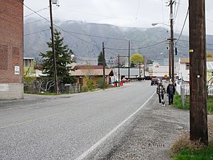
Main Street
|
|
| Country | United States |
| State | Washington |
| County | Chelan |
| Elevation | 715 ft (218 m) |
| Time zone | UTC-8 (Pacific (PST)) |
| • Summer (DST) | UTC-7 (PDT) |
| ZIP code |
98815
|
| Area code(s) | 509 |
| GNIS feature ID | 1523315 |
Monitor is a small unincorporated community in Chelan County, Washington, United States. This means it's a group of homes and businesses that doesn't have its own city government. It's located along the Wenatchee River, about 8 miles upstream from where the Wenatchee River joins the Columbia River. This area is known as the fertile Wenatchee Valley.
Monitor is part of the larger Wenatchee–East Wenatchee metropolitan area. The USPS ZIP Code for Monitor is 98836. In 2000, about 342 people lived in the Monitor ZIP code area. Since Monitor is not an official city, the Census doesn't track its population separately.
Contents
History of Monitor
Before Monitor existed, the area was called Brown's Flat. It was named after Reuben Brown, who settled there in 1885. Back then, the Wenatchee River was the border between two old counties, Kittitas and Okanogan. A school was built here to serve students from both sides of the river.
Railroad and Farming Growth
The Great Northern Railway came through in 1892. This helped start the construction of the Peshastin irrigation ditch. An irrigation ditch is like a small canal that brings water to dry land. This ditch made the area perfect for farming, especially for growing fruit. Local farmers like James Weythman and the Brown Brothers helped dig the part of the ditch near Monitor.
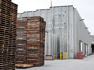
The ditch was finished in the early 1900s, and local fruit orchards began to do very well. Monitor became an important place for shipping farm products by train. A small community grew around the warehouses where the fruit was stored.
How Monitor Got Its Name
A post office was set up in 1902. The people living there decided to rename their community. They chose "Monitor" to honor the USS Monitor. This was a famous Ironclad warship (a ship protected by iron armor) that fought for the Union navy during the American Civil War. The USS Monitor was known for its part in the Battle of Hampton Roads.
Today, Monitor still has a post office and a few small businesses. These are located along US 2, a highway that goes around Monitor on the north side of the Wenatchee River.
Geography of Monitor
Monitor is located next to the Wenatchee River in the lower part of the Wenatchee Valley. It's about 8 miles upstream from where the Wenatchee River flows into the Columbia River. The city of Wenatchee, the largest city in the area, is located where these two rivers meet.
Elevation and Nearby Routes
The valley floor in Monitor is about 715 feet (218 meters) above sea level. However, steep hills rise quickly to the north of the community, reaching almost 1,500 feet (457 meters). Even taller peaks, over 2,400 feet (732 meters), are just a couple of miles to the south and west.
U.S. Route 2 and U.S. Route 97 both pass through Monitor. They run together along the north side of the Wenatchee River. These highways connect Monitor to Wenatchee, which is 8 miles downstream, and to Cashmere, which is about 4 miles upstream.
Climate in Monitor
Monitor has a climate that features warm, but not extremely hot, and dry summers. The average monthly temperatures never go above 71.6°F (22°C). According to the Köppen Climate Classification system, Monitor has a "warm-summer Mediterranean climate." This type of climate is often called "Csb" on climate maps. It means the area has mild, wet winters and warm, dry summers.
See also
 In Spanish: Monitor (Washington) para niños
 | Chris Smalls |
 | Fred Hampton |
 | Ralph Abernathy |


