Moore County, Texas facts for kids
Quick facts for kids
Moore County
|
|
|---|---|

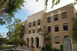
Moore County Courthouse in Dumas
|
|

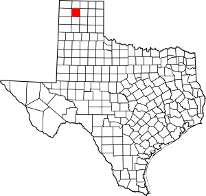
Location within the U.S. state of Texas
|
|
 Texas's location within the U.S. |
|
| Country | |
| State | |
| Founded | 1892 |
| Named for | Edwin Ward Moore |
| Seat | Dumas |
| Largest city | Dumas |
| Area | |
| • Total | 910 sq mi (2,400 km2) |
| • Land | 900 sq mi (2,000 km2) |
| • Water | 9.9 sq mi (26 km2) 1.1% |
| Population
(2020)
|
|
| • Total | 21,358 |
| • Density | 23/sq mi (9/km2) |
| Time zone | UTC−6 (Central) |
| • Summer (DST) | UTC−5 (CDT) |
| Congressional district | 13th |
Moore County is a county in the U.S. state of Texas. In 2020, about 21,358 people lived here. The main town and county seat is Dumas.
Moore County was officially created in 1876 and started operating in 1892. It is named after Edwin Ward Moore, who was a brave commander of the Texas Navy. You can learn more about the county's past at the Window on the Plains Museum in Dumas.
Contents
A Look Back in Time
Ancient Seas and Early People
Imagine this: 100 million years ago, the land that is now Moore County was covered by a huge ocean! This ocean was called the Western Interior Seaway.
Later, from about the years 1200 to 1450, a group of people known as the Antelope Creek Phase lived in the southeastern part of Moore County. They made their homes near the Canadian River Valley.
Where is Moore County?
Land and Water
Moore County covers a total area of about 910 square miles. Most of this is land, but about 9.9 square miles (or 1.1%) is covered by water.
Main Roads
Here are some of the important highways that run through Moore County:
Neighboring Counties
Moore County shares its borders with several other counties:
- Sherman County (to the north)
- Hutchinson County (to the east)
- Carson County (to the southeast)
- Potter County (to the south)
- Oldham County (to the southwest)
- Hartley County (to the west)
- Dallam County (to the northwest)
Protected Areas
Part of the Lake Meredith National Recreation Area is located within Moore County. This is a special place for outdoor activities and enjoying nature.
Who Lives in Moore County?
Population Over Time
The number of people living in Moore County has changed a lot over the years. Here's a quick look:
- In 1890, there were only 15 people!
- By 1950, the population grew to 13,349.
- In 2000, it was 20,121.
- In 2010, it reached 21,904.
- In 2020, the population was 21,358.
Towns and Communities
Cities in Moore County
- Cactus
- Dumas (This is the county seat, where the main county government offices are.)
- Fritch (Most of this city is actually in Hutchinson County.)
- Sunray
Other Communities
- Masterson is a smaller, unincorporated community.
Learning in Moore County
School Districts
Students in Moore County attend schools in these districts:
- Dumas Independent School District
- Sanford-Fritch Independent School District
- Sunray Independent School District
College Opportunities
If you're looking to go to college, all of Moore County is served by Amarillo College.
Images for kids
-
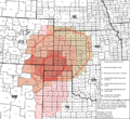
Area affected by the 1930s Dust Bowl
See also
 In Spanish: Condado de Moore (Texas) para niños
 | John T. Biggers |
 | Thomas Blackshear |
 | Mark Bradford |
 | Beverly Buchanan |


