
Morrill, Maine facts for kids
Quick facts for kids
Morrill, Maine
|
|
|---|---|

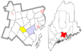
Location of Morrill (in yellow) in Waldo County and the state of Maine
|
|
| Country | United States |
| State | Maine |
| County | Waldo |
| Area | |
| • Total | 17.05 sq mi (44.16 km2) |
| • Land | 16.56 sq mi (42.89 km2) |
| • Water | 0.49 sq mi (1.27 km2) |
| Elevation | 240 ft (73 m) |
| Population
(2020)
|
|
| • Total | 971 |
| • Density | 59/sq mi (22.6/km2) |
| Time zone | UTC-5 (Eastern (EST)) |
| • Summer (DST) | UTC-4 (EDT) |
| ZIP code |
04952
|
| Area code(s) | 207 |
| FIPS code | 23-47245 |
| GNIS feature ID | 0582608 |
| Website | Town of Morrill |
Morrill is a small town located in Waldo County, Maine, in the United States. In 2020, about 971 people lived there.
Contents
A Look at Morrill's Past
Morrill is in the middle of Waldo County, about 6.5 miles west of Belfast. The land in Morrill is hilly but mostly usable. Morey and Rowe hills are the highest points, but they are not very tall. The soil is a mix of sand and clay. Farmers mostly grow hay and potatoes. The usual forest trees of the area grow well here.
There are two main ponds in town: Cross Pond, which is about 100 acres (40 ha) big, and Dolliff Pond, which is about 50 acres (200,000 m2). The main source of water power is at the village on the Passagassawakeag Stream. In the past, there were mills that made shingles and staves (wooden strips for barrels), and a factory that made horse-rakes. Morrill was on the stage-line that went between Belfast and Kendall's Mills. The closest train station was in Belfast.
Morrill became an official town on March 3, 1855. It was named after Anson P. Morrill, who was the governor of Maine at that time. The first settlers arrived in 1801 and 1802. These early families included James Weymouth, Benjamin Smith, Joseph Corning, and Nathaniel Cushman. They bought their land from General Henry Knox.
Morrill is known for its healthy climate. The town has a building for the Grange, which is a community organization, and it also serves as the town hall. There is a Methodist church and a Union meetinghouse in the village. Morrill has five public schoolhouses for its students.
Morrill's Geography
According to the United States Census Bureau, the town of Morrill covers a total area of about 17.05 square miles (44.16 km2). Most of this area, about 16.56 square miles (42.89 km2), is land. The rest, about 0.49 square miles (1.27 km2), is water. The main bodies of water are Smiths Mill Pond (81 acres) and Cross Pond (159 acres).
Morrill shares its borders with several other towns. To the north is Knox. To the east are Waldo and Belfast. To the south is Belmont, and to the west are Searsmont and Montville.
Who Lives in Morrill?
| Historical population | |||
|---|---|---|---|
| Census | Pop. | %± | |
| 1860 | 629 | — | |
| 1870 | 523 | −16.9% | |
| 1880 | 494 | −5.5% | |
| 1890 | 460 | −6.9% | |
| 1900 | 420 | −8.7% | |
| 1910 | 353 | −16.0% | |
| 1920 | 307 | −13.0% | |
| 1930 | 288 | −6.2% | |
| 1940 | 328 | 13.9% | |
| 1950 | 306 | −6.7% | |
| 1960 | 355 | 16.0% | |
| 1970 | 410 | 15.5% | |
| 1980 | 506 | 23.4% | |
| 1990 | 644 | 27.3% | |
| 2000 | 774 | 20.2% | |
| 2010 | 884 | 14.2% | |
| 2020 | 971 | 9.8% | |
| U.S. Decennial Census | |||
Morrill's Population in 2010
In 2010, there were 884 people living in Morrill. These people lived in 337 households, and 242 of these were families. The town had about 53.4 inhabitants per square mile (20.6/km2) people per square mile. There were 379 housing units, which are homes or apartments, with about 22.9 per square mile (8.8/km2) units per square mile.
Most of the people in Morrill (96.3%) were White. A small number were African American (0.2%), Native American (1.1%), or Asian (0.1%). About 0.8% were from other races, and 1.5% were from two or more races. About 1.8% of the population identified as Hispanic or Latino.
Out of the 337 households, about 32.6% had children under 18 living with them. Most households (59.3%) were married couples living together. About 7.4% had a female head of household with no husband, and 5.0% had a male head of household with no wife. About 28.2% were not families.
The average age of people in Morrill was 40.9 years. About 25.3% of residents were under 18 years old. About 8% were between 18 and 24, and 23.1% were between 25 and 44. People aged 45 to 64 made up 29.6% of the population, and 13.9% were 65 years or older. The town had slightly more females (50.8%) than males (49.2%).
Quantabacook Lake
Quantabacook Lake is an important natural area near Morrill.
Recreation at Quantabacook Lake
Along with nearby ponds, a 15-mile (24 km) part of the St. George River flows from Appleton to Warren. This area is special because it has rare plants, small animals without backbones (invertebrates), and natural communities that are not found anywhere else in central or coastal Maine. The river winds its way from Quantabacook Lake through towns like Searsmont, Appleton, Union, and Warren.
Near the northeast end of Quantabacook Lake, there is an amazing fern ecosystem. You can get to the lake by boat from Route 3. When you are on the water, listen and look for Loons, which are a type of water bird.
Nature & Wildlife Sanctuary
At the north end of Quantabacook Lake, along Route 3, there is a privately owned nature and wildlife sanctuary. This sanctuary includes a small islet called Converse Island, which is about 2 acres (8,100 m2) in size. There are also a few rock formations in Quantabacook Lake itself.
Places to See in Morrill
Morrill has several local landmarks, including:
- Bartlett Stream Reservoir
- Converse Island
- Dolliff Pond
- Green Wood Cemetery
- Hillcrest Cemetery
- Little Pond
- Merrill Point
- Morey Hill
- Quantabacook Lake
- Quantabacook Lake Dam
- Ruffingham Meadow State Game Management Area
- Ruffingham Meadows Dam
- Sheep Island
- Thompson Brook
- Wilson Brook
- Witcher Swamp
- Wood Island
Schools in Morrill
Morrill is part of a school district that includes two elementary schools: Ames Elementary and Gladys Weymouth Schools.
Gladys Weymouth School
Weymouth School is located right in Morrill. It has six classrooms, with two classrooms each for kindergarten, first grade, and second grade. The school also has support staff, including a special education assistant (ed tech) and a teacher who helps students with reading and literacy. One full-time administrative assistant works for both Weymouth and Ames schools. There is also a custodian and a kitchen cook.
Ames Elementary School
Ames School is located in the nearby town of Searsmont. It has eight classrooms, including two for third grade, two for fourth grade, and two for fifth grade. There is also a special program for students who need extra support with their behavior. A new Pre-K program started this year for four-year-olds from Morrill and the surrounding towns. This classroom has a full-time teacher, a full-time assistant teacher, and a part-time ed tech. It is a full-day program.
Ames School also has support staff. This includes four ed techs who help students in the behavior program learn in regular classrooms. There is also a special education teacher who works with students in their classrooms and helps the ed tech at Weymouth School. A literacy teacher, a secretary, a custodian, and a kitchen cook also work at Ames School.
Images for kids
-
Location of Morrill (in yellow) in Waldo County and the state of Maine
See also
 In Spanish: Morrill (Maine) para niños
