Mount Blackburn facts for kids
Quick facts for kids Mount Blackburn |
|
|---|---|

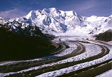
Mount Blackburn from the southeast, looking up the Kennicott Glacier
|
|
| Highest point | |
| Elevation | 16,390 ft (4996 m) NAVD88 |
| Prominence | 11,640 ft (3548 m) |
| Isolation | 60.7 mi (97.6 km) |
| Listing |
|
| Geography | |
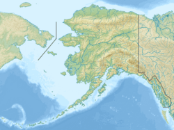
| Location | Wrangell-St. Elias National Park and Preserve, Alaska, U.S. |
| Parent range | Wrangell Mountains |
| Topo map | USGS McCarthy C-7 |
| Geology | |
| Age of rock | 3.4 to 5 million years |
| Mountain type | Shield volcano |
| Last eruption | 3.4 million years ago |
| Climbing | |
| First ascent | 1958 (true summit) Gilbert, Wahlstrom, Gmoser, Bitterlich, and Blumer |
| Easiest route | North Ridge: snow/glacier climb |
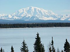
Mount Blackburn is the tallest mountain in the Wrangell Mountains in Alaska, USA. It is the fifth-highest peak in the United States. It is also the twelfth-highest peak in all of North America.
This mountain is an old shield volcano that has been worn down over time. It is the second-highest volcano in the U.S., after Mount Bona. It is also the fifth-highest volcano in North America.
Mount Blackburn got its name in 1885 from Lt. Henry T. Allen of the U.S. Army. He named it after Joseph Clay Stiles Blackburn, who was a U.S. senator from Kentucky. The mountain is found inside Wrangell – St. Elias National Park. This park is the largest national park in the United States.
Contents
About Mount Blackburn
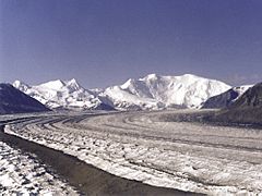
The mountain is mostly covered by huge ice fields and glaciers. These ice fields are the main source of ice for the Kennicott Glacier. This glacier flows southeast for over 20 miles (32 km). It ends just above the town of McCarthy.
Mount Blackburn also sends a lot of ice to other glaciers. These include the Nabesna Glacier, which flows north, and the Kuskulana Glacier system.
Mount Blackburn is a very large and impressive mountain. It stands out a lot from the land around it. Its west side drops more than 11,000 feet (3,353 m) down to the Kuskulana Glacier. This huge drop happens in less than 4 miles (6.4 km) horizontally. Other sides of the mountain drop between 8,000 and 10,000 feet (2,438 to 3,048 m). These drops happen in less than 8 miles (13 km).
The lowest part of the Kuskulana Glacier is about 12 miles (19 km) from the summit. It sits at an elevation of 2,400 feet (732 m). This means the mountain rises about 14,000 feet (4,267 m) from its base. Mount Blackburn is known for its "prominence." This means it stands very tall above the land around it. It is the 50th-most prominent peak in the world.

First Climbs
Mount Blackburn has two main summits. The western summit is actually the highest point of the mountain. People did not realize this until the 1960s. That is when new maps from the USGS were released.
The first time anyone reached the true highest point (the west peak) was on May 30, 1958. A team of climbers made this first ascent. The team included Bruce Gilbert, Dick Wahlstrom, Hans Gmoser, Adolf Bitterlich, and Leon Blumer. They climbed using the North Ridge, which is also called the Northwest Ridge.
Interestingly, this team did not know they had reached the highest point at the time. They thought the eastern peak was taller. Leon Blumer even titled his article in the 1959 American Alpine Journal "Mount Blackburn – Second Ascent."
Kennedy Peak (East Blackburn)
Kennedy Peak, also known as East Blackburn, is the eastern summit. It is 16,286 feet (4,964 m) tall. For a long time, people thought this was the highest point of Mount Blackburn.
The first ascent of Kennedy Peak happened in 1912. It was climbed by Dora Keen and George Handy. They took a route up the Kennicott Glacier on the south side of the mountain. Then they climbed the East Face.
This was a very daring climb for its time. Dora Keen was determined to reach the top. She asked miners from the nearby Kennecott Copper Mines for help. She found a way up the East Face, which had many deep cracks in the ice called crevasses. They reached the East Peak but did not cross over to the West Peak.
Dora Keen later wrote a famous article about her adventure. It was called "First up Mount Blackburn" and appeared in the Saturday Evening Post. In 1912, Keen and Handy truly believed they had reached the highest point of Mount Blackburn.
How Mount Blackburn Formed
Mount Blackburn is what remains of an old shield volcano. A shield volcano is a type of volcano that looks like a warrior's shield lying on the ground. Its slopes are gentle. Because Mount Blackburn is always covered in ice, scientists cannot see its inner structure easily.
They believe it once had a large crater at its top, called a caldera. This caldera has been greatly changed by glaciers over millions of years. The oldest rocks in this area are granites, which are about 4.2 million years old.
Most of the mountain is made of granite that is 3.4 million years old. This granite pushed its way into older rock layers, including andesite flows. From this, scientists think that the caldera collapsed between 4.2 and 3.4 million years ago. After that, the volcano stopped being active.
Climbing Mount Blackburn Today
Today, the most common way to climb Mount Blackburn is the same route used for the first ascent in 1958. This is the North (or Northwest) Ridge. Climbers usually start from an airstrip on the Nabesna Glacier. This airstrip is on the north side of the mountain, at an altitude of 7,200 feet (2,195 m).
This route is considered a moderate climb for Alaska. It is rated as Alaska Grade 2. This means it involves glacier travel and some steep snow or ice climbing, but it is not extremely difficult by Alaskan climbing standards.
See also
 In Spanish: Monte Blackburn para niños
 | George Robert Carruthers |
 | Patricia Bath |
 | Jan Ernst Matzeliger |
 | Alexander Miles |


