Mount Byron, Queensland facts for kids
Quick facts for kids Mount ByronQueensland |
|||||||||||||||
|---|---|---|---|---|---|---|---|---|---|---|---|---|---|---|---|

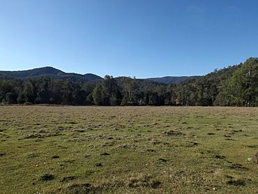
Paddocks along Mount Byron Road, 2015
|
|||||||||||||||
| Population | 21 (2021 census) | ||||||||||||||
| • Density | 0.141/km2 (0.37/sq mi) | ||||||||||||||
| Postcode(s) | 4312 | ||||||||||||||
| Area | 148.9 km2 (57.5 sq mi) | ||||||||||||||
| Time zone | AEST (UTC+10:00) | ||||||||||||||
| Location |
|
||||||||||||||
| LGA(s) | Somerset Region | ||||||||||||||
| State electorate(s) | Nanango | ||||||||||||||
| Federal Division(s) | Blair | ||||||||||||||
|
|||||||||||||||
Mount Byron is a small rural area in Queensland, Australia. It is part of the Somerset Region. In 2021, only 21 people lived in Mount Byron. It is named after the mountain, Mount Byron, which is also located there.
Contents
Exploring Mount Byron's Landscape
Mount Byron is known for its rugged land. The eastern part of the area is very hilly. This part is protected as part of the D'Aguilar National Park. The main mountain, Mount Byron, rises high above the ground. It reaches over 600 meters (about 2,000 feet) above sea level.
Rivers and Valleys
Lower areas near Byron Creek are different. This creek flows into the Stanley River. These lower lands have been cleared of most trees and plants. This makes them look different from the protected park areas.
A Look Back at Mount Byron's Past
Mount Byron has an interesting history. The area got its name from the mountain itself.
Early Settlers and Stations
A large property called Mount Byron Station was important for many years. The Bowman Family ran this station from the 1880s until the 1960s. William Macarthur Bowman first arrived in 1848. He worked at a nearby station called Mt Brisbane. The McConnel family still runs Mt Brisbane today.
Timber and Mining
Around 1912, a company called Brown & Broad had a timber sawmill in Mount Byron. A sawmill is a place where logs are cut into planks. By 1923, another company, Raymond & Hossack, also had a timber mill here. Mining started in the area in 1918.
Local School and Events
Mount Byron even had its own school for a short time. Mount Byron State School opened on May 29, 1919. However, it closed just over 10 years later, on January 17, 1930. In October 1926, a large bushfire happened in the area.
Education in Mount Byron
Mount Byron does not have any schools within its boundaries. Students living here travel to nearby towns for their education.
Primary School Options
For younger students, the closest primary schools are:
- Dayboro State School, to the east.
- Toogoolawah State School, to the west.
Secondary School Options
Older students have several choices for high school:
- Woodford State School (up to Year 10) in Woodford, to the north-east.
- Bray Park State High School in Bray Park, to the south-east.
- Toogoolawah State High School (up to Year 12) in Toogoolawah, to the west.
- Kilcoy State High School in Kilcoy, to the north-west.
 | Aaron Henry |
 | T. R. M. Howard |
 | Jesse Jackson |


