Mount Claywood facts for kids
Quick facts for kids Mount Claywood |
|
|---|---|

Southeast aspect, from Mt. Fromme
|
|
| Highest point | |
| Elevation | 6,836 ft (2,084 m) |
| Prominence | 1,236 ft (377 m) |
| Isolation | 2.41 mi (3.88 km) |
| Parent peak | Mount Cameron (7,190 ft) |
| Naming | |
| Etymology | Henry Clay Wood |
| Geography | |
| Location | Olympic National Park Jefferson County, Washington, US |
| Parent range | Olympic Mountains |
| Topo map | USGS Wellesley Peak |
| Geology | |
| Age of rock | Eocene |
| Climbing | |
| Easiest route | class 2 hiking via Hayden Pass Trail |
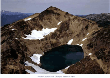
Mount Claywood is a tall mountain peak, standing at 6,836-foot (2,084-metre) high. It is located inside Olympic National Park in Jefferson County, Washington state. This mountain is found at the start of the Lost River. It is about 15 mi (24 km) east of Mount Olympus.
Mount Cameron is its closest taller neighbor, about 2.4 mi (3.9 km) to the northeast. Other nearby peaks include Mt. Fromme, 0.58 mi (0.93 km) to the southeast, and Sentinel Peak, 2 mi (3.2 km) also to the southeast. Rain and melting snow from Mount Claywood flow into different rivers. Water drains north and west into parts of the Elwha River. To the east, water flows into Claywood Lake, then into the Dosewallips River.
Mountain's Name: A Look at History
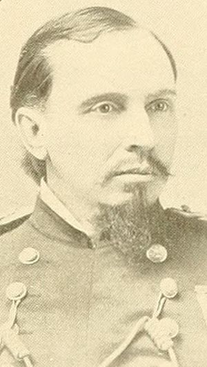
Mount Claywood got its name in 1885. Lieutenant Joseph P. O'Neil named it to honor his boss, Colonel Henry Clay Wood (1832–1918). Colonel Wood was an important officer who signed the orders for O'Neil's 1885 trip to explore the Olympic Mountains.
Mount Claywood was the furthest point O'Neil's team reached from the north into the wild Olympic area.
Weather and Climate Around the Mountain
Mount Claywood is in a marine west coast climate zone. This means it has mild, wet winters and cool, dry summers. Most of the weather systems come from the Pacific Ocean. They travel northeast towards the Olympic Mountains.
When these weather systems hit the tall Olympic peaks, they are forced to rise. This causes them to drop their moisture as rain or snow. This process is called Orographic lift. Because of this, the Olympic Mountains get a lot of rain and snow, especially in winter.
In winter, it's often cloudy. But in summer, high-pressure systems over the Pacific Ocean bring clear skies. The best time to visit or climb Mount Claywood is usually from July to September. During these months, the weather is often sunny and clear.
How the Mountain Was Formed
The Olympic Mountains are made of different types of rock. These rocks were formed from material pushed up from the ocean floor. This includes Eocene sandstone, turbidite (a type of sedimentary rock), and basalt (a volcanic rock).
Over millions of years, during the Pleistocene era, glaciers played a big role in shaping the mountains. These huge sheets of ice moved forward and backward many times. As they moved, they carved out valleys and peaks, giving the mountains their unique shapes.
 | Isaac Myers |
 | D. Hamilton Jackson |
 | A. Philip Randolph |


