Mount Cramer facts for kids
Quick facts for kids Mount Cramer |
|
|---|---|
| Highest point | |
| Elevation | 10,716 ft (3,266 m) |
| Prominence | 1,716 ft (523 m) |
| Parent peak | Thompson Peak |
| Geography | |
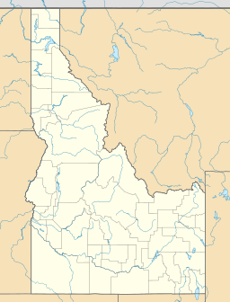
| Location | Custer and Boise Counties, Idaho, U.S. |
| Parent range | Sawtooth Range |
| Topo map | USGS Mount Cramer |
| Climbing | |
| Easiest route | Scramble - Class 3 |
Mount Cramer is a really tall mountain in Idaho! It stands at 10,716 feet (3,266 m) high. It's the second-highest peak in the beautiful Sawtooth Range. You can find Mount Cramer right on the edge of Custer and Boise Counties. It's actually the highest point in Boise County!
This amazing mountain is also part of the Sawtooth Wilderness. This wilderness area is inside the larger Sawtooth National Recreation Area. The town of Stanley, Idaho is about 14 miles (23 km) from Mount Cramer. Another area called Sawtooth City is nearly 12 miles (19 km) away. Water from the west side of Mount Cramer flows into the South Fork of the Payette River. Water from the east side flows into the Salmon River.
Climbing Mount Cramer
You can climb Mount Cramer in just one day. The adventure starts from the Hell Roaring Lake Trailhead. This trailhead is about 5 miles (8.0 km) down a dirt road (Sawtooth National Forest road 398). This road is west of Idaho Route 75.
The hike is about 16-mile (26 km) long. The last part of the climb is off the main trail. It involves a "Class 3 scramble." This means you'll need to use your hands sometimes to help you climb over rocks, but you won't need special climbing ropes or gear.
 | Percy Lavon Julian |
 | Katherine Johnson |
 | George Washington Carver |
 | Annie Easley |


