Mount Engadine facts for kids
Quick facts for kids Mount Engadine |
|
|---|---|

Mount Engadine
|
|
| Highest point | |
| Elevation | 2,972 m (9,751 ft) |
| Prominence | 320 m (1,050 ft) |
| Listing | Mountains of Alberta |
| Geography | |
| Location | Alberta, Canada |
| Parent range | Kananaskis Range |
| Topo map | NTS 82J/14 |
| Climbing | |
| First ascent | 1956 B. Fraser, J. Gorrill, M. Hicks |
| Easiest route | A difficult scramble via west-northwest ridge. |
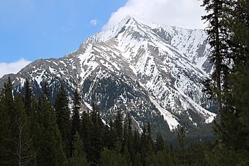
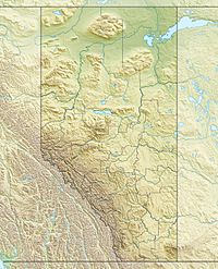
Mount Engadine is a tall mountain peak in the Canadian Rockies of Alberta, Canada. It stands 2,972-metre (9,751-foot) high. You can find it in the beautiful Spray River Valley, within Kananaskis Country.
The mountain got its name in 1917. It was named after a ship called HMS Engadine. This ship was a seaplane tender (a ship that carries and launches seaplanes) for the Royal Navy. It was part of an important naval battle during World War I called the Battle of Jutland.
How Mountains Formed
Mount Engadine is made of sedimentary rock. This type of rock forms from layers of sand, mud, and tiny bits of plants and animals that settle over millions of years. These layers were laid down during ancient times, from the Precambrian to the Jurassic periods.
Later, a huge event called the Laramide orogeny happened. This was a time when powerful forces deep inside the Earth pushed and folded the land. These forces lifted the rock layers of Mount Engadine, pushing them up and over younger rocks. This is how the mountain we see today was created.
Weather and Climbing
Mount Engadine has a subarctic climate. This means it has very cold winters with lots of snow. Summers are usually mild. Temperatures can drop below −20 °C (that's -4 °F). With the wind, it can feel even colder, sometimes below −30 °C (that's -22 °F).
If you want to climb Mount Engadine, the best time to go is from June through September. The weather is usually nicer and safer then. Water from the mountain flows into Smuts Creek and Buller Creek. These creeks then flow into the Spray Lakes Reservoir.
 | Delilah Pierce |
 | Gordon Parks |
 | Augusta Savage |
 | Charles Ethan Porter |


