Mount Jerram facts for kids
Quick facts for kids Mount Jerram |
|
|---|---|

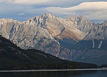
Mount Jerram, seen from southwest at Upper Kananaskis Lake
|
|
| Highest point | |
| Elevation | 2,996 m (9,829 ft) |
| Prominence | 314 m (1,030 ft) |
| Parent peak | Elpoca Mountain (3036 m) |
| Geography | |
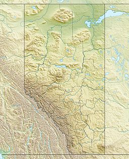
| Location | Alberta, Canada |
| Parent range | Opal Range Canadian Rockies |
| Topo map | NTS 82J/11 |
| Geology | |
| Age of rock | Cambrian |
| Type of rock | Limestone |
| Climbing | |
| First ascent | 1957 by J.F. Tarrant and D.K. Morrison |
| Easiest route | Mountaineering |
Mount Jerram is a 2,996-metre (9,829-foot) mountain peak. It is found in the Opal Range, which is part of the Canadian Rockies in Alberta, Canada. The closest taller mountain is Elpoca Mountain, about 4.0 km (2.5 mi) to the south. Mount Jerram is located east of Mount Wintour, inside Peter Lougheed Provincial Park.
Many mountains in Kananaskis Country (a region in Alberta) are named after people and ships from the Battle of Jutland. This was a big sea battle during World War I in 1916. Mount Jerram also got its name this way.
Contents
History of Mount Jerram
How the Mountain Got Its Name
The mountain was named after Sir Thomas Henry Martyn Jerram (1858-1933). He was an Admiral in the Royal Navy, which is the United Kingdom's navy. He led a group of ships called the Second Battle Squadron during the Battle of Jutland in World War I.
The official name for the mountain was decided in 1922 by the Geographical Names Board of Canada.
First Climbers
The first time anyone successfully climbed to the top of Mount Jerram was on June 15, 1957. Two climbers, Jim Tarrant and Don Morrison, made this first ascent.
What Mount Jerram is Made Of
Mount Jerram is made of sedimentary rock. This type of rock forms from layers of sand, mud, and other materials that build up over time. These layers were laid down during periods from the Precambrian to the Jurassic eras.
This sedimentary rock formed in shallow seas. Later, during a time called the Laramide orogeny, these rocks were pushed eastward. They even moved over younger rock layers. Mount Jerram was created during a big geological event called the Lewis Overthrust. The rock layers in the Opal Range are very similar, with softer layers found between harder ones.
Weather and Climate
Mount Jerram has a subarctic climate. This means it has very cold, snowy winters and mild summers. Temperatures can drop below −20 °C. With the wind chill, it can feel even colder, sometimes below −30 °C.
The best time to climb Mount Jerram is usually from June through September. This is when the weather is most favorable.
Water from the west side of the mountain flows into the Kananaskis River. Water from the east side flows into smaller streams that join the Elbow River.
 | Dorothy Vaughan |
 | Charles Henry Turner |
 | Hildrus Poindexter |
 | Henry Cecil McBay |


