Mount Nestor (Alberta) facts for kids
Quick facts for kids Mount Nestor |
|
|---|---|

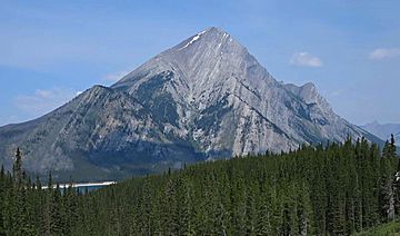
Mount Nestor seen from the south
|
|
| Highest point | |
| Elevation | 2,970 m (9,740 ft) |
| Prominence | 288 m (945 ft) |
| Parent peak | Old Goat Mountain (3120 m) |
| Listing | Mountains of Alberta |
| Geography | |
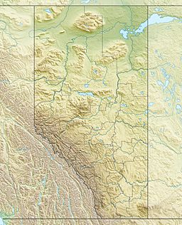
| Location | Alberta, Canada |
| Parent range | Canadian Rockies |
| Topo map | NTS 82J/14 |
| Geology | |
| Age of rock | Cambrian |
| Type of rock | sedimentary rock |
| Climbing | |
| First ascent | 1913 by Interprovincial Boundary Commission |
| Easiest route | Scrambling South Ridge |
Mount Nestor is a tall mountain peak in the Canadian Rockies of Alberta, Canada. It stands about 2,970 meters (9,744 feet) high. This impressive mountain is located in an area known as Kananaskis Country.
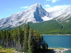
Mount Nestor got its name from a ship called HMS Nestor. This ship was a destroyer that sank during a big naval battle in World War I, called the Battle of Jutland. The mountain sits at the southern end of the Goat Range. It is also found along the western shore of the Spray Lakes Reservoir.
Part of Mount Nestor, its eastern side, is inside Spray Valley Provincial Park. The western side is part of Banff National Park. The border between these two parks actually runs right over the mountain's top. The closest higher peak is Old Goat Mountain, which is about 2 kilometers (1.2 miles) north of Mount Nestor. You can easily see Mount Nestor from Alberta Highway 742, also known as the Smith-Dorrien/Spray Trail.
Mountain History
The first time anyone climbed Mount Nestor was in 1913. This climb was done by a group called the Interprovincial Boundary Commission. They were likely surveying the area to mark borders.
The mountain's name, Mount Nestor, became official in 1922. This decision was made by the Geographical Names Board of Canada. This board is responsible for naming places across Canada.
Understanding Mountain Geology
Mount Nestor is made up of a type of rock called sedimentary rock. This rock formed over millions of years, from the Precambrian to the Jurassic periods. Sedimentary rock is created when layers of sand, mud, and other materials settle at the bottom of ancient seas. Over time, these layers get pressed together and harden into rock.
Later, during a major event called the Laramide orogeny, these rocks were pushed and folded. The Laramide orogeny was a period when the Earth's crust moved a lot. This movement caused the sedimentary rock of Mount Nestor to be pushed eastward. It even moved over the top of younger rock layers.
Mountain Climate
Mount Nestor is located in what is called a subarctic climate. This means the area has very cold, snowy winters. The summers are usually mild, not too hot.
Winter temperatures can drop below -20 degrees Celsius (-4 degrees Fahrenheit). With the wind, it can feel even colder, sometimes below -30 degrees Celsius (-22 degrees Fahrenheit). When snow and ice on the mountain melt, the water flows down. This water eventually drains into the nearby Spray Lakes Reservoir.


