Mount Osmond, South Australia facts for kids
Quick facts for kids Mount OsmondAdelaide, South Australia |
|||||||||||||||
|---|---|---|---|---|---|---|---|---|---|---|---|---|---|---|---|
| Postcode(s) | 5064 | ||||||||||||||
| Location | 5 km (3 mi) from Adelaide | ||||||||||||||
| LGA(s) | City of Burnside | ||||||||||||||
| State electorate(s) | Bragg | ||||||||||||||
| Federal Division(s) | Sturt | ||||||||||||||
|
|||||||||||||||
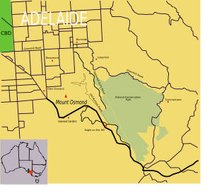
Mount Osmond is a small suburb in Adelaide, the capital city of South Australia. It is home to about 2,500 people. This suburb is part of the City of Burnside local council area. You can find it in the foothills of the Adelaide Hills, about five kilometres south-east of the city centre.
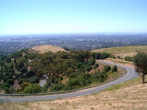
Mount Osmond sits high on a hill with the same name. This hill is the last one you see when driving into Adelaide on the South Eastern Freeway. The suburb offers amazing views over Adelaide. It also has a famous golf course and country club. In the 1800s, mining made the area well-known. Since then, it has slowly grown into a quiet and private neighbourhood.
Contents
History of Mount Osmond
Who lived here first?
Mount Osmond is on the traditional lands of the Kaurna people. This area is part of the Mount Lofty Ranges. For the Kaurna people, these ranges are linked to the Nganno Dreamtime story. The legend says that Nganno, an ancestor-creator, was hurt in a battle. He lay down to die, and his body formed the Mount Lofty Ranges.
When Europeans arrived
When Adelaide was first mapped, Mount Osmond was divided into three large sections. At first, no one bought these sections. The first activity here was after the mining boom in nearby Glen Osmond. This boom was caused by the Wheal Watkins and Wheal Gawler mines.
One mine in Mount Osmond's Slaughterhouse Gully was only used for a short time. Later, people found lots of bluestone, a type of rock. This rock was dug up until 1900. After that, mining stopped, and the old mines were either filled in or closed off.
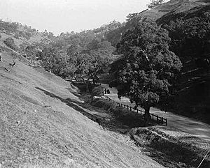
Land developers eventually bought the Mount Osmond sections. But still, not many people wanted to live there. To attract settlers, Mount Osmond Road was built in 1882. It wound around the hills from Mount Barker Road. Developers then split the large sections into about 200 smaller one-acre (4,000 square metre) plots.
A few plots were sold to quarry workers and gardeners. But most of the land was rented to farmers for their livestock. In 1907, Ernest C. Sanders bought a large part of Mount Osmond. His family used the land to build houses, raise sheep, and grow hay. The Sanders family also spent a lot of time naming and mapping the area.
Around 1922–23, the Sanders family decided to sell much of their land. Like before, there was little interest until 1925. Then, the land was turned into a golf course and Country Club. The Burnside Council helped with this idea. The golf course and club were built on the highest part of the mount. They used 85 acres (34 hectares) of the former Sanders estate.
The country club sold the remaining land to buyers. These buyers had to follow strict rules about building and keeping their properties. Special rules applied to how gardens should look. Even with the golf course, electricity, and water, the 18 plots sold very slowly.
One of the last big land purchases was by Ross Thiem in the 1940s. He bought 200 acres (80 hectares) around the golf course. Thiem used it for sheep, being the last person to do so. In 1951, the Highways Department also bought 200 acres (80 hectares) for future transport plans.
Thiem's land was sold in the 1950s. It then changed hands again to Mount Osmond Heights Pty Ltd. This company divided the land into new sections. Finally, in the late 1960s, many parts of Mount Osmond were sold to people wanting to build homes. On October 12, 1968, 52 out of 116 new sites were sold. They cost about $3,500 each.
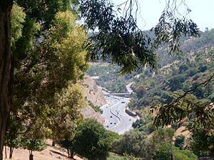
Since then, Mount Osmond has grown slowly. This is because there isn't much land left. Also, there are strict rules about building in the Hills Face Zone. Today, the suburb has large, beautiful houses surrounded by trees. When Mount Barker Road became part of the South Eastern Freeway in 1997, Mount Osmond got its own freeway exit.
Geography and Nature
Mount Osmond includes the main hill and a long ridge. This ridge stretches south-east between the South Eastern Freeway valley and Waterfall Gully valley. Most of the suburb is over 300 metres above sea level. The peak of Mount Osmond itself is 384 metres high. It is located near the golf course clubhouse.
Slopes lead down to the suburbs of Beaumont, Glen Osmond, and Waterfall Gully. Much of this land is public. It is used as parks, walking tracks, or empty land for future use. There is a ring of reserves on the slopes. The South Australian Department of Environment, Water and Natural Resources looks after the Mount Osmond Reserve. You can reach it from Dashwood Gully Reserve and Waterfall Gully Road.
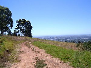
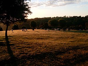
The Old Bullock/Long Ridge track goes along Long Ridge towards Eagle on the Hill. Most houses are on the north-west side of the Mount. This allows for great views over Adelaide. You can still find a few small farms with sheep, goats, and deer on the slopes. These are between the South Eastern Freeway and the Long Ridge Track.
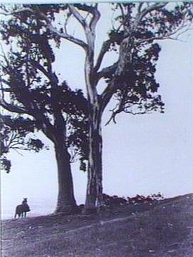
Mount Osmond still has a lot of native plants. It has not been affected by harmful introduced plants as much as other areas. However, much of the land was cleared for grazing long ago. It has not fully grown back yet. Before Europeans arrived, trees like Grey Box, SA Blue Gum, Sheoak, Manna Gum, and River Red Gum grew here. They were especially common on the slopes leading down to the Adelaide Plains.
Getting Around Mount Osmond
Mount Osmond has few roads because it is isolated and hilly. It does not have Adelaide's usual grid pattern. The first road built was Mount Osmond Road in 1882. Developers built it to make the suburb more appealing. Mount Osmond Road is one of two paved roads that lead into Mount Osmond today. It starts at the first exit on the South Eastern Freeway (which used to be Mount Barker Road). Then it winds around the Mount to the top and around the golf course.
The other paved road is Hayward Drive. It starts in Beaumont. It then winds around the hills to connect with the rest of the suburb's roads.
Many fire and walking tracks also lead to Mount Osmond. These include the Old Bullock Track and the Pioneer Women's Heritage Trail. You can access Mount Osmond from Waterfall Gully, Eagle On The Hill, Beaumont, and Glen Osmond.
Public transport is available from Adelaide Metro. However, no buses go through Mount Osmond itself. You can find bus stops in the nearby suburbs. A bikeway runs next to the South Eastern Freeway at the foot of Mount Osmond. You can get to it through the freeway interchange.
Who Lives Here?
In 2006, Mount Osmond itself had a population of 612 people. The larger census area, which includes Mount Osmond and nearby suburbs like Glen Osmond, Leawood Gardens, and Waterfall Gully, had 2,522 people.
Most people in this area are Christian. The most common Christian groups are Anglican, Catholic, and Uniting. About 67% of people here say they have a religious belief. This is higher than the average for Adelaide.
People living in Mount Osmond and the surrounding suburbs tend to earn more money than the average for Adelaide. Many workers have professional or office jobs. The area has a good mix of younger people (under 18) and older people (over 60). Family numbers have also stayed steady over the years.
Fun Things to See and Do
Mount Osmond has several historical sites. You can see old mines and mining structures on the hillside. These remind us of the area's past. The mines continue up through the hills from Glen Osmond. While some mines were open pits, Mount Osmond has deeper mineshafts, some up to sixty metres deep.
The Mount Osmond Golf Course is at the very top of the suburb. It includes the highest point of the Mount. The course is only open to members. Its English-Manor style clubhouse offers meals, coffee, and event facilities. These are for both members and public visitors.
There are many walking trails. You can take a historical walk through the mines from Beaumont or Glen Osmond. Longer walks can take you to Waterfall Gully's waterfalls. You can also reach the Cleland Wildlife Park and the Adelaide Hills town of Crafers. Walking the Long Ridge track gives you great views of Adelaide. This track is between the valley of the South Eastern Freeway and Waterfall Gully.
The Old Toll House is located at the start of the South Eastern Freeway, below Mount Osmond. The suburb also has a small bed and breakfast. It is located at the northern end of Mount Osmond Road.
 | James Van Der Zee |
 | Alma Thomas |
 | Ellis Wilson |
 | Margaret Taylor-Burroughs |


