Mount Passaconaway facts for kids
Quick facts for kids Mount Passaconaway |
|
|---|---|

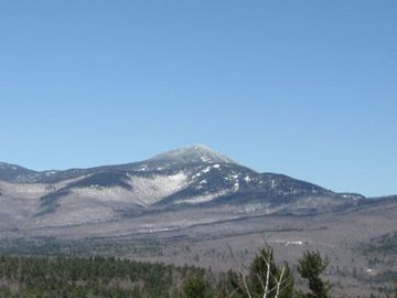
Mt. Passaconaway as seen from Great Hill
|
|
| Highest point | |
| Elevation | 4,043 ft (1,232 m) |
| Prominence | 803 ft (245 m) |
| Geography | |
| Location | Grafton County, New Hampshire, U.S. |
| Parent range | Sandwich Range, White Mountains |
| Topo map | USGS Mount Tripyramid |
| Climbing | |
| Easiest route | Hike |
Mount Passaconaway is a 4,043 ft (1,232 m) mountain located in the Sandwich Range Wilderness. This area is part of the White Mountain National Forest in Grafton County, New Hampshire. The mountain is close to Waterville Valley. It gets its name from Passaconaway, a respected leader (called a sachem) of the Pennacook tribe in the 1500s. A small village nearby, in Albany, also shares his name.
Contents
Discovering Mount Passaconaway
Mount Passaconaway is one of the famous "White Mountains four-thousand footers". This means it's one of the 48 mountains in the White Mountains that are over 4,000 feet tall! It's currently ranked 42nd in height on this special list.
The top of Mount Passaconaway is covered in thick woods. There aren't any clear signs at the very summit. Hikers can reach the top from trails starting in the north, near the Kancamagus Highway, or from the south, near Wonalancet.
How Mount Passaconaway Got Its Name
Originally, this mountain was called "North Whiteface" by a person named Arnold Henry Guyot. He was likely the first European to climb it. Later, a state geologist named Charles Henry Hitchcock gave the mountain its current name, honoring the Pennacook chieftain, Passaconaway.
Passaconaway had children named Wonalancet and Nanomocomuck. Today, two smaller parts of the mountain are named after them, keeping their memory alive.
The Mountain's Story Through Time
Mount Passaconaway has an interesting history, showing how people have used and protected this natural area over many years.
Early Uses and Changes
- 1700s: A path called Old Mast Road was created. It was used to transport huge white pine trees. These trees were needed for the Royal Navy to build ships.
- 1890: A big landslide happened on the northwest side of the mountain. This natural event later became a hiking path known as the Downes Brook Slide Trail.
- 1891: Kate Sleeper opened an inn near the mountain's base. This made the area more popular for visitors. Local people then made the Dicey's Mill Trail. A building called the "Passaconaway Lodge" was also built on the mountain's southeast side.
- 1899: The Appalachian Mountain Club, a group that loves the outdoors, created the Passaconaway Loop trail. This trail made it possible for hikers to go all the way around and over the mountain's summit.
Protecting the Wilderness
- 1914: A special forest area below the mountain, called The Bowl, was added to the White Mountain National Forest (WMNF). This was done to stop logging and protect the trees.
- 1948: The Passaconaway Lodge was renamed Camp Rich. The building was rebuilt two times, in 1925 and again in 1953.
- 1984: The Sandwich Range Wilderness was officially created. This protected area included most of Mount Passaconaway, helping to keep it wild.
- 2000: Camp Rich collapsed and was removed. This was done to follow the rules for wilderness areas, which aim to keep nature untouched.
- 2006: The Sandwich Range Wilderness was made even bigger. This expansion meant that all of Mount Passaconaway was now part of this protected wilderness.
 | Roy Wilkins |
 | John Lewis |
 | Linda Carol Brown |

