Mount Richards facts for kids
Quick facts for kids Mount Richards |
|
|---|---|

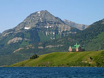
The northern end of Mount Richards seen with Prince of Wales Hotel
|
|
| Highest point | |
| Elevation | 2,377 m (7,799 ft) |
| Prominence | 137 m (449 ft) |
| Parent peak | Mount Alderson (2692 m) |
| Listing | Mountains of Alberta |
| Geography | |
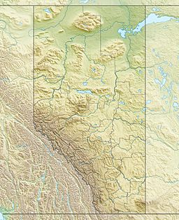
| Location | Alberta, Canada |
| Parent range | Clark Range Canadian Rockies |
| Topo map | NTS 82H04 |
| Geology | |
| Age of rock | Cambrian |
| Climbing | |
| Easiest route | Scrambling |
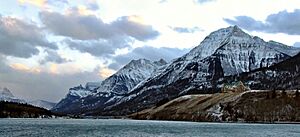
Mount Richards is a tall mountain, about 2,377 meters (7,799 feet) high. It's found in Waterton Lakes National Park in Alberta, Canada. This park is part of the amazing Canadian Rockies mountain range. Mount Richards sits very close to the border between Canada and the United States. Its southern base even touches Glacier National Park in the U.S. The mountain's closest taller neighbor is Mount Alderson, which is about 2 kilometers (1.2 miles) to the northwest. Just north of Mount Richards, you'll find Bertha Lake and Bertha Peak.
The Story Behind the Name
Mount Richards got its name from a special person. He was Admiral Sir George Henry Richards (1820–1896). He worked as a Hydrographer of the Navy, which means he made maps of the oceans. He was also important in marking the border between Canada and the United States. This border stretches from the Pacific Ocean all the way to the Rocky Mountains.
For a while, the mountain was also known as Sleeping Indian Mountain. The name "Mount Richards" was officially chosen in 1943. This decision was made by the Geographical Names Board of Canada.
How Mount Richards Was Formed
Like other mountains in Waterton Lakes National Park, Mount Richards is made of sedimentary rock. This type of rock forms from layers of sand, mud, and tiny bits of plants and animals that settle over millions of years. These layers were laid down during ancient times, from the Precambrian to the Jurassic periods.
Imagine these rocks forming at the bottom of shallow seas. Then, a huge event called the Laramide orogeny happened. This was a time when massive forces deep within the Earth pushed and folded the land. These forces pushed the older sedimentary rock layers eastward. They even pushed them on top of younger rock layers from the Cretaceous period. This incredible pushing and folding created the tall mountains we see today.
Weather and Climate
Mount Richards is located in a subarctic climate zone. This means it has very cold and snowy winters. Summers are usually mild, not too hot. Temperatures can drop below −20 °C (or −4 °F). With the wind chill, it can feel even colder, sometimes below −30 °C (−22 °F).
When snow melts or rain falls on Mount Richards, the water flows down the mountain. This water eventually drains into Waterton Lake. From there, it continues into the Waterton River.
 | Ernest Everett Just |
 | Mary Jackson |
 | Emmett Chappelle |
 | Marie Maynard Daly |


