Mount Rogers facts for kids
Quick facts for kids Mount Rogers |
|
|---|---|

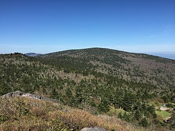
View of Mount Rogers from Pine Mountain
|
|
| Highest point | |
| Elevation | 5,730 ft (1,750 m) |
| Prominence | 2,449 ft (746 m) |
| Listing | U.S. state high point 19th |
| Geography | |
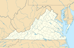
| Location | Grayson / Smyth counties, Virginia, United States |
| Parent range | Blue Ridge Mountains |
| Topo map | USGS Whitetop Mountain |
| Climbing | |
| Easiest route | Hike via Appalachian Trail spur |
Mount Rogers is the tallest natural point in Virginia, United States. It stands 5,729 feet (1,746 m) (about 1,746 meters) high! The very top of the mountain is right on the border between Grayson and Smyth Counties in Virginia.
Most of Mount Rogers is part of the Lewis Fork Wilderness. The whole area is also inside the Mount Rogers National Recreation Area, which is part of the larger Jefferson National Forest.
The mountain is named after William Barton Rogers. He was from Virginia and studied at the College of William & Mary. He taught at William & Mary and the University of Virginia. He also became Virginia's first State Geologist. Later, he started the famous Massachusetts Institute of Technology.
You can easily reach the top of Mount Rogers from Grayson Highlands State Park. You follow the Appalachian Trail for about 3.5 miles (5.6 km) (5.6 km). Then, a special blue-marked trail leads you to the summit. The top is covered by trees and has four special markers from the National Geodetic Survey. Because the Appalachian Trail goes so close, many hikers love to visit this area.
Contents
Discovering Mount Rogers' Ancient Past
The rocks at Mount Rogers tell an amazing story about Virginia's history. About 750 million years ago, there were active volcanoes here! These volcanoes erupted as the Earth's crust pulled apart. You can still see the remains of these ancient volcanoes and their volcanic rocks at Mount Rogers.
Volcanic Rocks and Glaciers
Huge flows of rhyolite lava burst out from the mountain during this time. Mount Rogers is also the only place in Virginia that shows signs of a very old ice age. This happened during the Proterozoic era, when glaciation covered parts of the Earth.
Exploring the Spruce-Fir Forests
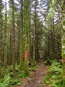
Mount Rogers is home to a special type of high-altitude forest called the Southern Appalachian spruce-fir forest. This forest type is found in only a few other places in the United States. These include the Great Smoky Mountains and the Black Mountains.
The Fraser Fir Tree
This forest is one of the last places where the Fraser fir tree grows. Fraser firs only live at high elevations, usually above 5,500 feet (1,700 m) (about 1,676 meters), in the southern Appalachian Mountains.
Challenges for the Forest
Sadly, these forests have faced problems recently. A tiny insect from Europe called the balsam woolly adelgid has caused a lot of damage. It first arrived at Mount Rogers in 1962. Since then, many Fraser firs across the U.S. have died. Mount Rogers was not hit as hard as some other places, though.
Some scientists think that air pollution might also be making the Fraser firs weaker. This could make them more likely to get sick from the balsam woolly adelgid. However, this idea is still being studied.
 | May Edward Chinn |
 | Rebecca Cole |
 | Alexa Canady |
 | Dorothy Lavinia Brown |


