Mount Saul facts for kids
Quick facts for kids Mount Saul |
|
|---|---|

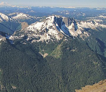
Mt. Saul, northeast aspect
|
|
| Highest point | |
| Elevation | 7,293 ft (2,223 m) |
| Prominence | 1,360 ft (410 m) |
| Isolation | 3.1 mi (5.0 km) |
| Parent peak | Mount David (7,420 ft) |
| Geography | |
| Location | Glacier Peak Wilderness Chelan County Washington state, U.S. |
| Parent range | North Cascades Cascade Range |
| Topo map | USGS Glacier Peak East |
| Type of rock | granitic |
| Climbing | |
| Easiest route | Hiking |
Mount Saul is a tall mountain in Chelan County, Washington state. It stands about 7,293 feet (2,223 meters) high. This mountain is found in the beautiful Glacier Peak Wilderness area. The land around it is managed by the Okanogan-Wenatchee National Forest.
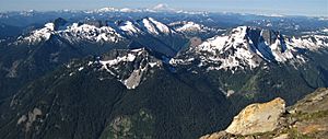
Mount Saul is one of the highest points on Wenatchee Ridge. This ridge is a group of mountains that also includes Indian Head Peak, Whittier Peak, Mount David, and Mount Jonathan. Mount David is its closest taller neighbor, about 3.1 miles (5.0 km) away to the south-southeast. Water flowing off Mount Saul eventually reaches the White River.
Even though it's not the tallest mountain, Mount Saul looks very impressive. Its south side rises 4,000 feet (1,219 meters) above the Indian Creek Valley in just over a mile. A pioneer surveyor and explorer named Albert Hale Sylvester gave the peak its name. He thought it looked "gloomy," like the biblical Saul. Albert Sylvester named thousands of natural places in the Cascade Mountains.
How the Mountains Formed
The North Cascades, where Mount Saul is located, have very rugged land. You can see sharp peaks, tall spires, long ridges, and deep valleys carved by glaciers. These amazing shapes were created by geological events that happened millions of years ago. These events also caused the big changes in height across the Cascade Range, which led to different climates.
The Cascade Mountains started forming millions of years ago, during a time called the late Eocene Epoch. This happened because the North American Plate (a huge piece of Earth's crust) was slowly moving over the Pacific Plate. This movement caused many volcanoes to erupt. Glacier Peak, a large volcano, is only about 8.7 miles (14.0 km) northwest of Mount Saul. Because it's so close, you can often find volcanic ash in the area around Mount Saul.
About 50 million years ago, small pieces of land called terranes crashed into North America. These pieces, which came from the ocean floor and other continents, helped build the North Cascades.
During the Pleistocene period, which began over two million years ago, huge sheets of ice called glaciers moved across the land many times. As they advanced and retreated, they carved and shaped the landscape. The land rising up (called uplift) and cracks forming in the Earth's crust (called faulting) worked with the glaciers to create the tall peaks and deep valleys we see in the North Cascades today.
Mountain Weather
Most of the weather in this area starts over the Pacific Ocean. These weather systems then travel east towards the Cascade Mountains. When they reach the mountains, the air is forced to rise. As the air goes higher, it cools down and drops its moisture as rain or snow onto the Cascades. This process is called Orographic lift.
Because of this, the Cascades get a lot of rain and snow, especially during the winter. In winter, the weather is often cloudy. However, during the summer months, high-pressure systems over the Pacific Ocean become stronger. This often means there are very few clouds, or no clouds at all. The months of July, August, and September usually have the best weather for visiting or climbing Mount Saul.
 | John T. Biggers |
 | Thomas Blackshear |
 | Mark Bradford |
 | Beverly Buchanan |


