
Mount Schaffer facts for kids
Quick facts for kids Mount Schaffer |
|
|---|---|

Mount Schaffer seen from Lake O'Hara
|
|
| Highest point | |
| Elevation | 2,691 m (8,829 ft) |
| Prominence | 46 m (151 ft) |
| Parent peak | Mount Biddle (3320 m) |
| Listing | Mountains of British Columbia |
| Geography | |

Mount Schaffer
Location in British Columbia

Mount Schaffer
Location in Canada
|
|
| Location | British Columbia, Canada |
| Parent range | Bow Range Canadian Rockies |
| Topo map | NTS 82N08 |
| Geology | |
| Age of rock | Cambrian |
| Type of rock | sedimentary rock |
| Climbing | |
| First ascent | 1909 M. Goddard, W. Richardson |
| Easiest route | Scramble class 3 |
Mount Schaffer is a tall mountain in Yoho National Park, British Columbia, Canada. It stands about 2,691 meters (8,829 feet) high. You can find it about one kilometer southwest of Lake O'Hara. This peak is part of the Bow Range in the Canadian Rockies.
Mount Schaffer's closest higher neighbor is Mount Biddle, which is about 3.2 kilometers (2 miles) to the southeast. The mountain is also located 3.5 kilometers west of the Continental Divide. This divide separates rivers that flow to different oceans. Mount Schaffer is also 12 kilometers southeast of the town of Field, British Columbia.
Contents
History of Mount Schaffer's Name
This mountain was named in 1909. It was named after Mary Schäffer Warren (1861–1939). She was an American-Canadian who loved nature. Mary was also an artist, photographer, and writer.
Some reports say the mountain was named earlier, in 1894. These reports suggest it was named by Samuel E.S. Allen for Dr. Charles Schäffer (1838-1903). Dr. Charles Schäffer was Mary's husband.
The first people to climb Mount Schaffer were M. Goddard and W. Richardson. They reached the top in 1909.
The mountain's name became official in 1924. This happened when the Geographical Names Board of Canada approved it.
How Mount Schaffer Was Formed (Geology)
Mount Schaffer is made of a type of rock called sedimentary rock. This rock formed a very long time ago, from the Precambrian to the Jurassic periods. Sedimentary rock forms from layers of sand, mud, and tiny bits of plants and animals that settle at the bottom of ancient seas.
Later, these layers of rock were pushed up and folded. This happened during a big mountain-building event called the Laramide orogeny. During this time, the older sedimentary rock was pushed over the top of younger rock. This process created the tall mountains we see today.
Mount Schaffer's Climate
Mount Schaffer is in a subarctic climate zone. This means it has very cold, snowy winters. The summers are usually mild.
Winter temperatures can drop below −20 °C (–4 °F). With the wind, it can feel even colder, sometimes below −30 °C (–22 °F).
Rain and melting snow from Mount Schaffer flow into small streams. These streams then join the Kicking Horse River. The Kicking Horse River is a larger river that eventually flows into the Columbia River.
Gallery
-
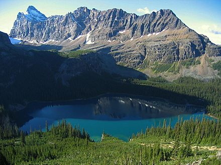
Mount Schäffer far right, Mount Biddle upper left corner
-
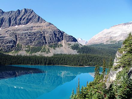
Mount Schäffer seen above Lake O'Hara


