Bow Range facts for kids
Quick facts for kids Bow Range |
|
|---|---|

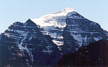
North face of Mount Temple
|
|
| Highest point | |
| Peak | Mount Temple (Alberta) |
| Elevation | 3,543 m (11,624 ft) |
| Dimensions | |
| Length | 34 km (21 mi) N-S |
| Width | 43 km (27 mi) |
| Area | 717 km2 (277 sq mi) |
| Geography | |
| Country | Canada |
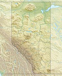
| Range coordinates | 51°20′00″N 116°17′00″W / 51.33333°N 116.28333°W |
| Parent range | Canadian Rockies (Southern Continental Ranges) |
The Bow Range is a group of mountains in the Canadian Rockies. You can find it in both Alberta and British Columbia, Canada. This mountain range got its name from the nearby Bow River. Its name was officially recognized on March 31, 1917.
This range is a key part of the Banff-Lake Louise area. It sits right on the Continental Divide, which is like a giant line that separates rivers flowing to different oceans. The Bow Range is located west of the Bow River valley. It is also found within two amazing national parks: Banff National Park and Kootenay National Park.
The Bow Range covers a large area, about 717 square kilometers (277 square miles). It stretches for 34 kilometers from north to south and is up to 43 kilometers wide. The tallest mountain in this range is Mount Temple, which stands at a towering 3,543 meters (11,624 feet) high.
The range is also home to the famous Valley of the Ten Peaks. The tallest peak in this valley is Mount Hungabee, reaching 3,492 meters. Many cool hiking trails are found here, like Consolation Lakes, Sentinel Pass-Larch Valley, and the area around The Beehive. These spots offer amazing views and adventures!
Tallest Mountains in the Bow Range
The Bow Range has many impressive peaks. Here are some of the highest ones:
- Mount Temple is the tallest at 3,543 meters (11,624 feet).
- Hungabee Mountain reaches 3,492 meters (11,457 feet).
- Mount Victoria stands at 3,464 meters (11,365 feet).
- Deltaform Mountain is 3,424 meters (11,234 feet) high.
- Mount Lefroy is 3,423 meters (11,230 feet) tall.
- Mount Huber reaches 3,368 meters (11,050 feet).
- Mount Biddle is 3,320 meters (10,892 feet) high.
- Neptuak Mountain stands at 3,241 meters (10,633 feet).
- Mount Fay is 3,235 meters (10,614 feet) tall.
- Odaray Mountain reaches 3,137 meters (10,292 feet).
- Mount Babel is 3,101 meters (10,174 feet) high.
These mountains offer incredible views and challenges for climbers and hikers. Some are easier to climb, while others require advanced skills.
 | Toni Morrison |
 | Barack Obama |
 | Martin Luther King Jr. |
 | Ralph Bunche |


