Lake Louise, Alberta facts for kids
Quick facts for kids
Lake Louise
|
|
|---|---|
|
Hamlet
|
|
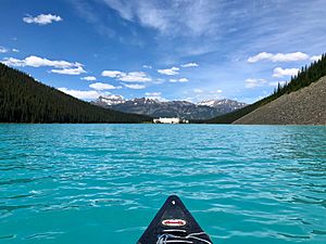
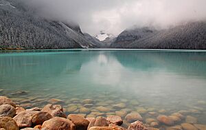
Lake Louise, with which the hamlet shares its name, pictured in June 2018
|
|
| Country | Canada |
| Province | Alberta |
| Region | Alberta's Rockies |
| Census division | No. 15 |
| Improvement district | Improvement District No. 9 |
| Government | |
| • Type | Unincorporated |
| Elevation | 1,600 m (5,200 ft) |
| Population
(2011)
|
|
| • Total | 691 |
| Time zone | UTC−07:00 (MST) |
| • Summer (DST) | UTC−06:00 (MDT) |
| Postal code span |
T0L 1E0
|
| Area code(s) | 403, 587 |
| Highways | |
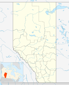
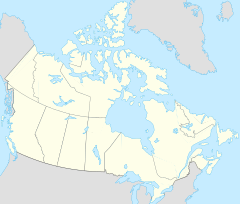
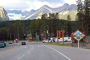
Lake Louise is a small community called a hamlet. It is located inside Banff National Park in Alberta, Canada. The hamlet is named after Princess Louise, Duchess of Argyll. It sits in the beautiful Alberta's Rockies area, right next to the Bow River. It's about 3 kilometers (1.9 miles) northeast of the famous lake that shares its name.
Lake Louise was first settled in 1884. It started as a small camp for the Canadian Pacific Railway. At 1,600 meters (5,200 feet) above sea level, Lake Louise is Canada's highest community. The nearby lake, surrounded by towering mountains, is known worldwide for its stunning views.
Contents
Discovering the History of Lake Louise
Before Europeans arrived, local Indigenous groups lived in the Rocky Mountain Foothills. This included the area where Lake Louise is today. They hunted animals like bison, elk, and moose. They also fished in the rivers and gathered plants for food and medicine. In the language of the Nakoda people, Lake Louise is called Ho-run-num-nay. This means "lake of the little fishes."
How the Canadian Pacific Railway Shaped Lake Louise
In the 1870s, construction began on the Canadian Pacific Railway (CPR). The railway line was planned to go through the Bow Valley. In 1882, a Nakoda guide led a CPR worker named Tom Wilson to the lake. Wilson first called it 'Emerald Lake'. The hamlet itself had a few names over time, including 'Holt City' and 'Laggan'. Eventually, it was renamed Lake Louise.
The original CPR station from around 1890 was replaced in 1910. The old station was used by the railway for other things until 1976. It was then given to Heritage Park Historical Village in Calgary. The old depot was moved to the park and restored. It now looks like it did when the village was called Laggan. The newer 1910 station is still well-preserved. In 1991, the government declared it a heritage railway station. Today, it operates as a restaurant.
Lake Louise as a Tourist Destination
Lake Louise became part of Rocky Mountains Park in 1892. Since then, it has become a popular place for tourists from all over the world. Its location near the Trans-Canada Highway makes it easy for visitors to reach.
Exploring the Geography of Lake Louise
The hamlet of Lake Louise is in Division No. 15. This is one of Alberta's 19 census divisions. It is also part of the federal area known as Banff—Airdrie. The community is right next to the Trans-Canada Highway (Highway 1). It is about 180 kilometers (110 miles) west of Calgary.
The views around Lake Louise are incredible. You can see several snow-capped mountains. These include Mount Temple, Mount Whyte, and Mount Niblock.
Understanding the Climate of Lake Louise
Lake Louise has a subarctic climate. This means it has long, cold winters and short, cool summers. On average, it gets about 279.1 centimeters (110 inches) of snow each year. Winter temperatures can drop very low, sometimes below −50°C (−58°F). However, the average temperatures in January and February are around −18.4°C (−1.1°F) and −17.6°C (0.3°F).
Summers in Lake Louise have frosty mornings and cool, crisp days. It can even snow in any month of the year! Because of its high altitude and big temperature changes between day and night, the period without frost is very short, only about 14 days on average.
| Climate data for Lake Louise Climate ID: 3034480; coordinates 51°26′N 116°13′W / 51.433°N 116.217°W; elevation: 1,524 m (5,000 ft); 1981−2010 normals |
|||||||||||||
|---|---|---|---|---|---|---|---|---|---|---|---|---|---|
| Month | Jan | Feb | Mar | Apr | May | Jun | Jul | Aug | Sep | Oct | Nov | Dec | Year |
| Record high °C (°F) | 7.8 (46.0) |
13.9 (57.0) |
17.0 (62.6) |
26.5 (79.7) |
31.7 (89.1) |
31.1 (88.0) |
34.4 (93.9) |
32.2 (90.0) |
29.0 (84.2) |
26.1 (79.0) |
18.3 (64.9) |
12.2 (54.0) |
34.4 (93.9) |
| Mean daily maximum °C (°F) | −5.4 (22.3) |
−1.7 (28.9) |
2.9 (37.2) |
7.5 (45.5) |
12.7 (54.9) |
16.7 (62.1) |
20.4 (68.7) |
20.1 (68.2) |
14.7 (58.5) |
7.3 (45.1) |
−1.7 (28.9) |
−6.9 (19.6) |
7.2 (45.0) |
| Daily mean °C (°F) | −12.0 (10.4) |
−9.7 (14.5) |
−4.7 (23.5) |
0.9 (33.6) |
5.8 (42.4) |
9.7 (49.5) |
12.6 (54.7) |
11.9 (53.4) |
7.1 (44.8) |
1.1 (34.0) |
−7.1 (19.2) |
−13.0 (8.6) |
0.2 (32.4) |
| Mean daily minimum °C (°F) | −18.4 (−1.1) |
−17.6 (0.3) |
−12.3 (9.9) |
−5.8 (21.6) |
−1.2 (29.8) |
2.8 (37.0) |
4.7 (40.5) |
3.6 (38.5) |
−0.5 (31.1) |
−5.1 (22.8) |
−12.6 (9.3) |
−19.1 (−2.4) |
−6.8 (19.8) |
| Record low °C (°F) | −52.8 (−63.0) |
−50.6 (−59.1) |
−44.4 (−47.9) |
−33.9 (−29.0) |
−27.8 (−18.0) |
−10.0 (14.0) |
−7.0 (19.4) |
−7.5 (18.5) |
−25.0 (−13.0) |
−32.0 (−25.6) |
−44.0 (−47.2) |
−49.4 (−56.9) |
−52.8 (−63.0) |
| Average precipitation mm (inches) | 52.4 (2.06) |
47.9 (1.89) |
37.3 (1.47) |
32.3 (1.27) |
59.9 (2.36) |
54.3 (2.14) |
56.4 (2.22) |
53.9 (2.12) |
41.9 (1.65) |
37.7 (1.48) |
57.4 (2.26) |
48.7 (1.92) |
543.8 (21.41) |
| Average rainfall mm (inches) | 0.7 (0.03) |
0.0 (0.0) |
1.5 (0.06) |
9.0 (0.35) |
32.8 (1.29) |
54.1 (2.13) |
56.4 (2.22) |
53.6 (2.11) |
39.1 (1.54) |
19.0 (0.75) |
2.4 (0.09) |
0.0 (0.0) |
268.7 (10.58) |
| Average snowfall cm (inches) | 51.3 (20.2) |
33.4 (13.1) |
36.4 (14.3) |
23.5 (9.3) |
7.1 (2.8) |
0.2 (0.1) |
0.0 (0.0) |
0.0 (0.0) |
2.8 (1.1) |
18.7 (7.4) |
57.0 (22.4) |
48.8 (19.2) |
279.1 (109.9) |
| Average precipitation days (≥ 0.2 mm) | 12.0 | 8.1 | 9.9 | 8.2 | 13.3 | 16.5 | 14.9 | 14.2 | 11.6 | 11.3 | 12.5 | 11.5 | 143.9 |
| Average rainy days (≥ 0.2 mm) | 0.1 | 0.0 | 0.38 | 2.6 | 11.9 | 16.5 | 14.9 | 14.2 | 11.2 | 6.1 | 0.5 | 0.0 | 78.3 |
| Average snowy days (≥ 0.2 cm) | 11.9 | 8.1 | 9.8 | 6.0 | 2.2 | 0.1 | 0.0 | 0.0 | 0.93 | 6.0 | 12.1 | 11.5 | 68.5 |
| Source: Environment and Climate Change Canada | |||||||||||||
Community and Attractions in Lake Louise
Lake Louise had a population of 691 people in the 2011 Census. The number of residents often changes each year. Many people move to the area for jobs in the service and tourism industries.
Fun Things to Do in Lake Louise
Lake Louise has a shopping center called Samson Mall. Across Highway 1, you'll find the Lake Louise Ski Resort. This is a popular place for downhill skiing. The famous Chateau Lake Louise is located southwest of the community. It sits right on the beautiful shores of the lake.
Getting Around: Infrastructure and Highways
The Trans-Canada Highway (Highway 1) runs right next to the community. Another road, Highway 1A, starts at the entrance to Lake Louise. The southern end of the Icefields Parkway (Highway 93) is just north of the community. This scenic highway leads to many other amazing spots in the Rockies.
 | Jackie Robinson |
 | Jack Johnson |
 | Althea Gibson |
 | Arthur Ashe |
 | Muhammad Ali |


