Mount Torment facts for kids
Quick facts for kids Mount Torment |
|
|---|---|
 |
|
| Highest point | |
| Elevation | 8,120+ ft (2,470+ m) |
| Prominence | 200 ft (60 m) |
| Geography | |
| Location | Skagit County, Washington, U.S. |
| Parent range | North Cascades |
| Geology | |
| Volcanic arc | Cascade Volcanic Arc |
| Climbing | |
| First ascent | 1946 by Jack Schwabland and Herb Staley |
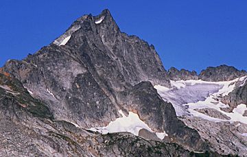
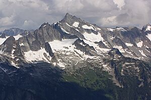
Mount Torment is a tall mountain peak in the North Cascades of Washington, United States. It stands about 8,120+ -foot (2,470+ m) high. This mountain is located roughly 65 miles (105 km) northeast of the city of Everett.
The first people to climb Mount Torment reached its top on August 23, 1946. They named it "Torment" because of how hard the climb was on a very hot day, with only one orange to share for thirst! Since then, Mount Torment has become famous for a challenging climbing path called the Torment-Forbidden Traverse. This route connects Mount Torment to its neighbor, Forbidden Peak.
The North Fork Cascade River starts in a valley below Mount Torment. It flows west for several miles to join the main Cascade River. Many beautiful waterfalls can be found in this valley.
Mountain Weather
Mount Torment is located in a wet, mild climate zone on the west coast of North America. Most of the weather systems come from the Pacific Ocean. They travel northeast towards the Cascade Mountains.
As these weather systems reach the North Cascades, the tall mountains force the air to rise. This causes the air to cool and drop its moisture as rain or snow onto the Cascades. This process is called orographic lift. Because of this, the western side of the North Cascades gets a lot of rain and snow, especially in winter.
During winter, the weather is usually cloudy. However, in summer, high-pressure systems over the Pacific Ocean often bring clear skies. The snow here tends to be wet and heavy due to the ocean's influence. This can lead to a high risk of avalanches.
How the Mountains Formed
The North Cascades have some of the roughest land in the Cascade Range. You can see jagged peaks, sharp spires, long ridges, and deep valleys carved by glaciers. These amazing shapes and big changes in height were created by geological events that happened millions of years ago.
The Cascade Mountains began forming millions of years ago, during the late Eocene Epoch. This happened because the North American Plate was slowly moving over the Pacific Plate. This movement caused many periods of volcanic activity. Also, small pieces of the Earth's crust, called terranes, came together to form the North Cascades about 50 million years ago.
During the Pleistocene period, which started over two million years ago, huge sheets of ice called glaciers moved across the land many times. As they moved, they scraped away rock and left behind rocky debris. The "U"-shaped valleys you see today were carved out by these glaciers. The rising of the land and cracks in the Earth, along with the glaciers, have created the tall peaks and deep valleys of the North Cascades.
 | Precious Adams |
 | Lauren Anderson |
 | Janet Collins |


